Chest opened
+${chestReward.xp} XP
Explorer
NOUVEAU ×${chestReward.collectible.quantity}
tapez pour fermer
Chest locked

Open chests in the app

Around Us is built for your phone — chests unlock when you walk, explore and capture nearby places.

Enable Location

We need your location to show you interesting places around you

Discover nearby places

Find interesting locations and hidden gems around you

Precise directions

Get accurate directions and distances to places

Your location is never shared with other users. It's only used when you tap the location button.

Oodnadatta Track

Log in to your account

Start exploring — it's free

Trusted by 72,890 travelers worldwide

Continue with Google
Continue with Apple
or

We will send you a code to connect

By continuing, you accept our Terms and Conditions and our Privacy Policy

Check your inbox

We've sent a pincode in your inbox. Please enter the code below.

Oodnadatta Track
Discussion Reviews 2 Photos
19.7k Popularity

Oodnadatta Track, track in South Australia

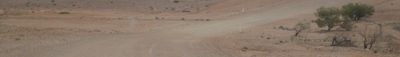
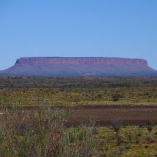
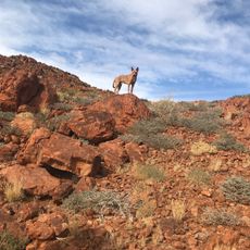
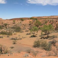
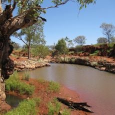
The Oodnadatta Track is a 620-kilometer unpaved road that runs between Marree and Marla, passing through Oodnadatta. It winds through flat outback terrain with sparse vegetation, dry creek beds lined with river red gums, and scattered rocky outcrops.

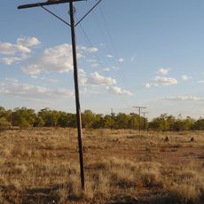
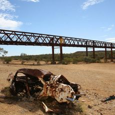
The track follows an ancient path that Aboriginal peoples used for ochre trading thousands of years ago. In the late 1800s, it became the route for the Overland Telegraph and the Ghan railway, leaving behind station ruins and buildings that remain visible today.

The track's name came from Adam Plate of the Oodnadatta Progress Association around 1980. The road passes through landscapes that Aboriginal peoples used for trading thousands of years ago, connecting visitors to this long-standing history.

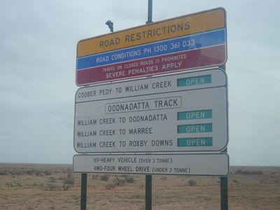
The road is open year-round, but sections may become muddy or flooded after heavy rain, so check conditions ahead of your trip. A four-wheel-drive vehicle is recommended, especially after rain or if towing a trailer, though gravel surfaces allow most vehicles to pass in dry conditions.

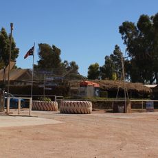
The Pink Roadhouse is distinctive not just for its bright pink color but also as a local landmark, famous for serving the Oodnaburger. The bright signage makes it easy to spot and acts as a natural stopping point for travelers along the route.

The community of curious travelers

AroundUs brings together thousands of curated places, local tips, and hidden gems, enriched daily by 60,000 contributors worldwide.

Start exploring
Location
GPS coordinates
-27.30000,133.61700
Latest update
February 16, 2026 22:20
Reviews
Share your experience

No review yet

Discussions
Start a discussion...

No discussion yet

« Oodnadatta Track - track in South Australia » is provided by Around Us (aroundus.com). Images and texts are derived from Wikimedia project under a Creative Commons license. You are allowed to copy, distribute, and modify copies of this page, under the conditions set by the license, as long as this note is clearly visible.

Discover hidden gems everywhere you go!

From secret cafés to breathtaking viewpoints, skip the crowded tourist spots and find places that match your style. Our app makes it easy with voice search, smart filtering, route optimization, and insider tips from travelers worldwide. Download now for the complete mobile experience.

Around Us App Screenshot

A unique approach to discovering new places

Le Figaro

All the places worth exploring

France Info

A tailor-made excursion in just a few clicks

20 Minutes

Around Us
Travel Guide & Maps
Download

Send to your phone

QR Code
1

Open the camera app on your mobile.

2

Point at the QR code with your camera. A notification will appear.

3

Tap the notification to open the link.