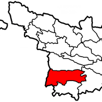
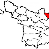
Karanganyar, Administrative region in Central Java, Indonesia
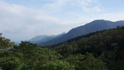
Karanganyar is an administrative region in Central Java that covers about 767 square kilometers and contains seventeen districts. The area stretches from lowland rice fields to hillsides reaching around 480 meters in elevation.
This administrative unit received its official status on November 20, 1917, with Karanganyar town chosen as the administrative seat. The regency remained part of the Dutch colonial structure until Indonesian independence in the mid-20th century.
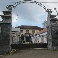
The Mangadeg Hill contains the Truloroyo royal burial complex where local residents practice Kejawen traditions connected to ancestor reverence.
The region has three hospitals and twenty-one public health centers spread across its territory. Many schools and educational facilities are located throughout the different districts and can be reached by public transport.
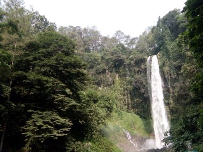
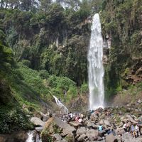
The waterfall system at Grojogan Sewu on Mount Lawu slopes gets its name from the many cascades found in the area. At Pablengan, seven pools fed by natural springs are used for traditional ritual bathing.
Location: Central Java
Inception: November 20, 1917
Capital city: Karanganyar
Elevation above the sea: 480 m
Shares border with: Wonogiri, Sukoharjo, Surakarta, Boyolali, Sragen, Ngawi, Magetan
Website: http://karanganyar.go.id
GPS coordinates: -7.59611,110.95083
Latest update: December 13, 2025 19:40
Lawu Mountain
27.1 km
Kraton of Surakarta
13.7 km
Cetho
22.8 km
Sukuh
20.2 km
Astana Giribangun
14.6 km
Manahan Stadium
16.6 km
Grojogan Sewu waterfall
21.1 km
Mangkunegaran Palace
14.5 km
Sriwedari Park
15.8 km
Fort Vastenburg
13.5 km
Radya Pustaka Museum
15.4 km
Arsitektur dan peninggalan sejarah di Surakarta
13.9 km
Great Mosque of Surakarta
13.9 km
National Press Monument
15 km
De Tjolomadoe
23.2 km
Danar Hadi Batik Museum
15.1 kmTumurun Museum
15.1 kmArchipelago Keris Museum
15.7 km
Masjid Wustho Mangkunegaran
14.7 km
Jumog waterfall
19.7 kmSitus Menggung
21.5 kmDullah Museum
15.9 kmHortus Medicus Herb Museum
21.6 km
Masjid Raya Fatimah
14.7 kmKawasan Laweyan
17.4 kmMasjid Al Wustho Mangkunegaran
14.7 kmMonumen 45 Banjarsari
14.3 kmWaduk Mulur
13.2 kmVisited this place? Tap the stars to rate it and share your experience / photos with the community! Try now! You can cancel it anytime.
Discover hidden gems everywhere you go!
From secret cafés to breathtaking viewpoints, skip the crowded tourist spots and find places that match your style. Our app makes it easy with voice search, smart filtering, route optimization, and insider tips from travelers worldwide. Download now for the complete mobile experience.
A unique approach to discovering new places❞
— Le Figaro
All the places worth exploring❞
— France Info
A tailor-made excursion in just a few clicks❞
— 20 Minutes