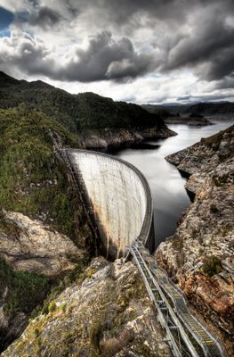
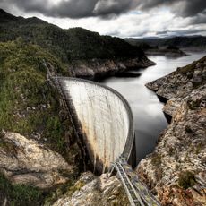
Gordon Dam, Concrete arch dam in Southwest National Park, Australia.
Gordon Dam is a double-curved concrete arch dam on the Gordon River in Southwest National Park, Tasmania, spanning one hundred ninety-eight meters and rising one hundred forty meters above the riverbed. The wall curves smoothly between steep rock faces, holding back a deep reservoir that stretches far upstream into the wilderness.
The government began building an access road through untouched wilderness in the early nineteen sixties to transport materials and equipment to the remote river site. Work on the dam wall itself started a few years later and continued into the early nineteen seventies, when the power station beneath the ground became operational.
Engineers Australia recognizes the Gordon Dam as a National Engineering Landmark through their Heritage Recognition Program for its technical achievements.
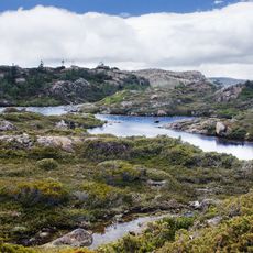
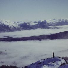
The approach follows a narrow mountain road through dense forest that can become slippery in rain and sometimes closes during winter months. Visitors should bring warm clothing, as wind near the dam edge can be strong and temperatures at this elevation often remain cool throughout the day.
Part of the dam wall is used for abseiling, with adventurers lowering themselves down the smooth concrete face while suspended above the water far below. The turbines deep beneath the ground are invisible from outside, yet they sit further below the surface than the dam wall rises above it.
The community of curious travelers
AroundUs brings together thousands of curated places, local tips, and hidden gems, enriched daily by 60,000 contributors worldwide.