Enable Location

We need your location to show you interesting places around you

Discover nearby places

Find interesting locations and hidden gems around you

Precise directions

Get accurate directions and distances to places

Your location is never shared with other users. It's only used when you tap the location button.

Log in to your account

Start exploring — it's free

Trusted by 62,049 travelers worldwide

Continue with Google
Continue with Apple
or

We will send you a code to connect

By continuing, you accept our Terms and Conditions and our Privacy Policy

Check your inbox

We've sent a pincode in your inbox. Please enter the code below.

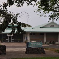
Kealakekua, Census-designated place on Big Island, Hawaii, United States

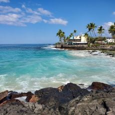
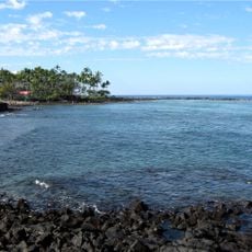
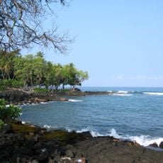
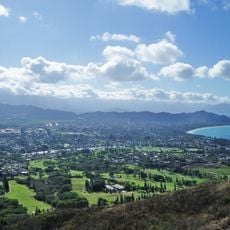
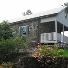
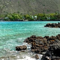
Kealakekua is a settlement on the western coast of Hawaii Island at 435 meters elevation, situated above Kealakekua Bay. The area features coastal landscapes that descend toward the water, combining residential sections with open spaces.

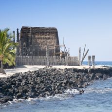
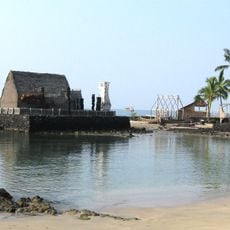
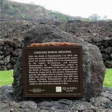
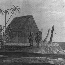
The area gained international significance in 1779 when British explorer Captain James Cook lost his life during a confrontation with local inhabitants. This event made Kealakekua a historically important site in European exploration of the Pacific.

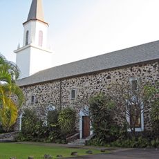
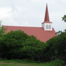
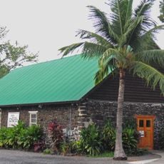
The name means "pathway of the god" in Hawaiian and reflects the deep spiritual bond of indigenous people to this coastal region. This meaning still shapes how locals relate to their surroundings and understand the place's significance.

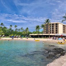
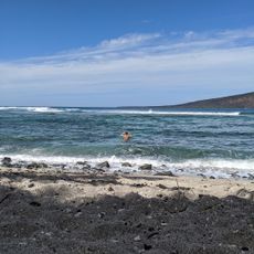
The area is reached via Highway 11, which connects it to other major locations on the western side of the island. Visitors can easily access beach attractions and explore the surrounding region.

The waters of the bay host populations of spinner dolphins and tropical fish that visitors can encounter while snorkeling or from boats. This marine diversity allows visitors to experience living ecosystems directly.

The community of curious travelers

AroundUs brings together thousands of curated places, local tips, and hidden gems, enriched daily by 60,000 contributors worldwide.

Start exploring
Location
Elevation above the sea
435 m
GPS coordinates
19.52640,-155.92300
Latest update
December 10, 2025 15:52
Around this place
Puʻuhonua o Hōnaunau National Historical Park
United States of America

Puʻuhonua o Hōnaunau National Historical Park

11.7 km
Kamakahonu
United States of America

Kamakahonu

14.8 km
Hulihee Palace
United States of America

Hulihee Palace

14.6 km
Keauhou Bay
United States of America

Keauhou Bay

5.6 km
Mokuaikaua Church
United States of America

Mokuaikaua Church

14.6 km
Magic Sands Beach
United States of America

Magic Sands Beach

9.1 km
Kuamoo Burials
United States of America

Kuamoo Burials

4.6 km
Kona Coffee Living History Farm
United States of America

Kona Coffee Living History Farm

4.1 km
Kahaluu Bay
United States of America

Kahaluu Bay

7.6 km
Holualoa Bay
United States of America

Holualoa Bay

10 km
Onion House
United States of America

Onion House

9.8 km
Keauhou Holua Slide
United States of America

Keauhou Holua Slide

5.4 km
Amy B. H. Greenwell Ethnobotanical Garden
United States of America

Amy B. H. Greenwell Ethnobotanical Garden

4.1 km
Kahikolu Church
United States of America

Kahikolu Church

6.4 km
Hale Halawai O Holualoa
United States of America

Hale Halawai O Holualoa

10.9 km
Sadie Seymour Botanical Gardens
United States of America

Sadie Seymour Botanical Gardens

10.9 km
Daifukuji Soto Zen Mission
United States of America

Daifukuji Soto Zen Mission

1.8 km
Hale o Keawe
United States of America

Hale o Keawe

11.7 km
Greenwell Store
United States of America

Greenwell Store

1.8 km
Pua'a-2 Agricultural Fields Archeological District
United States of America

Pua'a-2 Agricultural Fields Archeological District

12.8 km
Kamakahonu Beach
United States of America

Kamakahonu Beach

14.9 km
Aloha Theatre
United States of America

Aloha Theatre

866 m
Old Kona Airport Beach
United States of America

Old Kona Airport Beach

16.3 km
Kailua-Kona Public Library
United States of America

Kailua-Kona Public Library

14.3 km
Beans Beach
United States of America

Beans Beach

17.1 km
Kapahukapu Manini Beach
United States of America

Kapahukapu Manini Beach

6.2 km
Disappearing Sands Beach
United States of America

Disappearing Sands Beach

9.2 km
Keʻei Beach
United States of America

Keʻei Beach

7.2 km
Show the full map
« Kealakekua - Census-designated place on Big Island, Hawaii, United States » is provided by Around Us (aroundus.com). Images and texts are derived from Wikimedia project under a Creative Commons license. You are allowed to copy, distribute, and modify copies of this page, under the conditions set by the license, as long as this note is clearly visible.

Discover hidden gems everywhere you go!

From secret cafés to breathtaking viewpoints, skip the crowded tourist spots and find places that match your style. Our app makes it easy with voice search, smart filtering, route optimization, and insider tips from travelers worldwide. Download now for the complete mobile experience.

Around Us App Screenshot

A unique approach to discovering new places

Le Figaro

All the places worth exploring

France Info

A tailor-made excursion in just a few clicks

20 Minutes

Around Us
Travel Guide & Maps
Download

Send to your phone

QR Code
1

Open the camera app on your mobile.

2

Point at the QR code with your camera. A notification will appear.

3

Tap the notification to open the link.