Chest opened
+${chestReward.xp} XP
Explorer
NOUVEAU ×${chestReward.collectible.quantity}
tapez pour fermer

See the monuments around you in AR Open chests in the app

Around Us is built for your phone — point your camera at the streets and discover the monuments and places around you in augmented reality. Around Us is built for your phone — chests unlock when you walk, explore and capture nearby places.

Enable Location

We need your location to show you interesting places around you

Discover nearby places

Find interesting locations and hidden gems around you

Precise directions

Get accurate directions and distances to places

Your location is never shared with other users. It's only used when you tap the location button.

Hana Highway

Log in to your account

Start exploring — it's free

Trusted by 85,198 travelers worldwide

Continue with Google
Continue with Apple
or

We will send you a code to connect

By continuing, you accept our Terms and Conditions and our Privacy Policy

Check your inbox

We've sent a pincode in your inbox. Please enter the code below.

Discussion Reviews 1 Photos
67.5k Popularity

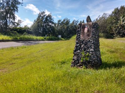
Hana Highway, Historic coastal road in Maui County, US.

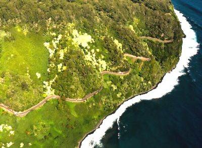
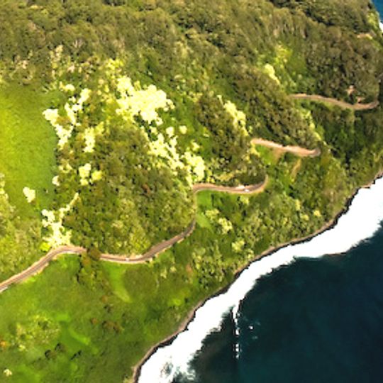
Hana Highway is a coastal road in Maui County that runs about 64.4 miles (104 kilometers) along the island's northern shore. It passes through dense rainforest, past waterfalls, and over narrow bridges that span valleys and gorges.

Construction of this road began in the 1920s to help move sugarcane from plantations in the east. Completion came in the early 1940s, after crews built dozens of concrete and steel bridges.

The name Hana comes from the Hawaiian language and means "work" or "craft," reflecting centuries of connection to farming. Small roadside stands offer fresh fruit and homemade snacks that travelers can buy directly from locals.

The drive from Kahului to the end near Hana takes about two and a half hours and requires full attention due to tight curves. Many bridges have only one lane, so travelers should pause and wait when meeting other vehicles.

In 2000, this road received special recognition as a Millennium Legacy Trail, acknowledging its importance to isolated villages in the east. The connection helped these communities stay in touch with the rest of Maui.

The community of curious travelers

AroundUs brings together thousands of curated places, local tips, and hidden gems, enriched daily by 60,000 contributors worldwide.

Start exploring
Location
GPS coordinates
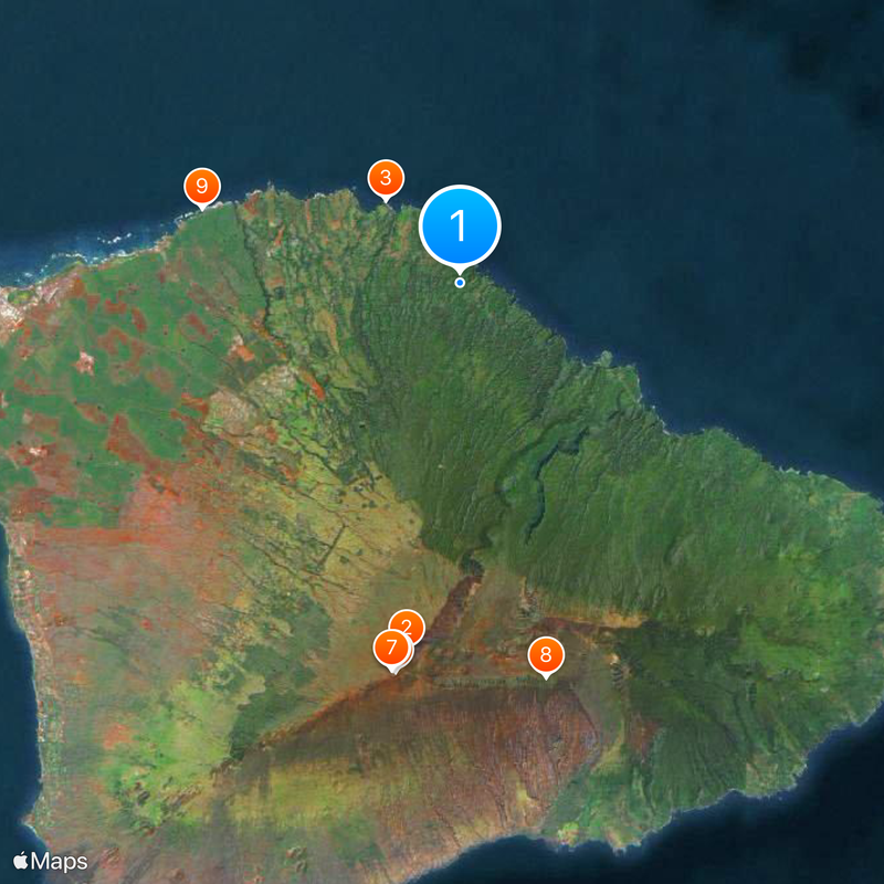
20.89778,-156.22222
Latest update
August 30, 2026 10:37
Around this place

Jaws
United States of America

Jaws

3.8 mi
United States of America

United States Space Surveillance Network

13.3 mi
Pan-STARRS
United States of America

Pan-STARRS

13.4 mi
Haleakalā Observatory
United States of America

Haleakalā Observatory

13.3 mi
Air Force Maui Optical and Supercomputing observatory
United States of America

Air Force Maui Optical and Supercomputing observatory

13.3 mi
Daniel K. Inouye Solar Telescope
United States of America

Daniel K. Inouye Solar Telescope

13.7 mi
Hookipa Park Beach
United States of America

Hookipa Park Beach

9.1 mi
Kahanu Garden
United States of America

Kahanu Garden

13.7 mi
3.67 m Advanced Electro Optical System Telescope
United States of America

3.67 m Advanced Electro Optical System Telescope

13.3 mi
Makawao Union Church
United States of America

Makawao Union Church

8.3 mi
Faulkes Telescope North
United States of America

Faulkes Telescope North

13.4 mi
Haleakalā Wilderness
United States of America

Haleakalā Wilderness

13.1 mi
Baldwin Beach
United States of America

Baldwin Beach

11.4 mi
Kula Botanical Garden
United States of America

Kula Botanical Garden

10 mi
Kaumahina State Wayside Park
United States of America

Kaumahina State Wayside Park

3.6 mi
Enchanted Floral Gardens of Kula, Maui
United States of America

Enchanted Floral Gardens of Kula, Maui

10 mi
Ke'anae Arboretum
United States of America

Ke'anae Arboretum

5.5 mi
Crater Historic District
United States of America

Crater Historic District

13.5 mi
Hookipa Park Beach
United States of America

Hookipa Park Beach

9.1 mi
Haleakalā Visitor Center
United States of America

Haleakalā Visitor Center

12.8 mi
Park Headquarters Visitor Center
United States of America

Park Headquarters Visitor Center

9.7 mi
Piilanihale Heiau
United States of America

Piilanihale Heiau

13.7 mi
Paia Secret Beach
United States of America

Paia Secret Beach

10.8 mi
Mather Plaque in Haleakalā National Park
United States of America

Mather Plaque in Haleakalā National Park

9.7 mi
Leleiwi Overlook
United States of America

Leleiwi Overlook

10.6 mi
Spreckelsville Beach
United States of America

Spreckelsville Beach

12.1 mi
VOR Beach
United States of America

VOR Beach

13.1 mi
Show the full map
Reviews
Share your experience

No review yet

Discussions
Start a discussion...

No discussion yet

« Hana Highway - Historic coastal road in Maui County, US » is provided by Around Us (aroundus.com). Images and texts are derived from Wikimedia project under a Creative Commons license. You are allowed to copy, distribute, and modify copies of this page, under the conditions set by the license, as long as this note is clearly visible.

Discover hidden gems everywhere you go!

From secret cafés to breathtaking viewpoints, skip the crowded tourist spots and find places that match your style. Our app makes it easy with voice search, smart filtering, route optimization, and insider tips from travelers worldwide. Download now for the complete mobile experience.

Around Us App Screenshot

A unique approach to discovering new places

Le Figaro

All the places worth exploring

France Info

A tailor-made excursion in just a few clicks

20 Minutes

Around Us
Travel Guide & Maps
Download

Send to your phone

QR Code
1

Open the camera app on your mobile.

2

Point at the QR code with your camera. A notification will appear.

3

Tap the notification to open the link.