Chest opened
+${chestReward.xp} XP
Explorer
NOUVEAU ×${chestReward.collectible.quantity}
tapez pour fermer
Chest locked

Open chests in the app

Around Us is built for your phone — chests unlock when you walk, explore and capture nearby places.

Enable Location

We need your location to show you interesting places around you

Discover nearby places

Find interesting locations and hidden gems around you

Precise directions

Get accurate directions and distances to places

Your location is never shared with other users. It's only used when you tap the location button.

Cook Inlet

Log in to your account

Start exploring — it's free

Trusted by 72,888 travelers worldwide

Continue with Google
Continue with Apple
or

We will send you a code to connect

By continuing, you accept our Terms and Conditions and our Privacy Policy

Check your inbox

We've sent a pincode in your inbox. Please enter the code below.

Cook Inlet
Discussion Reviews 2 Photos
36.7k Popularity

Cook Inlet, Tidal inlet in south-central Alaska, United States

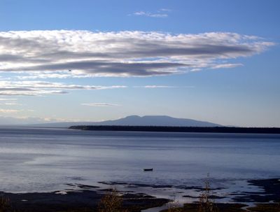
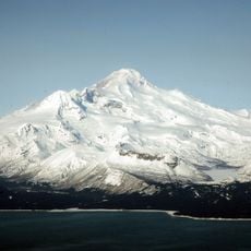
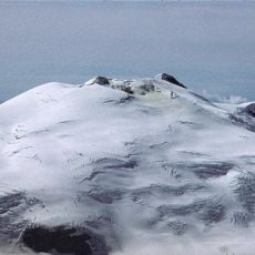
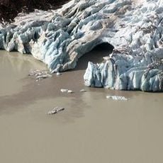
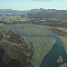
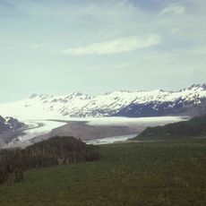
Cook Inlet is a tidal waterway in south-central Alaska that stretches roughly 180 miles and connects to the Gulf of Alaska through several channels. The body of water features varying widths and receives fresh water from multiple glacier-fed rivers flowing from inland mountains.

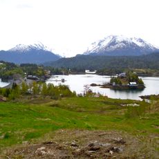
The Denaina people established settlements along its shores thousands of years ago, relying on the water's abundance for survival. Later exploration by European traders transformed the region into a center for commerce and resource extraction.

The Denaina people named this waterway Tikahtnu, meaning Big Water River, showing how central this body of water was to their way of life. The name itself reflects the respect and deep connection that indigenous communities had to this resource.

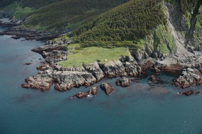
Commercial fishing operates year-round in these waters, with salmon, halibut, and cod being the main catches for local fleets. Visitors should prepare for harsh weather conditions and strong tidal currents when exploring this area.

These waters experience some of North America's most extreme tidal swings, with differences reaching up to 40 feet between high and low tide. Such dramatic shifts shape the landscape and affect how vessels and fishermen must plan their time on the water.

The community of curious travelers

AroundUs brings together thousands of curated places, local tips, and hidden gems, enriched daily by 60,000 contributors worldwide.

Start exploring
Location
GPS coordinates
58.94194,-153.18556
Latest update
December 17, 2025 10:44
Around this place
Augustine Volcano
United States of America

Augustine Volcano

48.8 km
Fourpeaked Mountain
United States of America

Fourpeaked Mountain

31.9 km
Mount Iliamna
United States of America

Mount Iliamna

121.5 km
Salty Dawg Saloon
United States of America

Salty Dawg Saloon

124.4 km
McNeil River
United States of America

McNeil River

74.7 km
Mount Douglas
United States of America

Mount Douglas

22.1 km
Kachemak Bay State Park
United States of America

Kachemak Bay State Park

130.3 km
Pratt Museum
United States of America

Pratt Museum

121.5 km
Holy Transfiguration of Our Lord Chapel
United States of America

Holy Transfiguration of Our Lord Chapel

150.3 km
Yukon Island Main Site
United States of America

Yukon Island Main Site

115.3 km
Mount Denison
United States of America

Mount Denison

93.6 km
United States of America

Grewingk Glacier

145.9 km
Homer Public Library
United States of America

Homer Public Library

122.3 km
Mount Kukak
United States of America

Mount Kukak

87 km
Mount Steller
United States of America

Mount Steller

90 km
United States of America

Mount Eleanor

94 km
St. Nicholas Chapel
United States of America

St. Nicholas Chapel

100.1 km
Nativity of Holy Theolokos Church
United States of America

Nativity of Holy Theolokos Church

106.6 km
Fourpeaked Glacier
United States of America

Fourpeaked Glacier

25.7 km
Sts. Sergius and Herman of Valaam Church
United States of America

Sts. Sergius and Herman of Valaam Church

85.6 km
Sts. Sergius and Herman of Valaam Chapel
United States of America

Sts. Sergius and Herman of Valaam Chapel

85.7 km
St. Nicholas Chapel
United States of America

St. Nicholas Chapel

107.3 km
Thorn-Stingley House
United States of America

Thorn-Stingley House

124.3 km
Savonoski River
United States of America

Savonoski River

106.3 km
Yalik Glacier
United States of America

Yalik Glacier

151.8 km
Tanalian River
United States of America

Tanalian River

152.3 km
Currant Creek
United States of America

Currant Creek

152.3 km
Pratt Museum and Park
United States of America

Pratt Museum and Park

121.5 km
Show the full map
Reviews
Share your experience

No review yet

Discussions
Start a discussion...

No discussion yet

« Cook Inlet - Tidal inlet in south-central Alaska, United States » is provided by Around Us (aroundus.com). Images and texts are derived from Wikimedia project under a Creative Commons license. You are allowed to copy, distribute, and modify copies of this page, under the conditions set by the license, as long as this note is clearly visible.

Discover hidden gems everywhere you go!

From secret cafés to breathtaking viewpoints, skip the crowded tourist spots and find places that match your style. Our app makes it easy with voice search, smart filtering, route optimization, and insider tips from travelers worldwide. Download now for the complete mobile experience.

Around Us App Screenshot

A unique approach to discovering new places

Le Figaro

All the places worth exploring

France Info

A tailor-made excursion in just a few clicks

20 Minutes

Around Us
Travel Guide & Maps
Download

Send to your phone

QR Code
1

Open the camera app on your mobile.

2

Point at the QR code with your camera. A notification will appear.

3

Tap the notification to open the link.