Enable Location

We need your location to show you interesting places around you

Discover nearby places

Find interesting locations and hidden gems around you

Precise directions

Get accurate directions and distances to places

Your location is never shared with other users. It's only used when you tap the location button.

Kasilof River

Log in to your account

Start exploring — it's free

Trusted by 62,290 travelers worldwide

Continue with Google
Continue with Apple
or

We will send you a code to connect

By continuing, you accept our Terms and Conditions and our Privacy Policy

Check your inbox

We've sent a pincode in your inbox. Please enter the code below.

Kasilof River

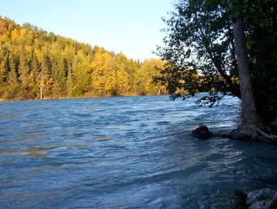
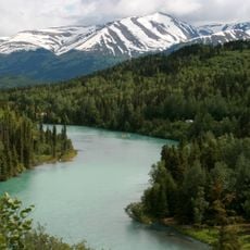
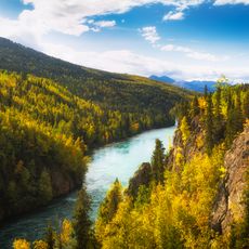
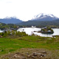
Kasilof River, Brook in Kenai Peninsula, US

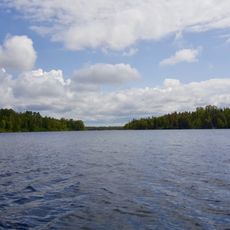
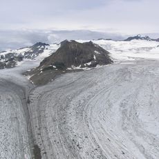
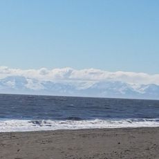
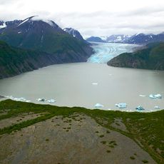
Kasilof River is a waterway on the Kenai Peninsula that flows from Tustumena Lake to Cook Inlet. The water moves swiftly and runs cold year-round because glaciers feed it upstream.

Russian settlers named this waterway Reka Kasilova, which later transformed into Kasilof through English adaptation. The name change reflects European expansion into the region during the colonial era.

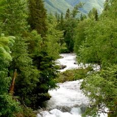
The Dena'ina people established fishing camps along these banks long before outsiders arrived in the region. Walking alongside the water today, you can sense the enduring connection between this place and the indigenous communities who depended on it.

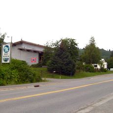
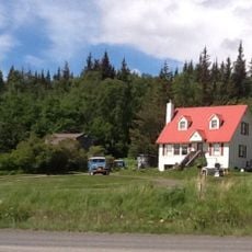
You can reach the river at three different State Parks locations, including the Kasilof River State Recreation Site with a boat launch for day-use visitors. The current is powerful, so take care when approaching the water or planning water-based activities.

The waterway maintains glacial temperatures throughout the year, making it a spawning ground for specific salmon species. These cold conditions create an unusual ecosystem that draws anglers and wildlife observers.

The community of curious travelers

AroundUs brings together thousands of curated places, local tips, and hidden gems, enriched daily by 60,000 contributors worldwide.

Start exploring
GPS coordinates
60.31242,-151.24501
Latest update
December 12, 2025 14:20
Around this place
Kenai Fjords National Park
United States of America

Kenai Fjords National Park

82.4 km
Mount Redoubt
United States of America

Mount Redoubt

84.7 km
Harding Icefield
United States of America

Harding Icefield

77 km
Kenai River
United States of America

Kenai River

39.2 km
Salty Dawg Saloon
United States of America

Salty Dawg Saloon

79.7 km
Kenai National Wildlife Refuge
United States of America

Kenai National Wildlife Refuge

41.1 km
Russian River
United States of America

Russian River

70 km
Tustumena Glacier
United States of America

Tustumena Glacier

60.4 km
Kachemak Bay State Park
United States of America

Kachemak Bay State Park

86.8 km
Pratt Museum
United States of America

Pratt Museum

76.2 km
Holy Transfiguration of Our Lord Chapel
United States of America

Holy Transfiguration of Our Lord Chapel

37.3 km
United States of America

Grewingk Glacier

82.8 km
Coral Seymour Ballpark
United States of America

Coral Seymour Ballpark

27.5 km
United States of America

McCarty Glacier

83 km
Captain Cook State Recreation Area
United States of America

Captain Cook State Recreation Area

54.2 km
Homer Public Library
United States of America

Homer Public Library

76.1 km
Soldotna Post Office
United States of America

Soldotna Post Office

22.4 km
Cooper Landing Historic District
United States of America

Cooper Landing Historic District

80.1 km
Double Glacier
United States of America

Double Glacier

81.2 km
Thorn-Stingley House
United States of America

Thorn-Stingley House

74.5 km
Andrew Berg Cabin
United States of America

Andrew Berg Cabin

40.3 km
Kenai Beach
United States of America

Kenai Beach

26.7 km
Drift River
United States of America

Drift River

80.5 km
Skilak Glacier
United States of America

Skilak Glacier

70 km
Kenai National Wildlife Refuge Visitor Center
United States of America

Kenai National Wildlife Refuge Visitor Center

19.4 km
Pratt Museum and Park
United States of America

Pratt Museum and Park

76.2 km
Dekanat Kenai
United States of America

Dekanat Kenai

26.9 km
Norman Lowell Gallery
United States of America

Norman Lowell Gallery

69 km
Show the full map
« Kasilof River - Brook in Kenai Peninsula, US » is provided by Around Us (aroundus.com). Images and texts are derived from Wikimedia project under a Creative Commons license. You are allowed to copy, distribute, and modify copies of this page, under the conditions set by the license, as long as this note is clearly visible.

Discover hidden gems everywhere you go!

From secret cafés to breathtaking viewpoints, skip the crowded tourist spots and find places that match your style. Our app makes it easy with voice search, smart filtering, route optimization, and insider tips from travelers worldwide. Download now for the complete mobile experience.

Around Us App Screenshot

A unique approach to discovering new places

Le Figaro

All the places worth exploring

France Info

A tailor-made excursion in just a few clicks

20 Minutes

Around Us
Travel Guide & Maps
Download

Send to your phone

QR Code
1

Open the camera app on your mobile.

2

Point at the QR code with your camera. A notification will appear.

3

Tap the notification to open the link.