Enable Location

We need your location to show you interesting places around you

Discover nearby places

Find interesting locations and hidden gems around you

Precise directions

Get accurate directions and distances to places

Your location is never shared with other users. It's only used when you tap the location button.

Captain Cook State Recreation Area

Log in to your account

Start exploring — it's free

Trusted by 61,780 travelers worldwide

Continue with Google
Continue with Apple
or

We will send you a code to connect

By continuing, you accept our Terms and Conditions and our Privacy Policy

Check your inbox

We've sent a pincode in your inbox. Please enter the code below.

Captain Cook State Recreation Area

Captain Cook State Recreation Area, State recreation area in Kenai Peninsula, Alaska.

Description

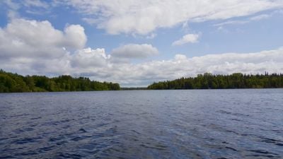
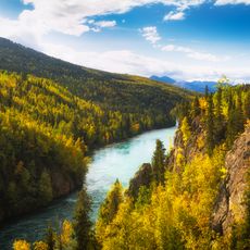
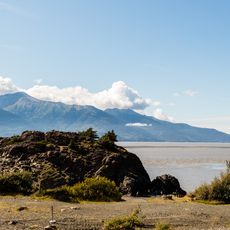
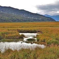
Captain Cook State Recreation Area covers roughly 3,400 acres along Cook Inlet and brings together beaches, forests, lakes, and hiking trails in one coastal setting. Discovery Campground with about 50 campsites sits north of Kenai and offers access to water, restrooms, and picnic areas.

History

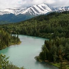
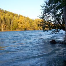
The area joined the Alaska State Parks system in 1971 and became one of the state's earliest established recreation zones. Before that, the coastal waters served for generations as hunting and fishing grounds for indigenous peoples.

Culture

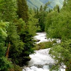
The Dena'ina Athabascan people established fishing camps along these shores and practiced salmon harvesting according to traditions passed down through families. The coastal landscape today reflects this long relationship between local communities and the waters.

Practical

The site is best visited during low tide when the mudflats become accessible and walking is easier. Discovery Campground sits about 25 miles north of Kenai and serves as a good base for exploring the area.

Did you know?

At low tide, vast mudflats emerge where visitors can spot offshore oil platforms in the distance, creating a striking reminder of the region's industrial side. This contrast between wild landscape and human presence shapes the character of a low-tide visit.

Location
GPS coordinates
60.78833,-151.03972
Latest update
December 14, 2025 14:41

AroundUs brings together thousands of curated places, local tips, and hidden gems, enriched daily by 60,000 contributors worldwide. Discover all places nearby (Alaska).

Around this place
Kenai River
United States of America

Kenai River

41.3 km
Conoco-Phillips Building
United States of America

Conoco-Phillips Building

77.8 km
Alaska Zoo
United States of America

Alaska Zoo

77.1 km
Kenai National Wildlife Refuge
United States of America

Kenai National Wildlife Refuge

58.6 km
Kincaid Park
United States of America

Kincaid Park

67 km
Russian River
United States of America

Russian River

70.6 km
Our Lady of Guadalupe Co-Cathedral
United States of America

Our Lady of Guadalupe Co-Cathedral

73.8 km
Beluga Point Site
United States of America

Beluga Point Site

76.8 km
Anchorage Alaska Temple
United States of America

Anchorage Alaska Temple

73.6 km
Alaska Aviation Museum
United States of America

Alaska Aviation Museum

72.2 km
Kasilof River
United States of America

Kasilof River

54.2 km
Oscar Anderson House Museum
United States of America

Oscar Anderson House Museum

77.7 km
H2Oasis Indoor Waterpark
United States of America

H2Oasis Indoor Waterpark

74 km
Statue of James Cook
United States of America

Statue of James Cook

77.8 km
Coral Seymour Ballpark
United States of America

Coral Seymour Ballpark

27 km
Pilgrim 100-B N709Y
United States of America

Pilgrim 100-B N709Y

72.2 km
Drift River Terminal Facility
United States of America

Drift River Terminal Facility

65.3 km
Chester Creek
United States of America

Chester Creek

77.8 km
KENI Radio Building
United States of America

KENI Radio Building

76 km
Anchorage Coastal Wildlife Refuge
United States of America

Anchorage Coastal Wildlife Refuge

70.7 km
Potter Section House
United States of America

Potter Section House

73.5 km
Oscar Gill House
United States of America

Oscar Gill House

77.3 km
Soldotna Post Office
United States of America

Soldotna Post Office

32.9 km
Cooper Landing Historic District
United States of America

Cooper Landing Historic District

73.8 km
McArthur River
United States of America

McArthur River

60.8 km
Blockade Glacier
United States of America

Blockade Glacier

72 km
Kenai National Wildlife Refuge Visitor Center
United States of America

Kenai National Wildlife Refuge Visitor Center

36.1 km
Dekanat Kenai
United States of America

Dekanat Kenai

28.6 km
Show the full map
« Captain Cook State Recreation Area - State recreation area in Kenai Peninsula, Alaska » is provided by Around Us (aroundus.com). Images and texts are derived from Wikimedia project under a Creative Commons license. You are allowed to copy, distribute, and modify copies of this page, under the conditions set by the license, as long as this note is clearly visible.

Discover hidden gems everywhere you go!

From secret cafés to breathtaking viewpoints, skip the crowded tourist spots and find places that match your style. Our app makes it easy with voice search, smart filtering, route optimization, and insider tips from travelers worldwide. Download now for the complete mobile experience.

Around Us App Screenshot

A unique approach to discovering new places

Le Figaro

All the places worth exploring

France Info

A tailor-made excursion in just a few clicks

20 Minutes

Around Us
Travel Guide & Maps
Download

Send to your phone

QR Code
1

Open the camera app on your mobile.

2

Point at the QR code with your camera. A notification will appear.

3

Tap the notification to open the link.