Enable Location

We need your location to show you interesting places around you

Discover nearby places

Find interesting locations and hidden gems around you

Precise directions

Get accurate directions and distances to places

Your location is never shared with other users. It's only used when you tap the location button.

Log in to your account

Start exploring — it's free

Trusted by 63,515 travelers worldwide

Continue with Google
Continue with Apple
or

We will send you a code to connect

By continuing, you accept our Terms and Conditions and our Privacy Policy

Check your inbox

We've sent a pincode in your inbox. Please enter the code below.

Steese National Conservation Area
Discussion Reviews Photo
1.8k Popularity

Steese National Conservation Area, National Conservation Area in Yukon-Koyukuk Census Area, Alaska.

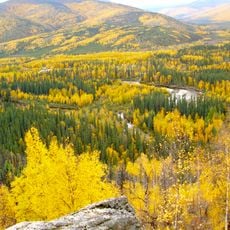
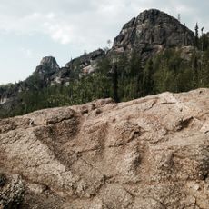
The Steese National Conservation Area is a protected region northeast of Fairbanks that features mountain ranges, flowing rivers, and dense forests across its expanses. The territory is divided into two distinct units, each offering different terrain and ecosystems to explore.

The area was designated as protected land in 1980 through federal legislation aimed at preserving Alaska's natural spaces. This designation came to safeguard the wilderness and its wildlife for future generations.

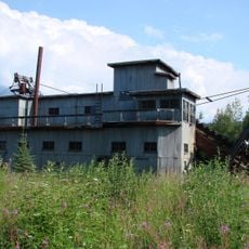
The conservation area contains evidence of Native Alaskan settlements and gold mining operations dating back to the late nineteenth century.

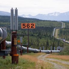
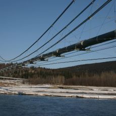
The Steese Highway provides the main entry route with several starting points for hiking and camping in the region. Visitors should prepare for seasonal conditions and travel with proper gear and adequate supplies.

The Pinnell Mountain National Recreation Trail winds through the North Unit and offers views of caribou mating grounds and habitats where Dall sheep gather seasonally. Hikers on this ridge path often encounter or spot signs of these animals moving across the landscape.

The community of curious travelers

AroundUs brings together thousands of curated places, local tips, and hidden gems, enriched daily by 60,000 contributors worldwide.

Start exploring
Location
Inception
1980
GPS coordinates
65.25000,-145.00000
Latest update
December 14, 2025 12:24
Around this place
Trans-Alaska Pipeline System
United States of America

Trans-Alaska Pipeline System

128.2 km
Fairbanks Gold Rush
United States of America

Fairbanks Gold Rush

119.4 km
Goldstream Dredge No. 8
United States of America

Goldstream Dredge No. 8

129.1 km
Yukon Flats National Wildlife Refuge
United States of America

Yukon Flats National Wildlife Refuge

129 km
White Mountains National Recreation Area
United States of America

White Mountains National Recreation Area

132 km
Rika's Landing Roadhouse
United States of America

Rika's Landing Roadhouse

128.3 km
Chena River State Recreation Area
United States of America

Chena River State Recreation Area

72.7 km
Creamer's Field Migratory Waterfowl Refuge
United States of America

Creamer's Field Migratory Waterfowl Refuge

135 km
Immaculate Conception Church
United States of America

Immaculate Conception Church

135.4 km
Slaven's Cabin
United States of America

Slaven's Cabin

88.2 km
Lacey Street Theatre
United States of America

Lacey Street Theatre

135.3 km
Coal Creek Historic Mining District
United States of America

Coal Creek Historic Mining District

84.5 km
Fairbanks City Hall
United States of America

Fairbanks City Hall

135.7 km
Rabinowitz Courthouse
United States of America

Rabinowitz Courthouse

135.4 km
Biederman's Cabin
United States of America

Biederman's Cabin

115.3 km
Masonic Temple
United States of America

Masonic Temple

135.8 km
Old Federal Building
United States of America

Old Federal Building

135.5 km
Discovery Claim on Pedro Creek
United States of America

Discovery Claim on Pedro Creek

120 km
Old City Hall
United States of America

Old City Hall

135.6 km
Fairbanks Exploration Company Housing
United States of America

Fairbanks Exploration Company Housing

135.1 km
Fairbanks Exploration Company Machine Shop
United States of America

Fairbanks Exploration Company Machine Shop

135.3 km
Fairbanks Exploration Company Manager's House
United States of America

Fairbanks Exploration Company Manager's House

134.9 km
Illinois Street Historic District
United States of America

Illinois Street Historic District

135.3 km
George McGregor Cabin
United States of America

George McGregor Cabin

87.8 km
Oddfellows House
United States of America

Oddfellows House

135.8 km
Angel Rocks Trail
United States of America

Angel Rocks Trail

62.8 km
Tanana Pipeline Bridge
United States of America

Tanana Pipeline Bridge

128.2 km
Tanana River Bridge
United States of America

Tanana River Bridge

128.2 km
Show the full map
Reviews
Share your experience

No review yet

Discussions
Start a discussion...

No discussion yet

« Steese National Conservation Area - National Conservation Area in Yukon-Koyukuk Census Area, Alaska » is provided by Around Us (aroundus.com). Images and texts are derived from Wikimedia project under a Creative Commons license. You are allowed to copy, distribute, and modify copies of this page, under the conditions set by the license, as long as this note is clearly visible.

Discover hidden gems everywhere you go!

From secret cafés to breathtaking viewpoints, skip the crowded tourist spots and find places that match your style. Our app makes it easy with voice search, smart filtering, route optimization, and insider tips from travelers worldwide. Download now for the complete mobile experience.

Around Us App Screenshot

A unique approach to discovering new places

Le Figaro

All the places worth exploring

France Info

A tailor-made excursion in just a few clicks

20 Minutes

Around Us
Travel Guide & Maps
Download

Send to your phone

QR Code
1

Open the camera app on your mobile.

2

Point at the QR code with your camera. A notification will appear.

3

Tap the notification to open the link.