Enable Location

We need your location to show you interesting places around you

Discover nearby places

Find interesting locations and hidden gems around you

Precise directions

Get accurate directions and distances to places

Your location is never shared with other users. It's only used when you tap the location button.

Carson

Log in to your account

Start exploring — it's free

Trusted by 62,445 travelers worldwide

Continue with Google
Continue with Apple
or

We will send you a code to connect

By continuing, you accept our Terms and Conditions and our Privacy Policy

Check your inbox

We've sent a pincode in your inbox. Please enter the code below.

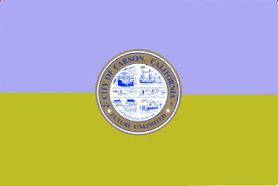
Carson, Urban center in South Bay region of Los Angeles County, California, United States.

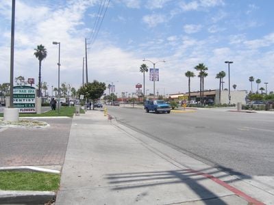
Carson is a city in the South Bay region of Los Angeles County, located south of downtown Los Angeles across developed land. The area contains residential neighborhoods, commercial districts, and recreational facilities connected by major transportation routes.

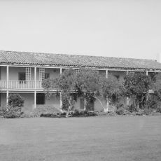
The area was originally part of Rancho San Pedro, granted by Spain in 1784, then shaped by George Henry Carson during the 1800s. His influence and name remain central to the city's heritage.

The city is home to a significant Filipino-American community whose presence shapes local restaurants, shops, and public gatherings. You notice this influence woven throughout daily life and the neighborhoods.

The city is well connected by highways and offers different ways to explore it, from driving to using public transportation. Visitors should know this is primarily car-oriented, so planning how to get around is worth doing.

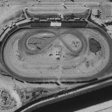
The city is home to Dignity Health Sports Park, a major regional stadium and home of the LA Galaxy soccer team. This sports center draws fans and visitors throughout the year.

The community of curious travelers

AroundUs brings together thousands of curated places, local tips, and hidden gems, enriched daily by 60,000 contributors worldwide.

Start exploring
Inception
1968
Elevation above the sea
12 m
Part of
South Bay, Los Angeles
Shares border with
Los Angeles
GPS coordinates
33.83972,-118.25972
Latest update
December 10, 2025 15:46
Around this place
Gerald Desmond Bridge
United States of America

Gerald Desmond Bridge

9.1 km
Ascot Park
United States of America

Ascot Park

3.9 km
Commodore Schuyler F. Heim Bridge
United States of America

Commodore Schuyler F. Heim Bridge

8.4 km
One World Trade Center
United States of America

One World Trade Center

9.7 km
Drum Barracks
United States of America

Drum Barracks

6.1 km
Henry Ford Bridge
United States of America

Henry Ford Bridge

8.4 km
Western Museum of Flight
United States of America

Western Museum of Flight

8.7 km
Banning House
United States of America

Banning House

5.5 km
International Printing Museum
United States of America

International Printing Museum

2.1 km
Los Cerritos Ranch House
United States of America

Los Cerritos Ranch House

6 km
Dominguez Rancho Adobe
United States of America

Dominguez Rancho Adobe

4.9 km
Bembridge House
United States of America

Bembridge House

8.7 km
Toyota USA Automobile Museum
United States of America

Toyota USA Automobile Museum

5.5 km
Pacific Electric Railroad Bridge
United States of America

Pacific Electric Railroad Bridge

4.7 km
Torrance School
United States of America

Torrance School

5.6 km
Leonie Pray House
United States of America

Leonie Pray House

5.9 km
José Dolores Sepúlveda Adobe
United States of America

José Dolores Sepúlveda Adobe

9.5 km
Scottish Rite Cathedral
United States of America

Scottish Rite Cathedral

9.6 km
Main Building
United States of America

Main Building

5.7 km
Lomita Railroad Museum
United States of America

Lomita Railroad Museum

7.2 km
Auditorium
United States of America

Auditorium

5.7 km
Home Economics Building
United States of America

Home Economics Building

5.8 km
SS. Peter and Paul's Church, Wilmington
United States of America

SS. Peter and Paul's Church, Wilmington

6.4 km
The Willmore
United States of America

The Willmore

9.8 km
Memory Chapel
United States of America

Memory Chapel

6 km
Long Beach Professional Building
United States of America

Long Beach Professional Building

9.4 km
The Banning Museum
United States of America

The Banning Museum

5.5 km
Drum Barracks Civil War Museum
United States of America

Drum Barracks Civil War Museum

6.2 km
Show the full map
« Carson - Urban center in South Bay region of Los Angeles County, California, United States » is provided by Around Us (aroundus.com). Images and texts are derived from Wikimedia project under a Creative Commons license. You are allowed to copy, distribute, and modify copies of this page, under the conditions set by the license, as long as this note is clearly visible.

Discover hidden gems everywhere you go!

From secret cafés to breathtaking viewpoints, skip the crowded tourist spots and find places that match your style. Our app makes it easy with voice search, smart filtering, route optimization, and insider tips from travelers worldwide. Download now for the complete mobile experience.

Around Us App Screenshot

A unique approach to discovering new places

Le Figaro

All the places worth exploring

France Info

A tailor-made excursion in just a few clicks

20 Minutes

Around Us
Travel Guide & Maps
Download

Send to your phone

QR Code
1

Open the camera app on your mobile.

2

Point at the QR code with your camera. A notification will appear.

3

Tap the notification to open the link.