Enable Location

We need your location to show you interesting places around you

Discover nearby places

Find interesting locations and hidden gems around you

Precise directions

Get accurate directions and distances to places

Your location is never shared with other users. It's only used when you tap the location button.

Arroyo Seco

Log in to your account

Start exploring — it's free

Trusted by 62,048 travelers worldwide

Continue with Google
Continue with Apple
or

We will send you a code to connect

By continuing, you accept our Terms and Conditions and our Privacy Policy

Check your inbox

We've sent a pincode in your inbox. Please enter the code below.

Arroyo Seco

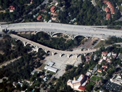
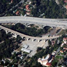
Arroyo Seco, Canyon and seasonal river in Los Angeles County, California.

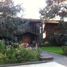
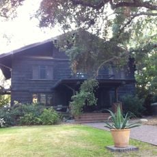
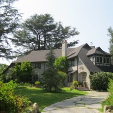
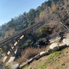
Arroyo Seco is a canyon and seasonal waterway that flows from the San Gabriel Mountains through Pasadena and joins the Los Angeles River near downtown Los Angeles. The area connects mountain terrain with urban surroundings and contains parks, trails, and recreational areas along its banks.

The area was originally inhabited by Native Americans before Spanish explorers arrived in the region during the 18th century. The waterway later became important for managing water resources as Los Angeles grew into a major city.

The name comes from Spanish, meaning "dry creek," reflecting how the waterway flows only seasonally. Today, residents use the banks and nearby parks as everyday spots to walk, rest, and spend time outdoors.

Visitors can explore the area on foot or by bike from several park entrances throughout the region. Water flows mainly after heavy rain, so it helps to check local conditions before planning a visit.

The Jet Propulsion Laboratory, a leading space research center, sits at the mouth of Arroyo Seco. This important facility chose the location because of its proximity to the waterway and mountain landscape.

The community of curious travelers

AroundUs brings together thousands of curated places, local tips, and hidden gems, enriched daily by 60,000 contributors worldwide.

Start exploring
GPS coordinates
34.15210,-118.16600
Latest update
December 17, 2025 11:00
Around this place
Rose Bowl
United States of America

Rose Bowl

1 km
Gamble House
United States of America

Gamble House

483 m
Colorado Street Bridge
United States of America

Colorado Street Bridge

850 m
Norton Simon Museum
United States of America

Norton Simon Museum

917 m
Millard House
United States of America

Millard House

538 m
Old Town Pasadena
United States of America

Old Town Pasadena

1.6 km
Ambassador Auditorium
United States of America

Ambassador Auditorium

1.3 km
St. Andrew's Catholic Church, Pasadena
United States of America

St. Andrew's Catholic Church, Pasadena

1.5 km
Kidspace Children's Museum
United States of America

Kidspace Children's Museum

401 m
Brookside Golf Course
United States of America

Brookside Golf Course

1.4 km
Pasadena Museum of History
United States of America

Pasadena Museum of History

570 m
Armory Center for the Arts
United States of America

Armory Center for the Arts

1.6 km
Raymond Theatre
United States of America

Raymond Theatre

1.6 km
Fenyes Estate
United States of America

Fenyes Estate

658 m
Hulett C. Merritt mansion
United States of America

Hulett C. Merritt mansion

1.1 km
Park Place-Arroyo Terrace Historic District
United States of America

Park Place-Arroyo Terrace Historic District

457 m
Finnish Folk Art Museum
United States of America

Finnish Folk Art Museum

637 m
Prospect Historic District
United States of America

Prospect Historic District

774 m
Dr. W. T. Bolton House
United States of America

Dr. W. T. Bolton House

1.5 km
Holly Street Livery Stable
United States of America

Holly Street Livery Stable

1.8 km
Louise C. Bentz House
United States of America

Louise C. Bentz House

651 m
House at 1015 Prospect Boulevard
United States of America

House at 1015 Prospect Boulevard

954 m
Court at 533-549 North Lincoln Avenue
United States of America

Court at 533-549 North Lincoln Avenue

1.1 km
W. L. Mead House
United States of America

W. L. Mead House

1.5 km
Raymond-Summit Historic District
United States of America

Raymond-Summit Historic District

1.7 km
Kosy Knook Court
United States of America

Kosy Knook Court

1.4 km
Holly Street Bridge
United States of America

Holly Street Bridge

373 m
Linda Vista Bridge
United States of America

Linda Vista Bridge

360 m
Show the full map
« Arroyo Seco - Canyon and seasonal river in Los Angeles County, California » is provided by Around Us (aroundus.com). Images and texts are derived from Wikimedia project under a Creative Commons license. You are allowed to copy, distribute, and modify copies of this page, under the conditions set by the license, as long as this note is clearly visible.

Discover hidden gems everywhere you go!

From secret cafés to breathtaking viewpoints, skip the crowded tourist spots and find places that match your style. Our app makes it easy with voice search, smart filtering, route optimization, and insider tips from travelers worldwide. Download now for the complete mobile experience.

Around Us App Screenshot

A unique approach to discovering new places

Le Figaro

All the places worth exploring

France Info

A tailor-made excursion in just a few clicks

20 Minutes

Around Us
Travel Guide & Maps
Download

Send to your phone

QR Code
1

Open the camera app on your mobile.

2

Point at the QR code with your camera. A notification will appear.

3

Tap the notification to open the link.