Chest opened
+${chestReward.xp} XP
Explorer
NOUVEAU ×${chestReward.collectible.quantity}
tapez pour fermer
Chest locked

Open chests in the app

Around Us is built for your phone — chests unlock when you walk, explore and capture nearby places.

Enable Location

We need your location to show you interesting places around you

Discover nearby places

Find interesting locations and hidden gems around you

Precise directions

Get accurate directions and distances to places

Your location is never shared with other users. It's only used when you tap the location button.

University City

Log in to your account

Start exploring — it's free

Trusted by 72,888 travelers worldwide

Continue with Google
Continue with Apple
or

We will send you a code to connect

By continuing, you accept our Terms and Conditions and our Privacy Policy

Check your inbox

We've sent a pincode in your inbox. Please enter the code below.

University City
Discussion Reviews 1 Photos
20.4k Popularity

University City, Residential neighborhood in San Diego, United States.

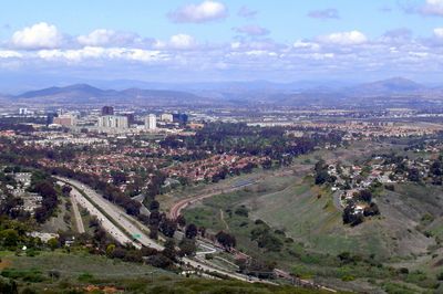
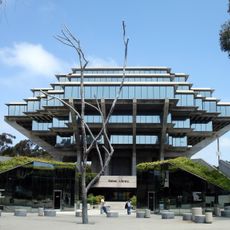
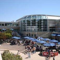
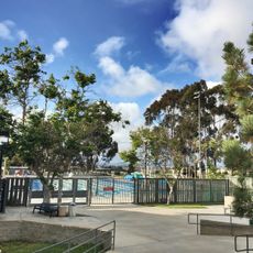
University City is a residential neighborhood in San Diego that spreads across a large area bounded by La Jolla, Interstate 5, Interstate 805, and Highway 52. The district contains shopping centers including Westfield UTC mall, grocery stores, and many dining options for both locals and visitors.

The area served as Camp Calvin B. Matthews, a rifle range during World War I, before closing in 1964. The site gradually transformed into the residential neighborhood it is today following military operations.

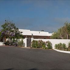
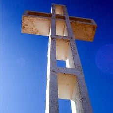
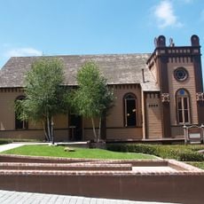
The San Diego California Temple of the Church of Jesus Christ of Latter-day Saints serves as a spiritual gathering place that shapes local religious life. It draws visitors from across the region and stands as a central landmark for the faith community.

The neighborhood is accessible by car via several major roads and has ample parking near shopping areas. Public transportation also connects the district to other parts of the city for those preferring not to drive.

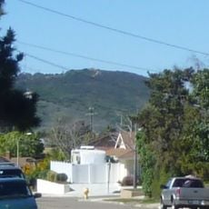
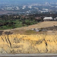
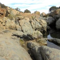
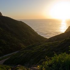
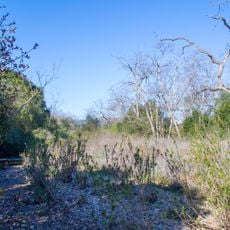
Rose Canyon divides the neighborhood into two sections and creates habitat for around 100 bird species. The valley offers trails where visitors can watch the variety of wild birds that live there.

The community of curious travelers

AroundUs brings together thousands of curated places, local tips, and hidden gems, enriched daily by 60,000 contributors worldwide.

Start exploring
Location
GPS coordinates
32.87000,-117.21000
Latest update
March 5, 2026 21:06
Around this place
Black's Beach
United States of America

Black's Beach

4.8 km
Salk Institute for Biological Studies
United States of America

Salk Institute for Biological Studies

3.9 km
Torrey Pines Golf Course
United States of America

Torrey Pines Golf Course

5 km
Geisel Library
United States of America

Geisel Library

2.9 km
La Jolla Cove
United States of America

La Jolla Cove

6.2 km
Mount Soledad
United States of America

Mount Soledad

4.7 km
San Diego Supercomputer Center
United States of America

San Diego Supercomputer Center

3.2 km
Birch Aquarium
United States of America

Birch Aquarium

3.8 km
Torrey Pines Gliderport
United States of America

Torrey Pines Gliderport

4.1 km
Ché Café
United States of America

Ché Café

2.7 km
Price Center
United States of America

Price Center

2.8 km
Audrey Geisel University House
United States of America

Audrey Geisel University House

3.8 km
Mount Soledad cross controversy
United States of America

Mount Soledad cross controversy

4.7 km
Los Peñasquitos Canyon Preserve
United States of America

Los Peñasquitos Canyon Preserve

6.7 km
Shell Beach
United States of America

Shell Beach

6.6 km
Conrad Prebys Music Center
United States of America

Conrad Prebys Music Center

2.5 km
Scripps Coastal Reserve
United States of America

Scripps Coastal Reserve

3.7 km
Old Scripps Building
United States of America

Old Scripps Building

4.1 km
Congregation Beth Israel
United States of America

Congregation Beth Israel

387 m
UCSD Moores Cancer Center
United States of America

UCSD Moores Cancer Center

1.6 km
Canyonview Aquatic Center
United States of America

Canyonview Aquatic Center

2.4 km
La Valencia Hotel
United States of America

La Valencia Hotel

6.4 km
San Clemente Canyon
United States of America

San Clemente Canyon

2.8 km
Athenaeum Music & Arts Library
United States of America

Athenaeum Music & Arts Library

6.5 km
Ellen Browning Scripps Memorial Pier
United States of America

Ellen Browning Scripps Memorial Pier

4.3 km
Torrey Pines Park Road
United States of America

Torrey Pines Park Road

6.7 km
Red Rest and Red Roost Cottages
United States of America

Red Rest and Red Roost Cottages

6.2 km
Torrey Pines City Beach
United States of America

Torrey Pines City Beach

3.9 km
Show the full map
Reviews
Share your experience

No review yet

Discussions
Start a discussion...

No discussion yet

« University City - Residential neighborhood in San Diego, United States » is provided by Around Us (aroundus.com). Images and texts are derived from Wikimedia project under a Creative Commons license. You are allowed to copy, distribute, and modify copies of this page, under the conditions set by the license, as long as this note is clearly visible.

Discover hidden gems everywhere you go!

From secret cafés to breathtaking viewpoints, skip the crowded tourist spots and find places that match your style. Our app makes it easy with voice search, smart filtering, route optimization, and insider tips from travelers worldwide. Download now for the complete mobile experience.

Around Us App Screenshot

A unique approach to discovering new places

Le Figaro

All the places worth exploring

France Info

A tailor-made excursion in just a few clicks

20 Minutes

Around Us
Travel Guide & Maps
Download

Send to your phone

QR Code
1

Open the camera app on your mobile.

2

Point at the QR code with your camera. A notification will appear.

3

Tap the notification to open the link.