Chest opened
+${chestReward.xp} XP
Explorer
NOUVEAU ×${chestReward.collectible.quantity}
tapez pour fermer
Chest locked

Open chests in the app

Around Us is built for your phone — chests unlock when you walk, explore and capture nearby places.

Enable Location

We need your location to show you interesting places around you

Discover nearby places

Find interesting locations and hidden gems around you

Precise directions

Get accurate directions and distances to places

Your location is never shared with other users. It's only used when you tap the location button.

Log in to your account

Start exploring — it's free

Trusted by 72,970 travelers worldwide

Continue with Google
Continue with Apple
or

We will send you a code to connect

By continuing, you accept our Terms and Conditions and our Privacy Policy

Check your inbox

We've sent a pincode in your inbox. Please enter the code below.

Discussion Reviews Photo
5.3k Popularity

Jamul Indian Village, Indigenous lands in San Diego County, US.

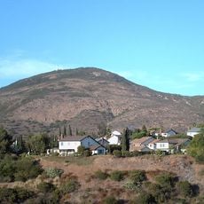
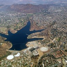
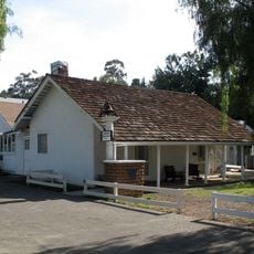
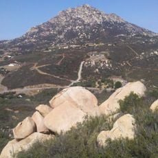
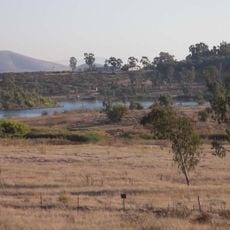
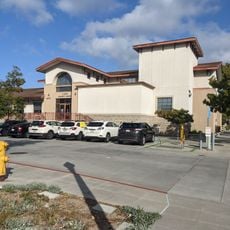
Jamul Indian Village is a settlement of the Kumeyaay people located on land southeast of El Cajon in San Diego County. The site contains homes and community spaces where a small population maintains their daily life.

The village received official recognition in 1912, though the Kumeyaay had lived in this region for thousands of years before. This formal acknowledgment was a turning point in the people's relationship with the broader government system.

The community maintains its Kumeyaay heritage through gatherings where members share stories and knowledge with younger generations. You can see how these traditions shape the way people interact and organize village life today.

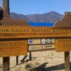
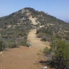
The site is small and easy to explore on foot without needing extensive planning. It helps to check ahead for visiting hours and any community events that might be happening during your visit.

The original boundaries of the village were marked in an unusual way by a young boy named Hank Aldama, who ran with a small rock to outline the territory. This tale shows how the village's formal borders rest on a simple gesture from decades ago.

The community of curious travelers

AroundUs brings together thousands of curated places, local tips, and hidden gems, enriched daily by 60,000 contributors worldwide.

Start exploring
Location
GPS coordinates
32.70238,-116.87141
Latest update
December 10, 2025 16:27
Around this place
Richard J. Donovan Correctional Facility
United States of America

Richard J. Donovan Correctional Facility

14.3 km
Cross Border Xpress
Mexico

Cross Border Xpress

19.7 km
United States of America

Cerutti Mastodon site

18.3 km
Cowles Mountain
United States of America

Cowles Mountain

19.4 km
North Island Credit Union Amphitheatre
United States of America

North Island Credit Union Amphitheatre

17.9 km
Skyline Church
United States of America

Skyline Church

8.7 km
Lake Murray
United States of America

Lake Murray

18.7 km
Lower Otay Reservoir
United States of America

Lower Otay Reservoir

9.8 km
Sweetwater Dam
United States of America

Sweetwater Dam

12.9 km
Otay Mountain
United States of America

Otay Mountain

12.3 km
San Miguel Mountain
United States of America

San Miguel Mountain

6.1 km
Museum of Creation and Earth History
United States of America

Museum of Creation and Earth History

17.9 km
Sweetwater Reservoir
United States of America

Sweetwater Reservoir

10.8 km
Barrett Dam
United States of America

Barrett Dam

19 km
Hubert H. Bancroft Ranch House
United States of America

Hubert H. Bancroft Ranch House

11.6 km
Loveland Dam
United States of America

Loveland Dam

11.4 km
Edgemoor Farm Dairy Barn
United States of America

Edgemoor Farm Dairy Barn

18.2 km
Lyons Peak
United States of America

Lyons Peak

10.1 km
McGinty Mountain
United States of America

McGinty Mountain

5.6 km
Savage Dam
United States of America

Savage Dam

11.4 km
Christian Fellowship Congregational Church
United States of America

Christian Fellowship Congregational Church

19.2 km
Creation & Earth History Museum & Bookstore
United States of America

Creation & Earth History Museum & Bookstore

17.9 km
Jardín Ahorrador de Agua en el Cuyamaca College
United States of America

Jardín Ahorrador de Agua en el Cuyamaca College

7.9 km
South Bay Botanic Gardens
United States of America

South Bay Botanic Gardens

13.4 km
Museum
United States of America

Museum

7.9 km
Lemon Grove Park
United States of America

Lemon Grove Park

14.5 km
Cine Zaragoza
Mexico

Cine Zaragoza

18.8 km
La Mesa Library
United States of America

La Mesa Library

15.9 km
Show the full map
Reviews
Share your experience

No review yet

Discussions
Start a discussion...

No discussion yet

« Jamul Indian Village - Indigenous lands in San Diego County, US » is provided by Around Us (aroundus.com). Images and texts are derived from Wikimedia project under a Creative Commons license. You are allowed to copy, distribute, and modify copies of this page, under the conditions set by the license, as long as this note is clearly visible.

Discover hidden gems everywhere you go!

From secret cafés to breathtaking viewpoints, skip the crowded tourist spots and find places that match your style. Our app makes it easy with voice search, smart filtering, route optimization, and insider tips from travelers worldwide. Download now for the complete mobile experience.

Around Us App Screenshot

A unique approach to discovering new places

Le Figaro

All the places worth exploring

France Info

A tailor-made excursion in just a few clicks

20 Minutes

Around Us
Travel Guide & Maps
Download

Send to your phone

QR Code
1

Open the camera app on your mobile.

2

Point at the QR code with your camera. A notification will appear.

3

Tap the notification to open the link.