Chest opened
+${chestReward.xp} XP
Explorer
NOUVEAU ×${chestReward.collectible.quantity}
tapez pour fermer
Chest locked

Open chests in the app

Around Us is built for your phone — chests unlock when you walk, explore and capture nearby places.

Enable Location

We need your location to show you interesting places around you

Discover nearby places

Find interesting locations and hidden gems around you

Precise directions

Get accurate directions and distances to places

Your location is never shared with other users. It's only used when you tap the location button.

Rancho Cucamonga

Log in to your account

Start exploring — it's free

Trusted by 72,882 travelers worldwide

Continue with Google
Continue with Apple
or

We will send you a code to connect

By continuing, you accept our Terms and Conditions and our Privacy Policy

Check your inbox

We've sent a pincode in your inbox. Please enter the code below.

Rancho Cucamonga
Discussion Reviews 1 Photos
18.8k Popularity

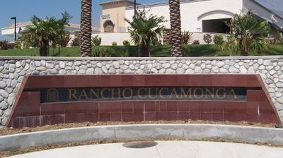
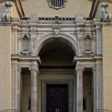
Rancho Cucamonga, Mexican land grant in San Bernardino County, California

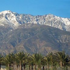
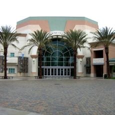
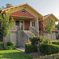
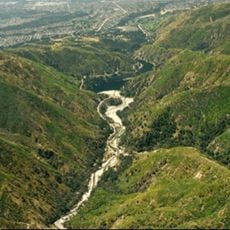
Rancho Cucamonga is a city in San Bernardino County located on the alluvial plain near the San Gabriel Mountains. The area contains residential neighborhoods and commercial districts with shopping centers and dining options throughout.

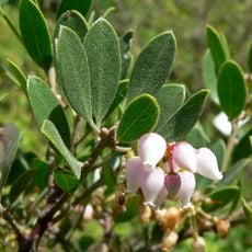
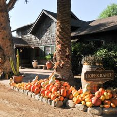
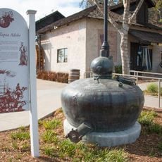
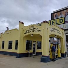
In 1839, Governor Juan Bautista Alvarado granted this territory to Tubercio Tapia, who established California's first winery here. Wine production became the economic foundation of the early settlement.

The city seal shows grape clusters, honoring the farming and wine-making past that shaped this place. You can see these symbols around town, connecting the present community to its roots in viticulture.

The city is accessible by car and offers various shops and restaurants throughout the area. Metrolink trains connect the location to Los Angeles and other nearby cities.

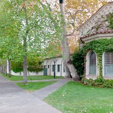
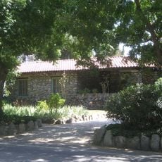
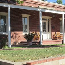
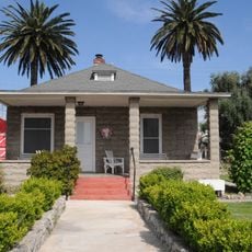
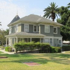
The Casa de Rancho Cucamonga was purchased by John Rains in 1858 and is registered as a historic building. The house remains in its original location and documents the region's early colonial period.

The community of curious travelers

AroundUs brings together thousands of curated places, local tips, and hidden gems, enriched daily by 60,000 contributors worldwide.

Start exploring
Location
Inception
1839
GPS coordinates
34.12000,-117.58000
Latest update
December 7, 2025 10:08
Around this place
Auto Club Speedway
United States of America

Auto Club Speedway

8.2 km
Scripps College
United States of America

Scripps College

12.2 km
Prometheus
United States of America

Prometheus

12.3 km
Cucamonga Peak
United States of America

Cucamonga Peak

11.5 km
Bridges Hall of Music
United States of America

Bridges Hall of Music

12.6 km
Padua Hills Theatre
United States of America

Padua Hills Theatre

11.7 km
Russian Village District
United States of America

Russian Village District

12.2 km
California Botanic Garden
United States of America

California Botanic Garden

12.6 km
Dividing the Light
United States of America

Dividing the Light

12.5 km
Bonita Falls
United States of America

Bonita Falls

14.1 km
Hofer Ranch
United States of America

Hofer Ranch

7.9 km
John Rains House
United States of America

John Rains House

2.9 km
Ontario Peak
United States of America

Ontario Peak

12.7 km
Raymond M. Alf Museum of Paleontology
United States of America

Raymond M. Alf Museum of Paleontology

14.6 km
Benton Museum of Art
United States of America

Benton Museum of Art

12.8 km
Bridges Auditorium
United States of America

Bridges Auditorium

12.4 km
Victoria Gardens Cultural Center
United States of America

Victoria Gardens Cultural Center

4.4 km
Tapia Adobe
United States of America

Tapia Adobe

3.2 km
Bullwinkle's
United States of America

Bullwinkle's

9.8 km
Old San Antonio Hospital
United States of America

Old San Antonio Hospital

7.6 km
John R. Rodman Arboretum
United States of America

John R. Rodman Arboretum

11.6 km
Frankish Building
United States of America

Frankish Building

9.1 km
Fontana Farms Company Ranch House, Camp No. 1
United States of America

Fontana Farms Company Ranch House, Camp No. 1

13.2 km
Aquatic Center
United States of America

Aquatic Center

11.3 km
San Dimas Experimental Forest
United States of America

San Dimas Experimental Forest

11.1 km
Folk Music Center
United States of America

Folk Music Center

13 km
Cucamonga Service Station
United States of America

Cucamonga Service Station

2 km
Helen Goodwin Renwick House
United States of America

Helen Goodwin Renwick House

12.7 km
Show the full map
Reviews
Share your experience

No review yet

Discussions
Start a discussion...

No discussion yet

« Rancho Cucamonga - Mexican land grant in San Bernardino County, California » is provided by Around Us (aroundus.com). Images and texts are derived from Wikimedia project under a Creative Commons license. You are allowed to copy, distribute, and modify copies of this page, under the conditions set by the license, as long as this note is clearly visible.

Discover hidden gems everywhere you go!

From secret cafés to breathtaking viewpoints, skip the crowded tourist spots and find places that match your style. Our app makes it easy with voice search, smart filtering, route optimization, and insider tips from travelers worldwide. Download now for the complete mobile experience.

Around Us App Screenshot

A unique approach to discovering new places

Le Figaro

All the places worth exploring

France Info

A tailor-made excursion in just a few clicks

20 Minutes

Around Us
Travel Guide & Maps
Download

Send to your phone

QR Code
1

Open the camera app on your mobile.

2

Point at the QR code with your camera. A notification will appear.

3

Tap the notification to open the link.