Chest opened
+${chestReward.xp} XP
Explorer
NOUVEAU ×${chestReward.collectible.quantity}
tapez pour fermer
Chest locked

Open chests in the app

Around Us is built for your phone — chests unlock when you walk, explore and capture nearby places.

Enable Location

We need your location to show you interesting places around you

Discover nearby places

Find interesting locations and hidden gems around you

Precise directions

Get accurate directions and distances to places

Your location is never shared with other users. It's only used when you tap the location button.

Pinacate Peaks

Log in to your account

Start exploring — it's free

Trusted by 72,885 travelers worldwide

Continue with Google
Continue with Apple
or

We will send you a code to connect

By continuing, you accept our Terms and Conditions and our Privacy Policy

Check your inbox

We've sent a pincode in your inbox. Please enter the code below.

Pinacate Peaks
Discussion Reviews 1 Photos
9.3k Popularity

Pinacate Peaks, Volcanic peaks in Sonora, Mexico.

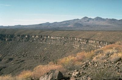
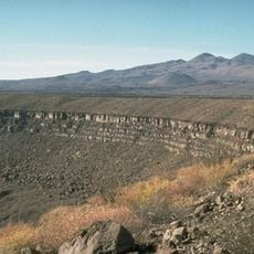
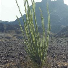
Pinacate Peaks is a volcanic complex in the Sonoran Desert composed of hundreds of cinder cones and extensive lava fields. The highest point reaches approximately 1,190 meters, creating a stark landscape of dark rock formations.

The peaks formed over millions of years through repeated volcanic eruptions and magma-water interactions beneath the surface. In the 1960s, the site became a training ground for astronauts preparing for lunar missions.

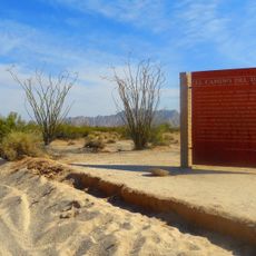
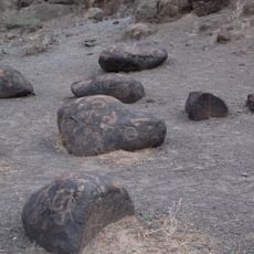
The landscape holds deep significance for indigenous communities who crossed these lands for thousands of years, adapting to extreme desert conditions. Local guides today continue these traditions of desert knowledge and navigation.

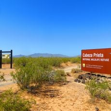
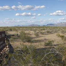
The site is best visited by vehicle, with access via Mexican roads from nearby towns. Bring plenty of water, fuel, and supplies since the area is remote and offers little in the way of services.

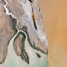
The region holds North America's only active star dunes, shaped by powerful desert winds in this isolated landscape. Nine massive crater depressions mark where magma explosively collided with groundwater deep underground.

The community of curious travelers

AroundUs brings together thousands of curated places, local tips, and hidden gems, enriched daily by 60,000 contributors worldwide.

Start exploring
Elevation above the sea
1,190 m
GPS coordinates
31.77000,-113.49000
Latest update
December 10, 2025 15:58
Around this place
Colorado River Delta
Mexico

Colorado River Delta

110.8 km
El Pinacate y Gran Desierto de Altar Biosphere Reserve
Mexico

El Pinacate y Gran Desierto de Altar Biosphere Reserve

47.8 km
El Camino Del Diablo
United States of America

El Camino Del Diablo

35 km
Painted Rock Petroglyph Site
United States of America

Painted Rock Petroglyph Site

145.6 km
Cabeza Prieta National Wildlife Refuge
United States of America

Cabeza Prieta National Wildlife Refuge

51.7 km
Desert Sun Stadium
United States of America

Desert Sun Stadium

146.8 km
Upper Gulf of California and Colorado River Delta biosphere reserve
Mexico

Upper Gulf of California and Colorado River Delta biosphere reserve

99.7 km
McPhaul Suspension Bridge
United States of America

McPhaul Suspension Bridge

140.8 km
Ventana Cave
United States of America

Ventana Cave

135 km
El Elegante Crater
Mexico

El Elegante Crater

12.7 km
Cabeza Prieta Wilderness
United States of America

Cabeza Prieta Wilderness

55.8 km
Playa Bonita Resort
Mexico

Playa Bonita Resort

50.7 km
Bates Well Ranch
United States of America

Bates Well Ranch

67.6 km
United States of America

Ajo Peak

83.6 km
Dos Lomitas Ranch
United States of America

Dos Lomitas Ranch

71.6 km
Z Fun Factory and Waylon's Water World
United States of America

Z Fun Factory and Waylon's Water World

143.1 km
Muggins Mountain Wilderness
United States of America

Muggins Mountain Wilderness

130 km
St. Paul's Episcopal Church
United States of America

St. Paul's Episcopal Church

149.7 km
United States Post Office–Yuma Main
United States of America

United States Post Office–Yuma Main

149.9 km
Gachado Well and Line Camp
United States of America

Gachado Well and Line Camp

67.6 km
Frank Ewing House
United States of America

Frank Ewing House

149.7 km
J. Homer Smith House
United States of America

J. Homer Smith House

150 km
Ruth Ewing House
United States of America

Ruth Ewing House

149.7 km
Westwind Golf Course
United States of America

Westwind Golf Course

135.7 km
Aquariam Mar De Cortez
Mexico

Aquariam Mar De Cortez

52.5 km
Gila Bend Visitor Center and Museum
United States of America

Gila Bend Visitor Center and Museum

149.1 km
San Felipe Lighthouse
Mexico

San Felipe Lighthouse

149.4 km
Stout's Hotel
United States of America

Stout's Hotel

149.9 km
Show the full map
Reviews
Share your experience

No review yet

Discussions
Start a discussion...

No discussion yet

« Pinacate Peaks - Volcanic peaks in Sonora, Mexico » is provided by Around Us (aroundus.com). Images and texts are derived from Wikimedia project under a Creative Commons license. You are allowed to copy, distribute, and modify copies of this page, under the conditions set by the license, as long as this note is clearly visible.

Discover hidden gems everywhere you go!

From secret cafés to breathtaking viewpoints, skip the crowded tourist spots and find places that match your style. Our app makes it easy with voice search, smart filtering, route optimization, and insider tips from travelers worldwide. Download now for the complete mobile experience.

Around Us App Screenshot

A unique approach to discovering new places

Le Figaro

All the places worth exploring

France Info

A tailor-made excursion in just a few clicks

20 Minutes

Around Us
Travel Guide & Maps
Download

Send to your phone

QR Code
1

Open the camera app on your mobile.

2

Point at the QR code with your camera. A notification will appear.

3

Tap the notification to open the link.