Enable Location

We need your location to show you interesting places around you

Discover nearby places

Find interesting locations and hidden gems around you

Precise directions

Get accurate directions and distances to places

Your location is never shared with other users. It's only used when you tap the location button.

Fort Leaton State Historic Site

Log in to your account

Start exploring — it's free

Trusted by 62,061 travelers worldwide

Continue with Google
Continue with Apple
or

We will send you a code to connect

By continuing, you accept our Terms and Conditions and our Privacy Policy

Check your inbox

We've sent a pincode in your inbox. Please enter the code below.

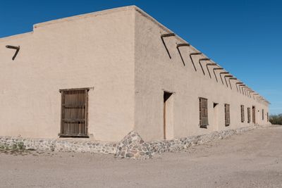
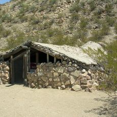
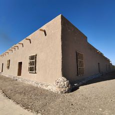
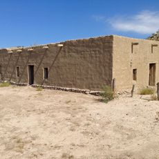
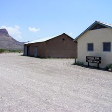
Fort Leaton State Historic Site, 19th century adobe fort in Presidio, United States.

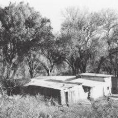
Fort Leaton is an adobe structure with thick walls reaching about 22 feet (7 meters) in height, featuring approximately 100 rooms arranged around a central courtyard near the Rio Grande. The building was designed to function as both a residence and a commercial space for trade operations.

Benjamin Leaton established this trading post in 1848, and it later served as the first governmental center of Presidio County. The site changed ownership multiple times after Leaton's death and was eventually preserved as a historic location.

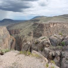
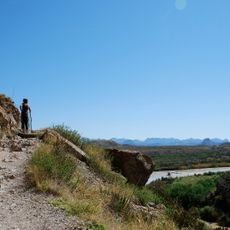
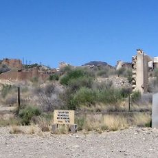
This place functioned as a trading hub along the Chihuahua Trail, where merchants from Santa Fe exchanged goods with local communities. The rooms show how commercial life and daily routines were organized during that era.

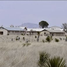
The fort is open daily from 8 AM to 4:30 PM and can be explored through guided tours or self-guided walks. The displays inside show artifacts and information about frontier life, making it easy to understand what you are seeing.

The adobe walls are about 3 feet (1 meter) thick and naturally regulate temperature, keeping interior spaces cool even during extreme desert heat. This traditional building technique shows how people adapted to harsh environmental conditions.

The community of curious travelers

AroundUs brings together thousands of curated places, local tips, and hidden gems, enriched daily by 60,000 contributors worldwide.

Start exploring
Location
Inception
1978
Elevation above the sea
782 m
Address
4 mi. E of Presidio on FM 170
GPS coordinates
29.54420,-104.32800
Latest update
December 12, 2025 08:00
Around this place
Cibolo Creek Ranch
United States of America

Cibolo Creek Ranch

35.4 km
Chinati Foundation
United States of America

Chinati Foundation

88.9 km
Cañón de Santa Elena Flora and Fauna Protection Area
Mexico

Cañón de Santa Elena Flora and Fauna Protection Area

65.6 km
Big Bend Ranch State Park
United States of America

Big Bend Ranch State Park

16.9 km
Aguja Formation
United States of America

Aguja Formation

84.8 km
El Paisano Hotel
United States of America

El Paisano Hotel

90.5 km
Luna Jacal
United States of America

Luna Jacal

85.2 km
Presidio County Courthouse
United States of America

Presidio County Courthouse

90.6 km
Rancho Estelle
United States of America

Rancho Estelle

85 km
Peguis Canyon
Mexico

Peguis Canyon

42.5 km
Santa Elena Canyon
Mexico

Santa Elena Canyon

81.3 km
Santa Elena Canyon Trail
United States of America

Santa Elena Canyon Trail

81.2 km
Central Marfa Historic District
United States of America

Central Marfa Historic District

90.4 km
Museum of Electronic Wonders @ FOOD SHARK with Snack Bar & Casita Bar
United States of America

Museum of Electronic Wonders @ FOOD SHARK with Snack Bar & Casita Bar

89.6 km
Castolon Historic District
United States of America

Castolon Historic District

91.2 km
Fort Leaton State Historic Site
United States of America

Fort Leaton State Historic Site

117 m
Marfa Lights Viewing Area
United States of America

Marfa Lights Viewing Area

92 km
Castolon Ranger Station
United States of America

Castolon Ranger Station

91.2 km
Palace Theater
United States of America

Palace Theater

90.7 km
Sacred Heart Catholic Mission Church
United States of America

Sacred Heart Catholic Mission Church

30.5 km
Texas Theater
United States of America

Texas Theater

90.6 km
Starlight Theatre
United States of America

Starlight Theatre

70.1 km
Maverick Entrance Sign
United States of America

Maverick Entrance Sign

84 km
Castolon Store
United States of America

Castolon Store

91.2 km
Alvino House
United States of America

Alvino House

91.1 km
Fortin de la Cienega
United States of America

Fortin de la Cienega

34.8 km
Recreation Building
United States of America

Recreation Building

91.2 km
Shafter Historic Mining District
United States of America

Shafter Historic Mining District

30.1 km
Show the full map
« Fort Leaton State Historic Site - 19th century adobe fort in Presidio, United States » is provided by Around Us (aroundus.com). Images and texts are derived from Wikimedia project under a Creative Commons license. You are allowed to copy, distribute, and modify copies of this page, under the conditions set by the license, as long as this note is clearly visible.

Discover hidden gems everywhere you go!

From secret cafés to breathtaking viewpoints, skip the crowded tourist spots and find places that match your style. Our app makes it easy with voice search, smart filtering, route optimization, and insider tips from travelers worldwide. Download now for the complete mobile experience.

Around Us App Screenshot

A unique approach to discovering new places

Le Figaro

All the places worth exploring

France Info

A tailor-made excursion in just a few clicks

20 Minutes

Around Us
Travel Guide & Maps
Download

Send to your phone

QR Code
1

Open the camera app on your mobile.

2

Point at the QR code with your camera. A notification will appear.

3

Tap the notification to open the link.