Chest opened
+${chestReward.xp} XP
Explorer
NOUVEAU ×${chestReward.collectible.quantity}
tapez pour fermer
Chest locked

Open chests in the app

Around Us is built for your phone — chests unlock when you walk, explore and capture nearby places.

Enable Location

We need your location to show you interesting places around you

Discover nearby places

Find interesting locations and hidden gems around you

Precise directions

Get accurate directions and distances to places

Your location is never shared with other users. It's only used when you tap the location button.

Apache Pass

Log in to your account

Start exploring — it's free

Trusted by 72,897 travelers worldwide

Continue with Google
Continue with Apple
or

We will send you a code to connect

By continuing, you accept our Terms and Conditions and our Privacy Policy

Check your inbox

We've sent a pincode in your inbox. Please enter the code below.

Apache Pass
Discussion Reviews 1 Photos
13.4k Popularity

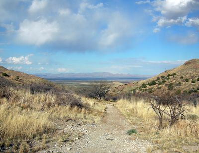
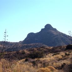
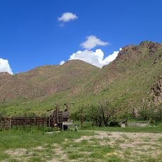
Apache Pass, Mountain pass in Cochise County, United States.

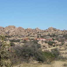
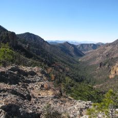
Apache Pass is a mountain pass in Arizona that cuts through rocky terrain between two ranges in Cochise County. The route provides a natural gateway through the landscape, connecting areas on either side of the mountains.

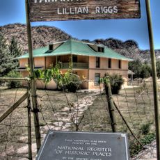
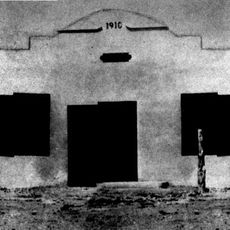
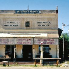
During the 1800s, the pass served as a key section of the Butterfield Overland Mail route, which carried mail and passengers across western territories. This role made it a vital point for early transportation and communication networks.

Apache peoples traveled through this natural corridor for generations, and the pass remains tied to their historical presence in the region. The route continues to represent an important connection to indigenous pathways across the desert landscape.

Visitors should prepare for high elevation and rocky terrain with proper gear and plenty of water. The cooler months offer the most comfortable conditions for exploring the area.

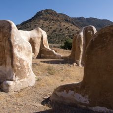
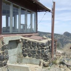
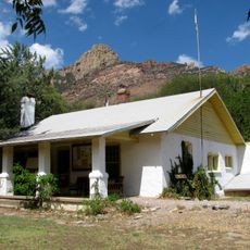
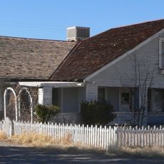
The pass contains archaeological remains from different eras showing the paths of indigenous peoples, settlers, and mail carriers. These traces tell the story of the many people who traveled through over the centuries.

The community of curious travelers

AroundUs brings together thousands of curated places, local tips, and hidden gems, enriched daily by 60,000 contributors worldwide.

Start exploring
Location
Elevation above the sea
1,558 m
Part of
Butterfield Overland Mail
GPS coordinates
32.15170,-109.48200
Latest update
December 7, 2025 20:40
Around this place
The Thing?
United States of America

The Thing?

54.1 km
Fort Bowie
United States of America

Fort Bowie

4.4 km
Texas Canyon
United States of America

Texas Canyon

58 km
Willcox Playa
United States of America

Willcox Playa

34.5 km
Chiricahua Peak
United States of America

Chiricahua Peak

38.5 km
Amerind Foundation
United States of America

Amerind Foundation

57.5 km
Faraway Ranch Historic District
United States of America

Faraway Ranch Historic District

18.8 km
Gleeson Jail
United States of America

Gleeson Jail

57.1 km
Rex Allen Arizona Cowboy Museum and Willcox Cowboy Hall of Fame
United States of America

Rex Allen Arizona Cowboy Museum and Willcox Cowboy Hall of Fame

34.8 km
United States of America

Bonita Canyon

19.9 km
Rucker Canyon
United States of America

Rucker Canyon

44.7 km
Chiricahua National Monument Historic Designed Landscape
United States of America

Chiricahua National Monument Historic Designed Landscape

21.3 km
United States of America

Lime Peak

58 km
Portal Ranger Station
United States of America

Portal Ranger Station

41.3 km
United States of America

Our Lady of Victory Catholic Church

42.3 km
Pearce General Store
United States of America

Pearce General Store

42.2 km
Johnson-Tillotson House
United States of America

Johnson-Tillotson House

35 km
John Gung'l House
United States of America

John Gung'l House

35.3 km
Benjamin E. Briscoe House
United States of America

Benjamin E. Briscoe House

35.7 km
Fort Bowie National Historic Site
United States of America

Fort Bowie National Historic Site

2.9 km
Bowie School District No. 14
United States of America

Bowie School District No. 14

19.3 km
Chiricahua Desert Museum
United States of America

Chiricahua Desert Museum

52.6 km
Silver Peak Lookout Complex
United States of America

Silver Peak Lookout Complex

38.2 km
Monte Vista Lookout Cabin
United States of America

Monte Vista Lookout Cabin

39.6 km
Fort Bowie Ranger Station & Visitor Center
United States of America

Fort Bowie Ranger Station & Visitor Center

4.3 km
Sugarloaf Mountain Lookout
United States of America

Sugarloaf Mountain Lookout

21.3 km
Horseshoe Canyon
United States of America

Horseshoe Canyon

54.1 km
Bonita Canyon Campground
United States of America

Bonita Canyon Campground

19.7 km
Show the full map
Reviews
Share your experience

No review yet

Discussions
Start a discussion...

No discussion yet

« Apache Pass - Mountain pass in Cochise County, United States » is provided by Around Us (aroundus.com). Images and texts are derived from Wikimedia project under a Creative Commons license. You are allowed to copy, distribute, and modify copies of this page, under the conditions set by the license, as long as this note is clearly visible.

Discover hidden gems everywhere you go!

From secret cafés to breathtaking viewpoints, skip the crowded tourist spots and find places that match your style. Our app makes it easy with voice search, smart filtering, route optimization, and insider tips from travelers worldwide. Download now for the complete mobile experience.

Around Us App Screenshot

A unique approach to discovering new places

Le Figaro

All the places worth exploring

France Info

A tailor-made excursion in just a few clicks

20 Minutes

Around Us
Travel Guide & Maps
Download

Send to your phone

QR Code
1

Open the camera app on your mobile.

2

Point at the QR code with your camera. A notification will appear.

3

Tap the notification to open the link.