Chest opened
+${chestReward.xp} XP
Explorer
NOUVEAU ×${chestReward.collectible.quantity}
tapez pour fermer
Chest locked

Open chests in the app

Around Us is built for your phone — chests unlock when you walk, explore and capture nearby places.

Enable Location

We need your location to show you interesting places around you

Discover nearby places

Find interesting locations and hidden gems around you

Precise directions

Get accurate directions and distances to places

Your location is never shared with other users. It's only used when you tap the location button.

Tonto National Monument

Log in to your account

Start exploring — it's free

Trusted by 72,995 travelers worldwide

Continue with Google
Continue with Apple
or

We will send you a code to connect

By continuing, you accept our Terms and Conditions and our Privacy Policy

Check your inbox

We've sent a pincode in your inbox. Please enter the code below.

Discussion Reviews 1 Photos
11.4k Popularity

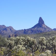
Tonto National Monument, Archaeological site in Superstition Mountains, Arizona.

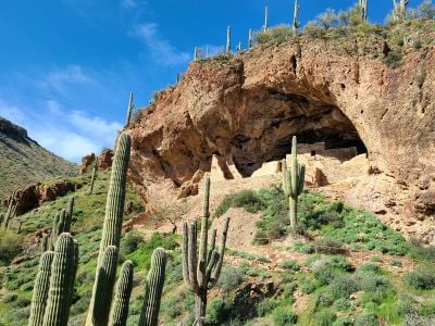
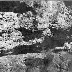
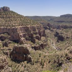
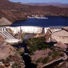
Tonto National Monument protects two dwellings carved into limestone cliffs overlooking the Salt River Valley in the Sonoran Desert. These stone structures date to medieval times and show how people adapted their homes to the rocky landscape.

The Salado built these dwellings in the 13th century and inhabited them for about two centuries. The federal government officially designated the site as a protected monument in 1907.

The Salado people left behind pottery and woven textiles that reflect how they lived and worked in the Salt River Valley landscape. These crafts show the skills and knowledge passed down through generations of people who made this place their home.

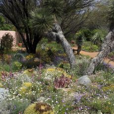
The lower dwelling is accessible through guided tours offered regularly, while the upper dwelling requires advance booking and is open at certain times. Bring plenty of water and wear comfortable shoes for the walk up the trail.

The site holds certification as an International Dark Sky Park, meaning city lights do not wash out the view of stars. Visitors can observe constellations and the Milky Way with remarkable clarity on clear nights.

The community of curious travelers

AroundUs brings together thousands of curated places, local tips, and hidden gems, enriched daily by 60,000 contributors worldwide.

Start exploring
Location
Inception
October 21, 1905
Operator
National Park Service
Address
26260 AZ-188, Roosevelt, AZ 85545, USA
Opening Hours
Monday-Sunday 08:00-17:00
Phone
GPS coordinates
33.65690,-111.09400
Latest update
February 8, 2026 09:32
Around this place
Canyon Lake
United States of America

Canyon Lake

34.2 km
Lost Dutchman State Park
United States of America

Lost Dutchman State Park

42 km
Four Peaks
United States of America

Four Peaks

21.7 km
Saguaro Lake
United States of America

Saguaro Lake

41.1 km
Weaver's Needle
United States of America

Weaver's Needle

35.8 km
Skeleton Cave
United States of America

Skeleton Cave

26.8 km
Salt River Canyon Wilderness
United States of America

Salt River Canyon Wilderness

25.9 km
Boyce Thompson Arboretum
United States of America

Boyce Thompson Arboretum

42.5 km
Sears-Kay Ruin
United States of America

Sears-Kay Ruin

27.3 km
Stewart Mountain Dam
United States of America

Stewart Mountain Dam

42.2 km
Mormon Flat Dam
United States of America

Mormon Flat Dam

34.2 km
Roosevelt Lake Bridge
United States of America

Roosevelt Lake Bridge

6.1 km
Globe Downtown Historic District
United States of America

Globe Downtown Historic District

40.9 km
Gila County Courthouse
United States of America

Gila County Courthouse

40.7 km
United States of America

Peralta Canyon

39.5 km
Our Lady of the Blessed Sacrament Church
United States of America

Our Lady of the Blessed Sacrament Church

35.3 km
Sierra Ancha Wilderness
United States of America

Sierra Ancha Wilderness

27.1 km
Holy Angels Church
United States of America

Holy Angels Church

40.9 km
Elks Building
United States of America

Elks Building

41.3 km
Miami Community Church
United States of America

Miami Community Church

35.5 km
Tonto National Monument Visitor Center
United States of America

Tonto National Monument Visitor Center

2.2 km
Bullion Plaza Cultural Center and Museum
United States of America

Bullion Plaza Cultural Center and Museum

35.4 km
Gila County Historical Museum
United States of America

Gila County Historical Museum

39.1 km
Boulder Creek Bridge
United States of America

Boulder Creek Bridge

33.5 km
Aztec Peak Lookout
United States of America

Aztec Peak Lookout

24.4 km
Pinto Creek Bridge
United States of America

Pinto Creek Bridge

35.2 km
Mormon Flat Bridge
United States of America

Mormon Flat Bridge

35 km
Alchesay Canyon Bridge
United States of America

Alchesay Canyon Bridge

6.2 km
Show the full map
Reviews
Share your experience

No review yet

Discussions
Start a discussion...

No discussion yet

« Tonto National Monument - Archaeological site in Superstition Mountains, Arizona » is provided by Around Us (aroundus.com). Images and texts are derived from Wikimedia project under a Creative Commons license. You are allowed to copy, distribute, and modify copies of this page, under the conditions set by the license, as long as this note is clearly visible.

Discover hidden gems everywhere you go!

From secret cafés to breathtaking viewpoints, skip the crowded tourist spots and find places that match your style. Our app makes it easy with voice search, smart filtering, route optimization, and insider tips from travelers worldwide. Download now for the complete mobile experience.

Around Us App Screenshot

A unique approach to discovering new places

Le Figaro

All the places worth exploring

France Info

A tailor-made excursion in just a few clicks

20 Minutes

Around Us
Travel Guide & Maps
Download

Send to your phone

QR Code
1

Open the camera app on your mobile.

2

Point at the QR code with your camera. A notification will appear.

3

Tap the notification to open the link.