Chest opened
+${chestReward.xp} XP
Explorer
NOUVEAU ×${chestReward.collectible.quantity}
tapez pour fermer
Chest locked

Open chests in the app

Around Us is built for your phone — chests unlock when you walk, explore and capture nearby places.

Enable Location

We need your location to show you interesting places around you

Discover nearby places

Find interesting locations and hidden gems around you

Precise directions

Get accurate directions and distances to places

Your location is never shared with other users. It's only used when you tap the location button.

Alpine

Log in to your account

Start exploring — it's free

Trusted by 72,878 travelers worldwide

Continue with Google
Continue with Apple
or

We will send you a code to connect

By continuing, you accept our Terms and Conditions and our Privacy Policy

Check your inbox

We've sent a pincode in your inbox. Please enter the code below.

Discussion Reviews 1 Photos
19.5k Popularity

Alpine, Census-designated place in Apache County, Arizona

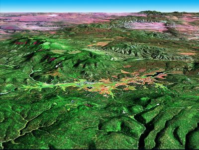
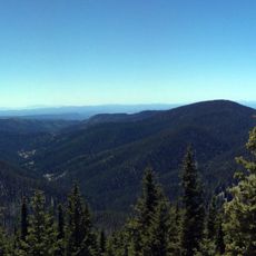
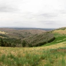
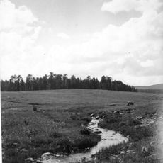
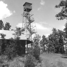
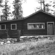
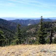
Alpine is a small settlement located in the White Mountains of eastern Arizona at an elevation of 8,050 feet (2,450 m). The community sits within a forested landscape surrounded by evergreens and mountainous terrain.

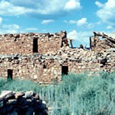
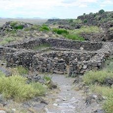
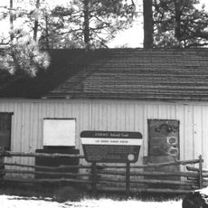
A trading post called Fort Bush was established in 1876 and later purchased by Mormon settlers who renamed the settlement Alpine. This early commercial activity laid the foundation for the community's development.

The community maintains connections to both Native American heritage and Mormon settlement history through local events and architectural elements throughout the area.

The settlement is accessible via U.S. Route 191 and offers a quiet rural setting for visitors. The area is well-suited for outdoor activities within the surrounding forest lands.

In February 1987, the area received a record amount of snowfall within 24 hours, marking a remarkable weather event in Arizona's snow history. This extreme snowfall demonstrates the unexpected climate conditions possible in this high-elevation region.

The community of curious travelers

AroundUs brings together thousands of curated places, local tips, and hidden gems, enriched daily by 60,000 contributors worldwide.

Start exploring
Location
GPS coordinates
33.84806,-109.14306
Latest update
December 7, 2025 10:07
Around this place
Morenci Mine
United States of America

Morenci Mine

86.8 km
Mount Baldy
United States of America

Mount Baldy

39.3 km
Round Valley Ensphere
United States of America

Round Valley Ensphere

33 km
Kinishba Ruins
United States of America

Kinishba Ruins

84.4 km
Escudilla Mountain
United States of America

Escudilla Mountain

12.2 km
Lyman Reservoir
United States of America

Lyman Reservoir

60.4 km
Apache National Forest
United States of America

Apache National Forest

30 km
Casa Malpaís
United States of America

Casa Malpaís

36.6 km
Cedar Canyon Bridge
United States of America

Cedar Canyon Bridge

101.2 km
Park Avenue Bridge
United States of America

Park Avenue Bridge

89.3 km
Lake Mountain Lookout Complex
United States of America

Lake Mountain Lookout Complex

67.3 km
Butterfly Lodge
United States of America

Butterfly Lodge

34.1 km
Whitewater Creek
United States of America

Whitewater Creek

64 km
Eagar Townsite Historic District
United States of America

Eagar Townsite Historic District

32 km
Corduroy Creek Bridge
United States of America

Corduroy Creek Bridge

97.6 km
Clifton Townsite Historic District
United States of America

Clifton Townsite Historic District

89.4 km
Eagar School
United States of America

Eagar School

32 km
Los Burros Ranger Station
United States of America

Los Burros Ranger Station

66 km
PS Knoll Lookout Complex
United States of America

PS Knoll Lookout Complex

25.8 km
Gila River Bridge
United States of America

Gila River Bridge

99.5 km
Mogollon Baldy Lookout Cabin
United States of America

Mogollon Baldy Lookout Cabin

81.9 km
Gallo Mountains
United States of America

Gallo Mountains

55.6 km
Cosmic Campground
United States of America

Cosmic Campground

45.8 km
Show Low Historical Society
United States of America

Show Low Historical Society

93.9 km
Chase Creek Railroad Bridge
United States of America

Chase Creek Railroad Bridge

89.2 km
Mogollon Baldy Lookout
United States of America

Mogollon Baldy Lookout

81.9 km
Bearwallow Lookout
United States of America

Bearwallow Lookout

62.5 km
Clifton Railroad Bridge
United States of America

Clifton Railroad Bridge

90 km
Show the full map
Reviews
Share your experience

No review yet

Discussions
Start a discussion...

No discussion yet

« Alpine - Census-designated place in Apache County, Arizona » is provided by Around Us (aroundus.com). Images and texts are derived from Wikimedia project under a Creative Commons license. You are allowed to copy, distribute, and modify copies of this page, under the conditions set by the license, as long as this note is clearly visible.

Discover hidden gems everywhere you go!

From secret cafés to breathtaking viewpoints, skip the crowded tourist spots and find places that match your style. Our app makes it easy with voice search, smart filtering, route optimization, and insider tips from travelers worldwide. Download now for the complete mobile experience.

Around Us App Screenshot

A unique approach to discovering new places

Le Figaro

All the places worth exploring

France Info

A tailor-made excursion in just a few clicks

20 Minutes

Around Us
Travel Guide & Maps
Download

Send to your phone

QR Code
1

Open the camera app on your mobile.

2

Point at the QR code with your camera. A notification will appear.

3

Tap the notification to open the link.