Carlsbad Irrigation District

Log in to your account

AroundUs is a community-driven map of interesting places, built by curious explorers like you. It grows with every review, story, and photo you share.
Connect to save your favorite spots, contribute locations, and create personalized routes.
Continue with Google
Continue with Apple
Continue with X
Continue with Facebook
Continue with email
By continuing, you accept our Terms and Conditions and our Privacy Policy
Create an account
Add to collection
Map
Suggest a change
Share

Carlsbad Irrigation District, Irrigation system in Eddy County, New Mexico, US.

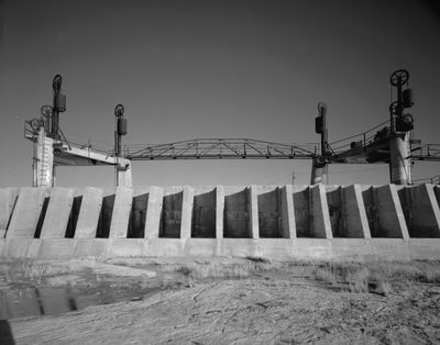
The Carlsbad Irrigation District oversees an extensive network of canals and dams along the Pecos River in southeastern New Mexico, distributing water for agricultural use across the arid landscape. The system remains operational and serves farming operations throughout the region.

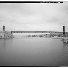
The irrigation project started in 1889 when Charles B. Eddy and Pat Garrett constructed the Avalon Dam to manage water in the lower Pecos River valley. This early infrastructure laid the foundation for permanent settlement and agriculture in the region.

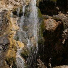
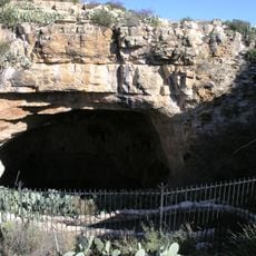
The irrigation network allowed early settlers to establish agricultural communities in a region that would otherwise be too dry for farming. Today, the canals remain visible throughout the landscape as a reminder of how water shaped this area's development.

The district office operates Monday through Thursday from 7 AM to 4 PM and manages water rights and allocation for local farmers. Visitors can stop by to learn how the system functions and ask questions about the water distribution network.

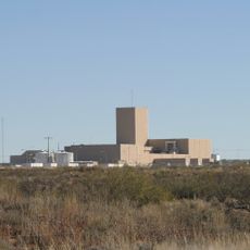
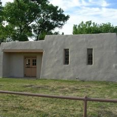
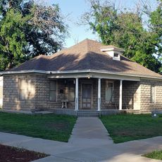
The district's administrative offices are housed in historic buildings in downtown Carlsbad, including the First Bank of Eddy building. This location connects local history with the daily operations of water management.

Location: Eddy County

GPS coordinates: 32.49190,-104.25240

Latest update: December 14, 2025 18:15

Photos
Around this place
Carlsbad Caverns National Park
United States of America

Carlsbad Caverns National Park

39.6 km
Waste Isolation Pilot Plant
United States of America

Waste Isolation Pilot Plant

9.1 km
Lechuguilla Cave
United States of America

Lechuguilla Cave

41 km
Sitting Bull Falls
United States of America

Sitting Bull Falls

49.9 km
Abo Elementary School
United States of America

Abo Elementary School

41 km
Living Desert Zoo and Gardens State Park
United States of America

Living Desert Zoo and Gardens State Park

6 km
Brantley Lake State Park
United States of America

Brantley Lake State Park

14 km
Rattlesnake Springs Historic District
United States of America

Rattlesnake Springs Historic District

47.1 km
The Caverns Historic District
United States of America

The Caverns Historic District

39.3 km
Sallie Chisum Robert House
United States of America

Sallie Chisum Robert House

41.7 km
Moore-Ward Cobblestone House
United States of America

Moore-Ward Cobblestone House

41.2 km
Rio Felix Bridge at Hagerman
United States of America

Rio Felix Bridge at Hagerman

71.6 km
Ozark Trails Marker at Lake Arthur
United States of America

Ozark Trails Marker at Lake Arthur

57.3 km
Willie D. Atkeson House
United States of America

Willie D. Atkeson House

40.9 km
William Baskin House
United States of America

William Baskin House

41.4 km
Bat Flight Amphitheater
United States of America

Bat Flight Amphitheater

39.3 km
F. L. Lukins House
United States of America

F. L. Lukins House

41.3 km
Hodges-Runyan-Brainard House
United States of America

Hodges-Runyan-Brainard House

41.4 km
Mauldin-Hall House
United States of America

Mauldin-Hall House

40.9 km
Carlsbad Cavern
United States of America

Carlsbad Cavern

39.3 km
John Acord House
United States of America

John Acord House

41.5 km
Hodges-Sipple House
United States of America

Hodges-Sipple House

41.1 km
Indian Rock Shelter
United States of America

Indian Rock Shelter

37.4 km
Rattlesnake Springs Pump House
United States of America

Rattlesnake Springs Pump House

47.3 km
Eddy County Courthouse
United States of America

Eddy County Courthouse

8.2 km
Natural Entrance
United States of America

Natural Entrance

39.3 km
Avalon Dam Suspension Bridge
United States of America

Avalon Dam Suspension Bridge

98 m
Cottonwood Day Use Area
United States of America

Cottonwood Day Use Area

48.6 km
Show the full map
Reviews

Visited this place? Tap the stars to rate it and share your experience / photos with the community! Try now! You can cancel it anytime.

« Carlsbad Irrigation District - Irrigation system in Eddy County, New Mexico, US » is provided by Around Us (aroundus.com). Images and texts are derived from Wikimedia project under a Creative Commons license. You are allowed to copy, distribute, and modify copies of this page, under the conditions set by the license, as long as this note is clearly visible.

Discover hidden gems everywhere you go!

From secret cafés to breathtaking viewpoints, skip the crowded tourist spots and find places that match your style. Our app makes it easy with voice search, smart filtering, route optimization, and insider tips from travelers worldwide. Download now for the complete mobile experience.

Around Us App Screenshot

A unique approach to discovering new places

Le Figaro

All the places worth exploring

France Info

A tailor-made excursion in just a few clicks

20 Minutes