The Caverns Historic District

Log in to your account

AroundUs is a community-driven map of interesting places, built by curious explorers like you. It grows with every review, story, and photo you share.
Connect to save your favorite spots, contribute locations, and create personalized routes.
By continuing, you accept our Terms and Conditions and our Privacy Policy
Add to collection
Map
Suggest a change
Share

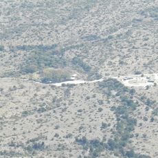
The Caverns Historic District, Historic district in Eddy County, New Mexico.

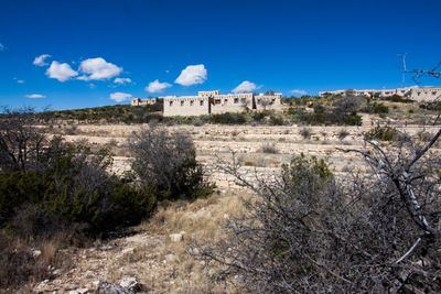
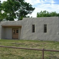
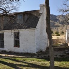
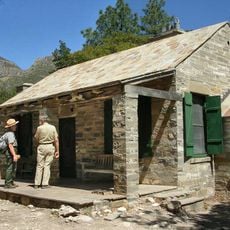
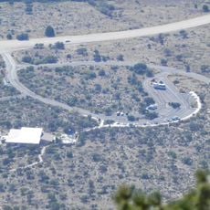
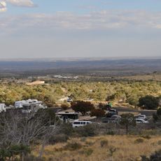
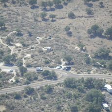
The Caverns Historic District is a group of thirteen buildings within Carlsbad Caverns National Park, constructed from local limestone and adobe materials. The structures are spread across the grounds and serve different purposes: administration, lodging, and visitor services.

The buildings arose between 1920 and 1942, marking the period when the park was being systematically developed for visitors. In the early 1940s, workers from the Civilian Conservation Corps provided crucial labor to complete several structures.

The buildings blend two architectural approaches: National Park Service rustic and Pueblo Revival styles, visible in the stonework and broad covered porches. This design choice reflected a desire to fit the structures into the landscape rather than dominate it.

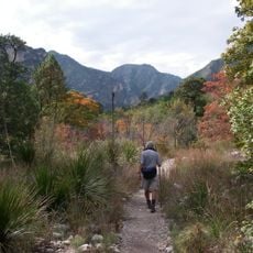
Visitors enter the district through the park's visitor center or entrance station and follow marked pathways through the grounds. The area is accessible year-round, though weather conditions can occasionally affect travel.

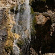
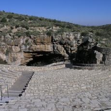
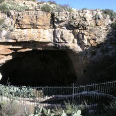
The Bat Flight Amphitheater is a specially built outdoor theater where thousands of Mexican free-tailed bats emerge from the cavern at dusk. This natural spectacle occurs from May through October and draws visitors who want to witness this nightly mass exodus.

Location: Eddy County

Architects: Thomas Chalmers Vint, Kenneth M. Saunders

Architectural style: National Park Service rustic, Pueblo Revival Style architecture

GPS coordinates: 32.17694,-104.44194

Latest update: December 14, 2025 09:42

Photos
Around this place
Carlsbad Caverns National Park
United States of America

Carlsbad Caverns National Park

261 m
Waste Isolation Pilot Plant
United States of America

Waste Isolation Pilot Plant

32.5 km
Lechuguilla Cave
United States of America

Lechuguilla Cave

6 km
Sitting Bull Falls
United States of America

Sitting Bull Falls

25.1 km
McKittrick Canyon
United States of America

McKittrick Canyon

36.8 km
Living Desert Zoo and Gardens State Park
United States of America

Living Desert Zoo and Gardens State Park

33.3 km
Brantley Lake State Park
United States of America

Brantley Lake State Park

42 km
Rattlesnake Springs Historic District
United States of America

Rattlesnake Springs Historic District

7.8 km
Wallace E. Pratt House
United States of America

Wallace E. Pratt House

38.6 km
Frijole Ranch
United States of America

Frijole Ranch

45.2 km
Wallace Pratt Lodge
United States of America

Wallace Pratt Lodge

38.5 km
Carlsbad Irrigation District
United States of America

Carlsbad Irrigation District

39.3 km
Pinery Station
United States of America

Pinery Station

47.4 km
Bat Flight Amphitheater
United States of America

Bat Flight Amphitheater

50 m
Carlsbad Cavern
United States of America

Carlsbad Cavern

86 m
Guadalupe Mountains Wilderness
United States of America

Guadalupe Mountains Wilderness

45.8 km
Smith Spring Trail
United States of America

Smith Spring Trail

44.6 km
Indian Rock Shelter
United States of America

Indian Rock Shelter

2.3 km
Butterfield Overland Mail Corridor
United States of America

Butterfield Overland Mail Corridor

47.3 km
Rattlesnake Springs Pump House
United States of America

Rattlesnake Springs Pump House

8 km
Pine Springs Visitor Center
United States of America

Pine Springs Visitor Center

47.7 km
Pine Springs Trailhead
United States of America

Pine Springs Trailhead

48 km
Eddy County Courthouse
United States of America

Eddy County Courthouse

33.8 km
Pine Springs Campground
United States of America

Pine Springs Campground

47.9 km
Frijole Ranch Picnic Area
United States of America

Frijole Ranch Picnic Area

45.4 km
Natural Entrance
United States of America

Natural Entrance

86 m
Cottonwood Day Use Area
United States of America

Cottonwood Day Use Area

9.4 km
Avalon Dam Suspension Bridge
United States of America

Avalon Dam Suspension Bridge

39.3 km
Show the full map
Reviews

Visited this place? Tap the stars to rate it and share your experience / photos with the community! Try now! You can cancel it anytime.

« The Caverns Historic District - Historic district in Eddy County, New Mexico » is provided by Around Us (aroundus.com). Images and texts are derived from Wikimedia project under a Creative Commons license. You are allowed to copy, distribute, and modify copies of this page, under the conditions set by the license, as long as this note is clearly visible.

Discover hidden gems everywhere you go!

From secret cafés to breathtaking viewpoints, skip the crowded tourist spots and find places that match your style. Our app makes it easy with voice search, smart filtering, route optimization, and insider tips from travelers worldwide. Download now for the complete mobile experience.

Around Us App Screenshot

A unique approach to discovering new places

Le Figaro

All the places worth exploring

France Info

A tailor-made excursion in just a few clicks

20 Minutes