Eddy County

Log in to your account

AroundUs is a community-driven map of interesting places, built by curious explorers like you. It grows with every review, story, and photo you share.
Connect to save your favorite spots, contribute locations, and create personalized routes.
Continue with Google
Continue with Apple
Continue with X
Continue with Facebook
Continue with email
By continuing, you accept our Terms and Conditions and our Privacy Policy
Create an account
Add to collection
Map
Suggest a change
Share

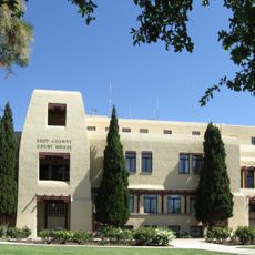
Eddy County, Administrative division in New Mexico, United States

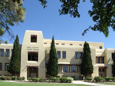
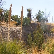
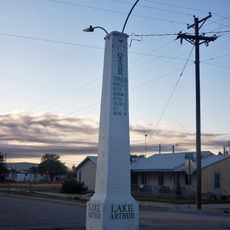
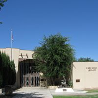
Eddy County is an administrative division in southeastern New Mexico with varied terrain ranging from flat desert expanses to rolling landforms. Carlsbad serves as the main hub, with several towns and communities spread across the wider territory.

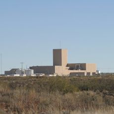
The area was established in 1917 and named after Edward Eddy, a figure in early development. Growth accelerated when oil and gas reserves were discovered, transforming the economy and settlement patterns.

The region's identity is shaped by its deep connection to oil and gas production, which has influenced how communities here develop and interact. This economic backbone continues to define local life and traditions.

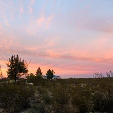
The area is best explored by car since distances between communities are large and public transportation is limited. Visitors should prepare for extreme weather conditions, as the region can be very hot and dry.

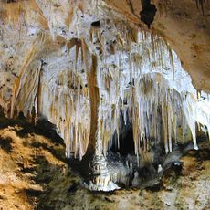
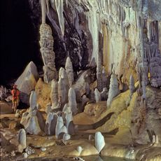
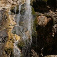
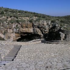
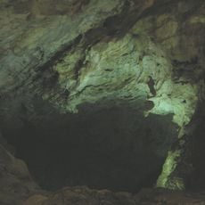
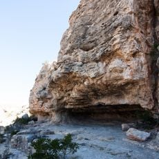
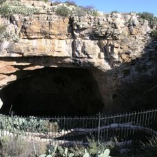
The Carlsbad Caverns, one of the world's largest cave systems, lies within the county and draws visitors from around the globe. These underground formations make the region known for something truly distinctive that few other places can offer.

Location: New Mexico

Inception: May 16, 1891

Capital city: Carlsbad

Shares border with: Chaves County, Culberson County, Otero County, Lea County, Loving County, Reeves County

Website: http://co.eddy.nm.us

GPS coordinates: 32.47000,-104.30000

Latest update: December 7, 2025 10:06

Photos
Around this place
Carlsbad Caverns National Park
United States of America

Carlsbad Caverns National Park

35.5 km
Waste Isolation Pilot Plant
United States of America

Waste Isolation Pilot Plant

8.8 km
Lechuguilla Cave
United States of America

Lechuguilla Cave

36.5 km
Sitting Bull Falls
United States of America

Sitting Bull Falls

44.9 km
Abo Elementary School
United States of America

Abo Elementary School

41.9 km
Living Desert Zoo and Gardens State Park
United States of America

Living Desert Zoo and Gardens State Park

3.8 km
Brantley Lake State Park
United States of America

Brantley Lake State Park

12 km
Rattlesnake Springs Historic District
United States of America

Rattlesnake Springs Historic District

43.1 km
The Caverns Historic District
United States of America

The Caverns Historic District

35.3 km
Carlsbad Irrigation District
United States of America

Carlsbad Irrigation District

5.1 km
Sallie Chisum Robert House
United States of America

Sallie Chisum Robert House

42.7 km
Moore-Ward Cobblestone House
United States of America

Moore-Ward Cobblestone House

42.3 km
Ozark Trails Marker at Lake Arthur
United States of America

Ozark Trails Marker at Lake Arthur

59.1 km
Willie D. Atkeson House
United States of America

Willie D. Atkeson House

42 km
William Baskin House
United States of America

William Baskin House

42.5 km
Bat Flight Amphitheater
United States of America

Bat Flight Amphitheater

35.2 km
F. L. Lukins House
United States of America

F. L. Lukins House

42.3 km
Hodges-Runyan-Brainard House
United States of America

Hodges-Runyan-Brainard House

42.4 km
Mauldin-Hall House
United States of America

Mauldin-Hall House

42 km
Carlsbad Cavern
United States of America

Carlsbad Cavern

35.2 km
John Acord House
United States of America

John Acord House

42.6 km
Hodges-Sipple House
United States of America

Hodges-Sipple House

42.2 km
Indian Rock Shelter
United States of America

Indian Rock Shelter

33.5 km
Rattlesnake Springs Pump House
United States of America

Rattlesnake Springs Pump House

43.2 km
Eddy County Courthouse
United States of America

Eddy County Courthouse

8.7 km
Natural Entrance
United States of America

Natural Entrance

35.2 km
Avalon Dam Suspension Bridge
United States of America

Avalon Dam Suspension Bridge

5.1 km
Cottonwood Day Use Area
United States of America

Cottonwood Day Use Area

44.6 km
Show the full map
Reviews

Visited this place? Tap the stars to rate it and share your experience / photos with the community! Try now! You can cancel it anytime.

Administrative divisions
« Eddy County - Administrative division in New Mexico, United States » is provided by Around Us (aroundus.com). Images and texts are derived from Wikimedia project under a Creative Commons license. You are allowed to copy, distribute, and modify copies of this page, under the conditions set by the license, as long as this note is clearly visible.

Discover hidden gems everywhere you go!

From secret cafés to breathtaking viewpoints, skip the crowded tourist spots and find places that match your style. Our app makes it easy with voice search, smart filtering, route optimization, and insider tips from travelers worldwide. Download now for the complete mobile experience.

Around Us App Screenshot

A unique approach to discovering new places

Le Figaro

All the places worth exploring

France Info

A tailor-made excursion in just a few clicks

20 Minutes