Lechuguilla Cave

Log in to your account

AroundUs is a community-driven map of interesting places, built by curious explorers like you. It grows with every review, story, and photo you share.
Connect to save your favorite spots, contribute locations, and create personalized routes.
By continuing, you accept our Terms and Conditions and our Privacy Policy

Lechuguilla Cave

Add to collection
Map
Suggest a change
Share

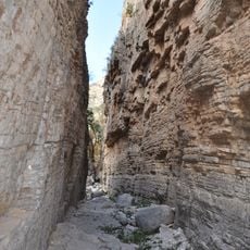
Lechuguilla Cave, Limestone cave in Carlsbad Caverns National Park, New Mexico, US

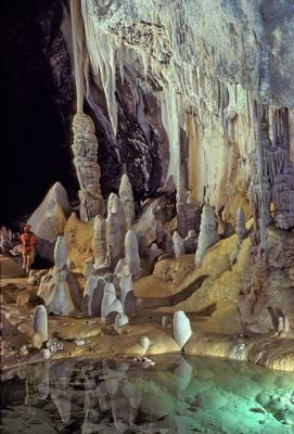
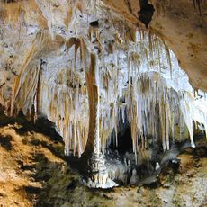
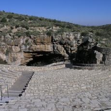
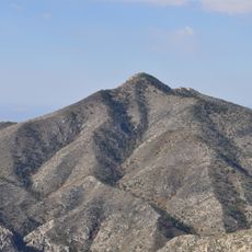
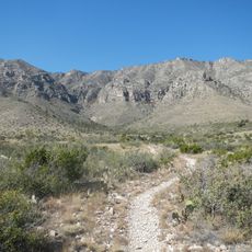
Lechuguilla Cave is a limestone formation in Carlsbad Caverns National Park, New Mexico, with mapped passages stretching 233 kilometers through the rock. The system reaches 489 meters below the Guadalupe Mountains surface, offering a labyrinth of chambers and passages on multiple levels.

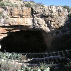
Cavers from Colorado discovered extensive passages beyond an entrance shaft in 1986, transforming what was once thought unimportant. This breakthrough made the site one of the longest and deepest cave systems in North America and a key location for geological research.

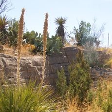
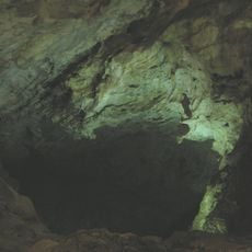
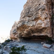
The site takes its name from a type of spiky leafed cactus common in the region, which resembles the shape of certain formations. Research teams spend weeks underground studying how minerals form and how life adapts to complete darkness.

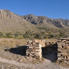
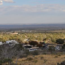
Access is strictly limited to approved scientific researchers, survey crews, and National Park Service staff. Visitors should be aware that no public tours are offered, as protecting the delicate environment takes priority.

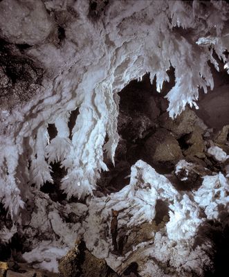
Rare bacteria that consume rock minerals live deep in the chambers, feeding on sulfur compounds. Some gypsum crystals hang up to 6 meters from the ceilings and are among the finest formations of their kind anywhere in the world.

Location: Eddy County

GPS coordinates: 32.19064,-104.50331

Latest update: December 5, 2025 16:30

Photos
The most beautiful caves and grottoes in the World

Caves form through gradual geological processes that can span millions of years. Water dissolves limestone and creates underground chambers filled with stalactites and stalagmites, while ice caves in alpine regions maintain their frozen formations even during summer months. Each cave system tells a...

Around this place
Show the full map
Carlsbad Caverns National Park
United States of America

Carlsbad Caverns National Park

5.9 km
Waste Isolation Pilot Plant
United States of America

Waste Isolation Pilot Plant

35.2 km
Sitting Bull Falls
United States of America

Sitting Bull Falls

19.1 km
McKittrick Canyon
United States of America

McKittrick Canyon

33.4 km
Living Desert Zoo and Gardens State Park
United States of America

Living Desert Zoo and Gardens State Park

35.1 km
Brantley Lake State Park
United States of America

Brantley Lake State Park

41.7 km
Rattlesnake Springs Historic District
United States of America

Rattlesnake Springs Historic District

9.6 km
Wallace E. Pratt House
United States of America

Wallace E. Pratt House

35.4 km
The Caverns Historic District
United States of America

The Caverns Historic District

6 km
Frijole Ranch
United States of America

Frijole Ranch

42.2 km
Wallace Pratt Lodge
United States of America

Wallace Pratt Lodge

34.9 km
Carlsbad Irrigation District
United States of America

Carlsbad Irrigation District

41 km
Pinery Station
United States of America

Pinery Station

44.4 km
Carlsbad Water Park
United States of America

Carlsbad Water Park

37.5 km
Bat Flight Amphitheater
United States of America

Bat Flight Amphitheater

6 km
Carlsbad Cavern
United States of America

Carlsbad Cavern

6.1 km
Guadalupe Mountains Wilderness
United States of America

Guadalupe Mountains Wilderness

42 km
Smith Spring Trail
United States of America

Smith Spring Trail

41.5 km
Indian Rock Shelter
United States of America

Indian Rock Shelter

7.7 km
Butterfield Overland Mail Corridor
United States of America

Butterfield Overland Mail Corridor

44.3 km
Rattlesnake Springs Pump House
United States of America

Rattlesnake Springs Pump House

9.5 km
Pine Springs Visitor Center
United States of America

Pine Springs Visitor Center

44.6 km
Pine Springs Trailhead
United States of America

Pine Springs Trailhead

44.8 km
Eddy County Courthouse
United States of America

Eddy County Courthouse

36.4 km
Devils Hall
United States of America

Devils Hall

45.3 km
Frijole Ranch Picnic Area
United States of America

Frijole Ranch Picnic Area

42.4 km
Natural Entrance
United States of America

Natural Entrance

6.1 km
Cottonwood Day Use Area
United States of America

Cottonwood Day Use Area

11.1 km
Show the full map
Reviews

Visited this place? Tap the stars to rate it and share your experience / photos with the community! Try now! You can cancel it anytime.

« Lechuguilla Cave - Limestone cave in Carlsbad Caverns National Park, New Mexico, US » is provided by Around Us (aroundus.com). Images and texts are derived from Wikimedia project under a Creative Commons license. You are allowed to copy, distribute, and modify copies of this page, under the conditions set by the license, as long as this note is clearly visible.

Discover hidden gems everywhere you go!

From secret cafés to breathtaking viewpoints, skip the crowded tourist spots and find places that match your style. Our app makes it easy with voice search, smart filtering, route optimization, and insider tips from travelers worldwide. Download now for the complete mobile experience.

Around Us App Screenshot

A unique approach to discovering new places

Le Figaro

All the places worth exploring

France Info

A tailor-made excursion in just a few clicks

20 Minutes