Chest opened
+${chestReward.xp} XP
Explorer
NOUVEAU ×${chestReward.collectible.quantity}
tapez pour fermer
Chest locked

Open chests in the app

Around Us is built for your phone — chests unlock when you walk, explore and capture nearby places.

Enable Location

We need your location to show you interesting places around you

Discover nearby places

Find interesting locations and hidden gems around you

Precise directions

Get accurate directions and distances to places

Your location is never shared with other users. It's only used when you tap the location button.

Log in to your account

Start exploring — it's free

Trusted by 72,891 travelers worldwide

Continue with Google
Continue with Apple
or

We will send you a code to connect

By continuing, you accept our Terms and Conditions and our Privacy Policy

Check your inbox

We've sent a pincode in your inbox. Please enter the code below.

Seven Rivers
Discussion Reviews Photo
2.9k Popularity

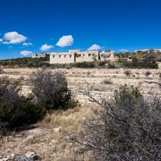
Seven Rivers, Archaeological site in southeastern New Mexico, United States

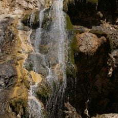
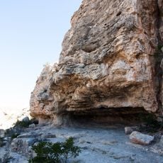
Seven Rivers is an archaeological site in southeastern New Mexico where multiple creek systems converge before flowing into the Pecos River. The landscape displays remains of former settlements and evidence of how people adapted to life around these water sources.

The area developed as a trading post starting in the 1860s and quickly added a hotel, post office, and commercial buildings to serve travelers and merchants. This infrastructure made it a significant stopping point for people moving through the region.

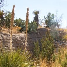
The region reflects the presence of Pueblo peoples and other indigenous groups who made this place home because of reliable water sources. Walking through the area, you can sense how water determined where people built and lived.

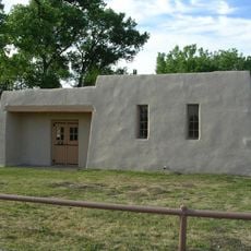
The best way to learn about this place is through regional museums that display archaeological finds and information about the settlement. Visitors should prepare for desert conditions with appropriate clothing and plenty of water.

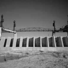
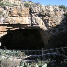
The original cemetery was relocated to the nearby town of Artesia in 1988 to make way for the Brantley Dam construction. This relocation illustrates how modern infrastructure projects transformed the relationship between place and its past.

The community of curious travelers

AroundUs brings together thousands of curated places, local tips, and hidden gems, enriched daily by 60,000 contributors worldwide.

Start exploring
Location
GPS coordinates
32.59500,-104.42200
Latest update
December 12, 2025 14:27
Around this place
Carlsbad Caverns National Park
United States of America

Carlsbad Caverns National Park

46.8 km
Waste Isolation Pilot Plant
United States of America

Waste Isolation Pilot Plant

26.9 km
Lechuguilla Cave
United States of America

Lechuguilla Cave

45.7 km
Sitting Bull Falls
United States of America

Sitting Bull Falls

46.7 km
Abo Elementary School
United States of America

Abo Elementary School

26.4 km
Living Desert Zoo and Gardens State Park
United States of America

Living Desert Zoo and Gardens State Park

21.8 km
Brantley Lake State Park
United States of America

Brantley Lake State Park

6 km
Rattlesnake Springs Historic District
United States of America

Rattlesnake Springs Historic District

54.2 km
The Caverns Historic District
United States of America

The Caverns Historic District

46.6 km
Carlsbad Irrigation District
United States of America

Carlsbad Irrigation District

19.6 km
Sallie Chisum Robert House
United States of America

Sallie Chisum Robert House

27.7 km
Moore-Ward Cobblestone House
United States of America

Moore-Ward Cobblestone House

27.3 km
Carlsbad Water Park
United States of America

Carlsbad Water Park

26.5 km
Rio Felix Bridge at Hagerman
United States of America

Rio Felix Bridge at Hagerman

60.2 km
Ozark Trails Marker at Lake Arthur
United States of America

Ozark Trails Marker at Lake Arthur

45.2 km
Willie D. Atkeson House
United States of America

Willie D. Atkeson House

27.2 km
William Baskin House
United States of America

William Baskin House

27.4 km
Bat Flight Amphitheater
United States of America

Bat Flight Amphitheater

46.6 km
F. L. Lukins House
United States of America

F. L. Lukins House

27.3 km
Hodges-Runyan-Brainard House
United States of America

Hodges-Runyan-Brainard House

27.5 km
Mauldin-Hall House
United States of America

Mauldin-Hall House

27.1 km
Carlsbad Cavern
United States of America

Carlsbad Cavern

46.6 km
John Acord House
United States of America

John Acord House

27.5 km
Hodges-Sipple House
United States of America

Hodges-Sipple House

27.1 km
Indian Rock Shelter
United States of America

Indian Rock Shelter

45.4 km
Rattlesnake Springs Pump House
United States of America

Rattlesnake Springs Pump House

54.2 km
Eddy County Courthouse
United States of America

Eddy County Courthouse

26.6 km
Natural Entrance
United States of America

Natural Entrance

46.6 km
Show the full map
Reviews
Share your experience

No review yet

Discussions
Start a discussion...

No discussion yet

« Seven Rivers - Archaeological site in southeastern New Mexico, United States » is provided by Around Us (aroundus.com). Images and texts are derived from Wikimedia project under a Creative Commons license. You are allowed to copy, distribute, and modify copies of this page, under the conditions set by the license, as long as this note is clearly visible.

Discover hidden gems everywhere you go!

From secret cafés to breathtaking viewpoints, skip the crowded tourist spots and find places that match your style. Our app makes it easy with voice search, smart filtering, route optimization, and insider tips from travelers worldwide. Download now for the complete mobile experience.

Around Us App Screenshot

A unique approach to discovering new places

Le Figaro

All the places worth exploring

France Info

A tailor-made excursion in just a few clicks

20 Minutes

Around Us
Travel Guide & Maps
Download

Send to your phone

QR Code
1

Open the camera app on your mobile.

2

Point at the QR code with your camera. A notification will appear.

3

Tap the notification to open the link.