Chest opened
+${chestReward.xp} XP
Explorer
NOUVEAU ×${chestReward.collectible.quantity}
tapez pour fermer

See the monuments around you in AR Open chests in the app

Around Us is built for your phone — point your camera at the streets and discover the monuments and places around you in augmented reality. Around Us is built for your phone — chests unlock when you walk, explore and capture nearby places.

•

Enable Location

We need your location to show you interesting places around you

Discover nearby places

Find interesting locations and hidden gems around you

Precise directions

Get accurate directions and distances to places

Your location is never shared with other users. It's only used when you tap the location button.

Lake Ilopango

Log in to your account

Start exploring — it's free

Trusted by 93,763 travelers worldwide

Continue with Google
Continue with Apple
or

We will send you a code to connect

By continuing, you accept our Terms and Conditions and our Privacy Policy

Check your inbox

We've sent a pincode in your inbox. Please enter the code below.

Lake Ilopango

Lake Ilopango, Volcanic crater lake in central El Salvador.

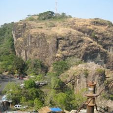
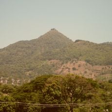
Lake Ilopango fills an 8 by 11 km volcanic caldera in central El Salvador, on the borders of the San Salvador, La Paz and Cuscatlán departments. Its scalloped rim rises 100 to 500 m above the water, which reaches a depth of 230 m. The lake is the largest natural lake in the country.

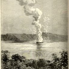
The Tierra Blanca Joven eruption collapsed the caldera between 410 and 535 CE, though Greenland ice cores and a charred tree in the ash point to 431 CE. It ejected 37–82 km³ of material, a VEI 6 event among the largest of the last 7,000 years, and buried Maya settlements. The only historical eruption, from 31 December 1879 to 26 March 1880, built the Islas Quemadas lava dome.

At the time of the Spanish arrival, the 1532 Relación de Marroquín records Pipil settlements around the lake, including Gilopango-Tonacatepeque, Purulapa, Tepezonte and Chinuapa. Their inhabitants fished the lake for olominas, a catch still associated with its waters.

The lake lies immediately east of San Salvador, on the borders of the San Salvador, La Paz and Cuscatlán departments. Any overflow drains through the Jiboa River toward the Pacific. Divers at Cerros Quemados reach depths of 27 to 30 m, where an underwater sand beach lies. The Ilopango international airbase holds annual airshows with pilots flying over the lake.

The only historical eruption of the caldera, lasting from 31 December 1879 to 26 March 1880, built a lava dome that reached the surface and formed the Islas Quemadas. The same event raised the lake level and caused landslides and cracks in nearby hamlets. Divers can now reach the dome at Cerros Quemados, where an underwater sand beach lies at 27 to 30 m.

The community of curious travelers

AroundUs brings together thousands of curated places, local tips, and hidden gems, enriched daily by 93,763 contributors worldwide.

Start exploring
Elevation above the sea
440 m
GPS coordinates
13.66667,-89.05000
Latest update
October 25, 2026 05:54
Discover the major Sites of El Salvador

El Salvador presents a collection of places where history, nature, and culture meet. The country is shaped by volcanic landscapes, clear lakes, and Pacific beaches that blend with archaeological sites from pre-Columbian times. Visitors can explore ancient Maya temples like Tazumal and Joya de Cerén,...

Reviews
Share your experience

No review yet

Discussions
Start a discussion...

No discussion yet

« Lake Ilopango - Volcanic crater lake in central El Salvador » is provided by Around Us (aroundus.com). Images and texts are derived from Wikimedia project under a Creative Commons license. You are allowed to copy, distribute, and modify copies of this page, under the conditions set by the license, as long as this note is clearly visible.

Discover hidden gems everywhere you go!

From secret cafés to breathtaking viewpoints, skip the crowded tourist spots and find places that match your style. Our app makes it easy with voice search, smart filtering, route optimization, and insider tips from travelers worldwide. Download now for the complete mobile experience.
Around Us App Screenshot
❝

A unique approach to discovering new places❞

— Le Figaro

❝

All the places worth exploring❞

— France Info

❝

A tailor-made excursion in just a few clicks❞

— 20 Minutes

Around Us
Travel Guide & Maps
Download

Send to your phone

QR Code
1

Open the camera app on your mobile.

2

Point at the QR code with your camera. A notification will appear.

3

Tap the notification to open the link.