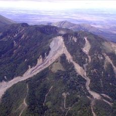
Cerro Mogotón, Mountain peak at Nicaragua-Honduras border, Nueva Segovia Department, Nicaragua.
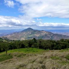
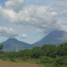
Cerro Mogotón is a mountain peak that reaches 2107 meters, straddling the Nicaragua-Honduras border between Nueva Segovia and El Paraíso departments. Cloud forest covers the slopes and summit area, with mist often obscuring the views.
During the 1980s, military forces placed land mines on the mountain, making it off-limits to climbers for many years afterward. Clearing operations eventually removed these obstacles, opening the area for hiking once again.
Local communities have grown coffee on these slopes for generations, taking advantage of the cool, misty conditions. You can see terraced plantations that follow the steep terrain as you walk through the area.
The hike to the summit takes about seven hours round trip starting from the village of Achuapa, so an early morning start gives you enough daylight for the journey. Professional guides are available, and the terrain is demanding with steep sections and cool, damp conditions that require proper gear.
A concrete marker at the summit reads 'Mogoton - mojon 59', marking the highest point in Nicaragua. This monument serves as a boundary marker between the two nations.
The community of curious travelers
AroundUs brings together thousands of curated places, local tips, and hidden gems, enriched daily by 60,000 contributors worldwide.