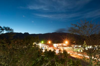
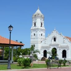
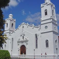
El Valle de Antón, Mountain community in Coclé Province, Panama.
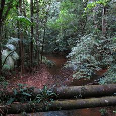
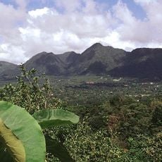
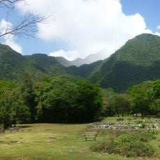
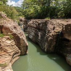
El Valle de Antón is situated inside a volcanic crater that is several kilometers wide, positioned at around 600 meters elevation. The area is surrounded by steep forested mountain slopes that form natural walls on all sides of the valley floor.
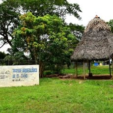
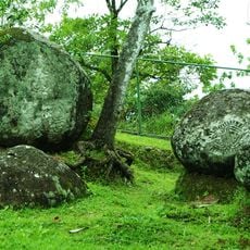
People have lived in this volcanic crater for a very long time, as shown by archaeological finds in the area. The volcano itself last erupted around 300,000 years ago and shaped the geological landscape that exists today.
The Sunday market shows local craftspeople selling handmade pottery, jewelry, and woven goods by hand. This tradition of making things by hand reflects skills that families in this region have practiced for many generations.
Minibuses run regularly from Panama City to this location, with the final direct bus departing in early afternoon and taking roughly two and a half hours to reach. Arriving in the morning is advisable to have ample time for exploring the area.
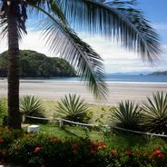
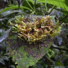
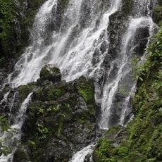
The forests here hold one of the last remaining populations of the Panamanian golden frog, a creature that has vanished from nearly everywhere else. Bird watchers visiting this area can spot more than 500 different bird species in the region.
Location: Antón District
GPS coordinates: 8.60080,-80.13030
Latest update: December 6, 2025 16:01
Panama features a variety of photographic settings, from the colonial district of Casco Viejo to the fine sandy beaches of the San Blas Islands. Panama City combines historic heritage and modern architecture, including Frank Gehry's Biomuseo and the Miraflores locks that showcase canal engineering. Walks such as Cinta Costera or Amador Causeway offer views over the bay and the city skyline. Beyond the city, the country reveals rich and accessible nature. The Baru volcano rises over 3400 meters in Chiriquí province, while the Bocas del Toro archipelago hosts secluded beaches with turquoise waters. Tropical forests, marine reserves, and mountain trails complete this landscape diversity, making Panama a full photographic destination between the Atlantic and Pacific.
Gatun Lake
71.3 km
Bridge of the Americas
72.9 km
Miraflores Locks Visitors Center
73.9 km
Biomuseo
74.2 km
Centennial Bridge, Panama
72.4 km
Miraflores
73.9 km
Soberanía National Park
73.9 km
Altos de Campana National Park
23.2 km
Summit Municipal Park
74.2 km
General Division Omar Torrijos Herrera National Park
63.6 km
El Valle
507 m
Iglesia de Santiago Apóstol
51.9 km
Cerro Gaital
2.8 km
Isla Farallón
27.6 km
El Caño Archaeological Park
51.9 km
St. John Baptist Cathedral, Penonomé
26.7 km
Capilla de San Juan de Dios
51.9 km
La India Dormida
2.7 km
Mausoleo al General Omar Torrijos Herrera y área circundante
74 km
El Chorro Macho
3 km
Painted rock
2.3 km
Catedral de San Juan Bautista
26.7 km
Monasterio de San Pedro
66.9 km
Área del Morro y La Restinga
67.2 km
Esclusas de Pedro Miguel
73.5 km
Puente de las Américas
73 km
Puente Centenario
72.6 km
Los Cajones de Chame
17.9 kmVisited this place? Tap the stars to rate it and share your experience / photos with the community! Try now! You can cancel it anytime.
Discover hidden gems everywhere you go!
From secret cafés to breathtaking viewpoints, skip the crowded tourist spots and find places that match your style. Our app makes it easy with voice search, smart filtering, route optimization, and insider tips from travelers worldwide. Download now for the complete mobile experience.
A unique approach to discovering new places❞
— Le Figaro
All the places worth exploring❞
— France Info
A tailor-made excursion in just a few clicks❞
— 20 Minutes