Coffre ${chestReward.rarityLabel}
+${chestReward.xp} XP
Explorer
NOUVEAU ×${chestReward.collectible.quantity}
tapez pour fermer

Enable Location

We need your location to show you interesting places around you

Discover nearby places

Find interesting locations and hidden gems around you

Precise directions

Get accurate directions and distances to places

Your location is never shared with other users. It's only used when you tap the location button.

Log in to your account

Start exploring — it's free

Trusted by 70,337 travelers worldwide

Continue with Google
Continue with Apple
or

We will send you a code to connect

By continuing, you accept our Terms and Conditions and our Privacy Policy

Check your inbox

We've sent a pincode in your inbox. Please enter the code below.

Río Grande de Matagalpa
Discussion Reviews Photo
8.6k Popularity

Río Grande de Matagalpa, Major river system in Matagalpa Region, Nicaragua.

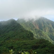
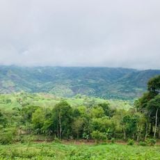
The Río Grande de Matagalpa is a river in Nicaragua that rises in the central highlands and flows east until it reaches the Caribbean Sea. Along the way it crosses very different types of land, from hilly interior terrain to flat, forested lowlands near the coast.

The headwaters of the Río Grande de Matagalpa were the site of Nicaragua's first hydroelectric plant in the early 20th century, which changed how the country produced power. Later in the 20th century, plans for additional projects along the lower river were drawn up to make further use of its flow.

The Miskito people of the Caribbean coast have their own name for this river, which reflects how central it has been to their way of life for generations. Along the lower stretches, local boats are still one of the main ways to move between communities where roads are few.

Access to the river changes depending on the time of year, since water levels rise considerably during the rainy season and some areas become harder to reach. In the lower section, where roads are scarce, a boat is often the only way to get around, so it is worth asking locals about conditions before heading out.

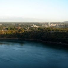
The river's mouth opens into a wetland on the Caribbean coast that is considered one of the richest natural areas in Central America, though it is barely visible from the shoreline. This delta surprises many visitors who reach it by boat, as it looks nothing like the highland rivers that feed it.

The community of curious travelers

AroundUs brings together thousands of curated places, local tips, and hidden gems, enriched daily by 60,000 contributors worldwide.

Start exploring
GPS coordinates
12.90029,-84.92351
Latest update
March 3, 2026 08:19
Reviews
Share your experience

No review yet

Discussions
Start a discussion...

No discussion yet

« Río Grande de Matagalpa - Major river system in Matagalpa Region, Nicaragua » is provided by Around Us (aroundus.com). Images and texts are derived from Wikimedia project under a Creative Commons license. You are allowed to copy, distribute, and modify copies of this page, under the conditions set by the license, as long as this note is clearly visible.

Discover hidden gems everywhere you go!

From secret cafés to breathtaking viewpoints, skip the crowded tourist spots and find places that match your style. Our app makes it easy with voice search, smart filtering, route optimization, and insider tips from travelers worldwide. Download now for the complete mobile experience.

Around Us App Screenshot

A unique approach to discovering new places

Le Figaro

All the places worth exploring

France Info

A tailor-made excursion in just a few clicks

20 Minutes

Around Us
Travel Guide & Maps
Download

Send to your phone

QR Code
1

Open the camera app on your mobile.

2

Point at the QR code with your camera. A notification will appear.

3

Tap the notification to open the link.