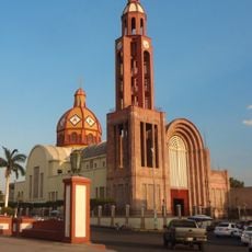
Municipality of Uruapan, Administrative division in Michoacán, Mexico
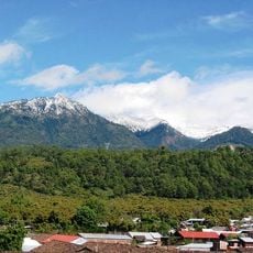
The municipality of Uruapan spreads across a fertile region at the western edge of the Purépecha highlands, positioned east of the Tierra Caliente area. It is organized into six neighborhoods that form its administrative and social structure.
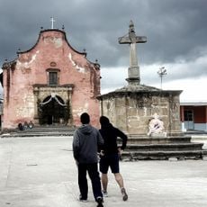
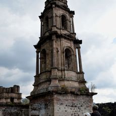
Spanish missionaries established the territory in 1533, creating six distinct neighborhoods that became the foundation of its administrative divisions. This original layout continues to define how the municipality is organized today.
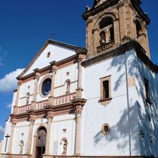
The six traditional neighborhoods maintain distinct religious celebrations and local festivals throughout the year. These communities preserve traditions that shape how residents gather and mark important occasions.
Public transportation regularly connects residential areas to the central district, markets, and neighboring communities throughout the municipality. Local contacts and on-site information are helpful for navigating the different neighborhoods.
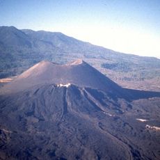
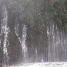
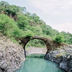
The territory contains the Barranca del Cupatitzio National Park, which ranks second among Mexican national parks in visitor numbers. This park is often a surprising attraction that many overlook when exploring the area.
Location: Michoacán
Capital city: Uruapan
GPS coordinates: 19.43000,-102.14000
Latest update: December 7, 2025 10:06
Parícutin
13.6 km
Cathedral of Our Lady of Guadalupe
63.4 km
Lago de Camécuaro National Park
53.2 km
Monument to Morelos on Janitzio Island
53.7 kmEl Opeño
58.8 km
Pico de Tancítaro
18.9 kmBarranca del Cupatitzio National Park
7.8 km
Presidente InterContinental Hotel
63.4 km
Edificio Reforma 222 Torre 1
63.4 km
Salto La Tzaráracua
10.8 km
Torre MAPFRE
63.4 km
Basilica of Nuestra Señora de la Salud, Pátzcuaro
56.8 km
Hyatt Regency Mexico City
63.4 km
Torre Lomas
63.4 kmZacapu Lagoon
57.4 km
Torre Mural
63.4 km
Ihuatzio
56.8 km
Reforma 115
63.4 km
Best Western Plus Posada de Don Vasco
56.6 km
Panorama Santa Fe
63.4 km
H2o Santa Fe building
63.4 km
Immaculate Conception Cathedral, Apatzingán
44.4 kmPunzo family
52.6 km
Mansión del Cupatitzio
6.9 km
Edificio Punta Poniente
63.4 km
Santiago Apóstol Temple
25.1 km
Puente del Diablo, Buenavista
48.3 km
Church of San Juan Parangaricutiro
16.1 kmVisited this place? Tap the stars to rate it and share your experience / photos with the community! Try now! You can cancel it anytime.
Discover hidden gems everywhere you go!
From secret cafés to breathtaking viewpoints, skip the crowded tourist spots and find places that match your style. Our app makes it easy with voice search, smart filtering, route optimization, and insider tips from travelers worldwide. Download now for the complete mobile experience.
A unique approach to discovering new places❞
— Le Figaro
All the places worth exploring❞
— France Info
A tailor-made excursion in just a few clicks❞
— 20 Minutes