Coffre ${chestReward.rarityLabel}
+${chestReward.xp} XP
Explorer
NOUVEAU ×${chestReward.collectible.quantity}
tapez pour fermer
Chest locked

Open chests in the app

Around Us is built for your phone — chests unlock when you walk, explore and capture nearby places.

Enable Location

We need your location to show you interesting places around you

Discover nearby places

Find interesting locations and hidden gems around you

Precise directions

Get accurate directions and distances to places

Your location is never shared with other users. It's only used when you tap the location button.

Log in to your account

Start exploring — it's free

Trusted by 72,282 travelers worldwide

Continue with Google
Continue with Apple
or

We will send you a code to connect

By continuing, you accept our Terms and Conditions and our Privacy Policy

Check your inbox

We've sent a pincode in your inbox. Please enter the code below.

Río Frío de Juárez
Discussion Reviews Photo
10.8k Popularity

Río Frío de Juárez, Mountain settlement at Mexico-Puebla pass, Mexico

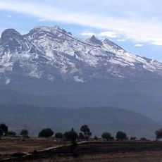
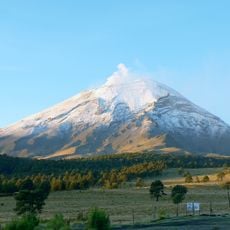
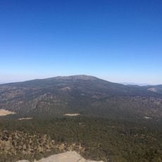
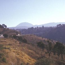
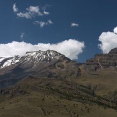
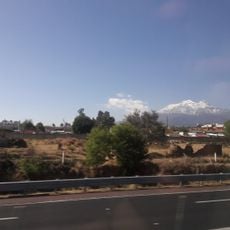
Río Frío de Juárez is a mountain settlement in the municipality of Ixtapaluca, State of Mexico, sitting at roughly 3,000 meters above sea level between Mexico City and Puebla. It lines Federal Highway 150D and is surrounded by pine forests that form part of the Zoquiapan National Park.

The settlement grew along the Camino Real, the colonial road that linked Mexico City to Veracruz through Puebla, serving as a rest point for merchants and travelers. The pass remained difficult and dangerous for centuries, long after the colonial trade route was established.

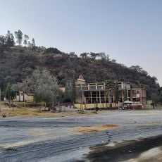
Río Frío de Juárez appears in the novels of Manuel Payno, a 19th-century Mexican writer who set stories of bandits and travelers on this mountain pass. Visitors today can still sense the isolation of the place, as the settlement sits tightly along the road with dense forest on both sides.

Warm clothing is advisable throughout the year, as temperatures at this altitude can drop sharply even in summer. Those planning to walk in the surrounding forest should wear sturdy shoes and bring a waterproof layer, since weather can change quickly on the pass.

Despite sitting along one of Mexico's busiest inter-city highways, Río Frío de Juárez is among the coldest permanently inhabited places in central Mexico. Some older buildings along the road show a roof style more typical of alpine regions, a direct response to the heavy snowfall that can occur here.

The community of curious travelers

AroundUs brings together thousands of curated places, local tips, and hidden gems, enriched daily by 60,000 contributors worldwide.

Start exploring
Location
Elevation above the sea
2,978 m
GPS coordinates
19.35250,-98.66970
Latest update
March 3, 2026 08:21
Reviews
Share your experience

No review yet

Discussions
Start a discussion...

No discussion yet

« Río Frío de Juárez - Mountain settlement at Mexico-Puebla pass, Mexico » is provided by Around Us (aroundus.com). Images and texts are derived from Wikimedia project under a Creative Commons license. You are allowed to copy, distribute, and modify copies of this page, under the conditions set by the license, as long as this note is clearly visible.

Discover hidden gems everywhere you go!

From secret cafés to breathtaking viewpoints, skip the crowded tourist spots and find places that match your style. Our app makes it easy with voice search, smart filtering, route optimization, and insider tips from travelers worldwide. Download now for the complete mobile experience.

Around Us App Screenshot

A unique approach to discovering new places

Le Figaro

All the places worth exploring

France Info

A tailor-made excursion in just a few clicks

20 Minutes

Around Us
Travel Guide & Maps
Download

Send to your phone

QR Code
1

Open the camera app on your mobile.

2

Point at the QR code with your camera. A notification will appear.

3

Tap the notification to open the link.