Enable Location

We need your location to show you interesting places around you

Discover nearby places

Find interesting locations and hidden gems around you

Precise directions

Get accurate directions and distances to places

Your location is never shared with other users. It's only used when you tap the location button.

Iztaccíhuatl–Popocatépetl National Park

Log in to your account

Start exploring — it's free

Trusted by 62,859 travelers worldwide

Continue with Google
Continue with Apple
or

We will send you a code to connect

By continuing, you accept our Terms and Conditions and our Privacy Policy

Check your inbox

We've sent a pincode in your inbox. Please enter the code below.

Iztaccíhuatl–Popocatépetl National Park

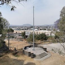
Iztaccíhuatl–Popocatépetl National Park, National park between State of Mexico, Puebla, and Morelos, Mexico.

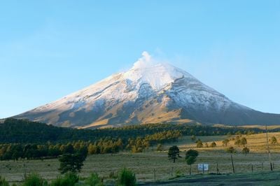
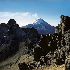
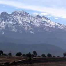
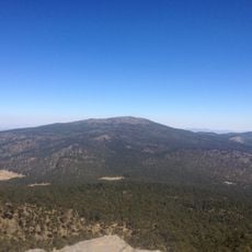
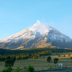
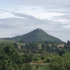
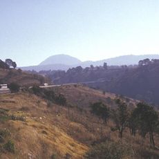
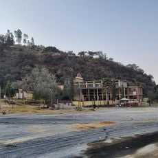
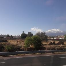
Iztaccíhuatl–Popocatépetl National Park stretches across three Mexican states and encompasses two of the country's highest peaks, including one active volcano. The terrain ranges from forested lower slopes to snow-capped summits, with trails passing through different climate zones and crossing varied types of vegetation.

President Lázaro Cárdenas created this protected area in November 1935 to safeguard both volcanoes and their surroundings from further deforestation. The establishment was part of a larger initiative to create natural reserves that spanned several regions of Mexico.

The name Iztaccíhuatl means sleeping woman in Nahuatl, while Popocatépetl translates to smoking warrior, both names dating back to pre-colonial times. The mountain's shape resembles a reclining figure, which hikers can still observe from different vantage points today.

Mountain streams within the reserve flow downhill and contribute to the water supply of several major cities through natural filtration. Visitors should watch for signage about volcanic activity, as certain zones may close when risk levels rise.

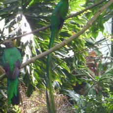
The volcano rabbit, a species with short ears and brown fur, lives only in the high elevations of these Mexican mountains and nowhere else on Earth. Observers sometimes spot the animals in grass tufts among lava rocks at altitudes above 3000 meters (9800 feet).

The community of curious travelers

AroundUs brings together thousands of curated places, local tips, and hidden gems, enriched daily by 60,000 contributors worldwide.

Start exploring
Location
Location
Location
Inception
November 8, 1935
GPS coordinates
19.23620,-98.66340
Latest update
December 20, 2025 12:32
« Iztaccíhuatl–Popocatépetl National Park - National park between State of Mexico, Puebla, and Morelos, Mexico » is provided by Around Us (aroundus.com). Images and texts are derived from Wikimedia project under a Creative Commons license. You are allowed to copy, distribute, and modify copies of this page, under the conditions set by the license, as long as this note is clearly visible.

Discover hidden gems everywhere you go!

From secret cafés to breathtaking viewpoints, skip the crowded tourist spots and find places that match your style. Our app makes it easy with voice search, smart filtering, route optimization, and insider tips from travelers worldwide. Download now for the complete mobile experience.

Around Us App Screenshot

A unique approach to discovering new places

Le Figaro

All the places worth exploring

France Info

A tailor-made excursion in just a few clicks

20 Minutes

Around Us
Travel Guide & Maps
Download

Send to your phone

QR Code
1

Open the camera app on your mobile.

2

Point at the QR code with your camera. A notification will appear.

3

Tap the notification to open the link.