Chest opened
+${chestReward.xp} XP
Explorer
NOUVEAU ×${chestReward.collectible.quantity}
tapez pour fermer

See the monuments around you in AR Open chests in the app

Around Us is built for your phone — point your camera at the streets and discover the monuments and places around you in augmented reality. Around Us is built for your phone — chests unlock when you walk, explore and capture nearby places.

Enable Location

We need your location to show you interesting places around you

Discover nearby places

Find interesting locations and hidden gems around you

Precise directions

Get accurate directions and distances to places

Your location is never shared with other users. It's only used when you tap the location button.

Laguna de Atexcac

Log in to your account

Start exploring — it's free

Trusted by 86,448 travelers worldwide

Continue with Google
Continue with Apple
or

We will send you a code to connect

By continuing, you accept our Terms and Conditions and our Privacy Policy

Check your inbox

We've sent a pincode in your inbox. Please enter the code below.

Laguna de Atexcac
Discussion Reviews 1 Photos
8.5k Popularity

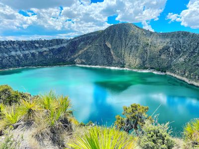
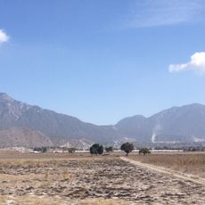
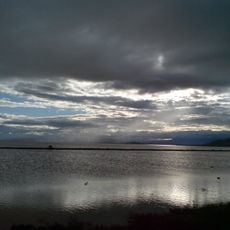
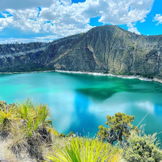
Laguna de Atexcac, Volcanic crater lake in Guadalupe Victoria Municipality, Mexico

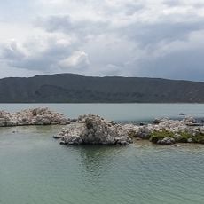
Laguna de Atexcac is a maar, a volcanic crater lake, located in Guadalupe Victoria Municipality in the highlands of Puebla, Mexico, at roughly 8,000 feet (2,400 meters) above sea level. Its oval-shaped basin is lined with dark volcanic rock, and the water surface shifts in color between blue and green depending on the light of the day.

The maar formed likely toward the end of the last ice age, when rising magma met underground water and triggered a powerful explosion that tore an oval crater into the rock. Over time, water filled the depression and created the lake that exists today.

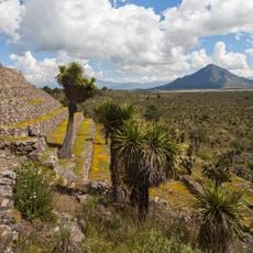
Getting to the lake requires driving rural roads from Guadalupe Victoria, followed by a short walk on rocky volcanic terrain to reach the water's edge. There are no facilities on site, so bring water, sturdy shoes, and protection against the strong sun at this altitude.

The name Atexcac comes from Nahuatl and means roughly 'in the waters on the steep cliffs', describing the sharp rock faces that drop directly to the water. A small town nearby, San Luis Atexcac, still has residents who speak Nahuatl and maintain traditions linked to the area.

The community of curious travelers

AroundUs brings together thousands of curated places, local tips, and hidden gems, enriched daily by 60,000 contributors worldwide.
Start exploring
Address
Laguna De San Luis Atexcac, 75043 Pue., Mexico
GPS coordinates
19.33399,-97.45087
Latest update
September 12, 2026 21:31
Reviews
Share your experience

No review yet

Discussions
Start a discussion...

No discussion yet

« Laguna de Atexcac - Volcanic crater lake in Guadalupe Victoria Municipality, Mexico » is provided by Around Us (aroundus.com). Images and texts are derived from Wikimedia project under a Creative Commons license. You are allowed to copy, distribute, and modify copies of this page, under the conditions set by the license, as long as this note is clearly visible.

Discover hidden gems everywhere you go!

From secret cafés to breathtaking viewpoints, skip the crowded tourist spots and find places that match your style. Our app makes it easy with voice search, smart filtering, route optimization, and insider tips from travelers worldwide. Download now for the complete mobile experience.

Around Us App Screenshot

A unique approach to discovering new places

Le Figaro

All the places worth exploring

France Info

A tailor-made excursion in just a few clicks

20 Minutes

Around Us
Travel Guide & Maps
Download

Send to your phone

QR Code
1

Open the camera app on your mobile.

2

Point at the QR code with your camera. A notification will appear.

3

Tap the notification to open the link.