Enable Location

We need your location to show you interesting places around you

Discover nearby places

Find interesting locations and hidden gems around you

Precise directions

Get accurate directions and distances to places

Your location is never shared with other users. It's only used when you tap the location button.

Rio Grande Wild and Scenic River

Log in to your account

Start exploring — it's free

Trusted by 62,065 travelers worldwide

Continue with Google
Continue with Apple
or

We will send you a code to connect

By continuing, you accept our Terms and Conditions and our Privacy Policy

Check your inbox

We've sent a pincode in your inbox. Please enter the code below.

Rio Grande Wild and Scenic River

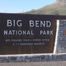
Rio Grande Wild and Scenic River, National Wild and Scenic River in New Mexico and Texas, US

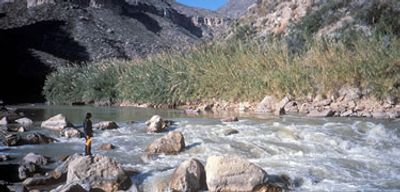
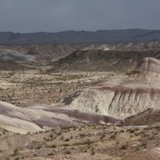
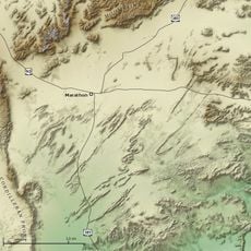
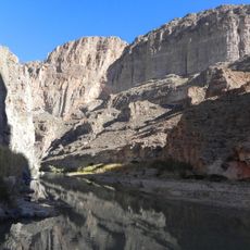
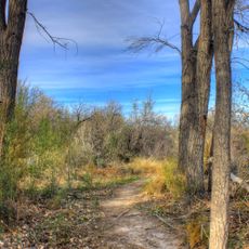
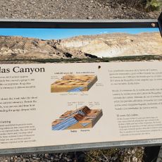
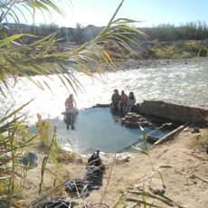
The Rio Grande flows through approximately 196 miles of desert landscape and creates deep canyons with layered rock walls and natural water channels. The river features steep rock formations with varying colors and textures that drop sharply from the surrounding terrain down to the water level.

Congress designated this section of the river in 1968 to safeguard its natural condition and prevent future development or alterations. This protection marked an important moment in efforts to preserve key river corridors across the nation.

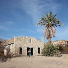
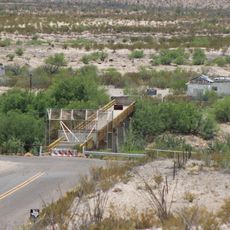
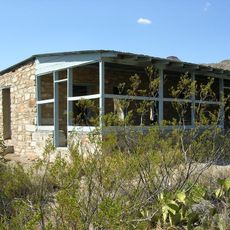
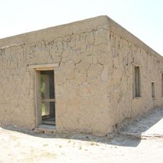
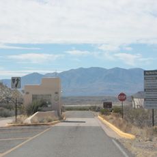
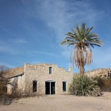
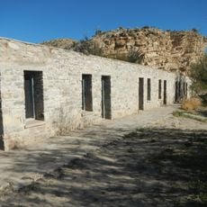
The river corridor served for centuries as a meeting point and boundary between different communities on both sides. Visitors can still see old pathways and settlement marks that show how people lived and traveled through this region.

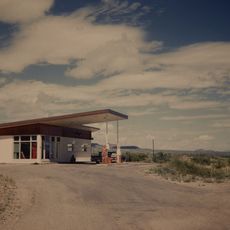
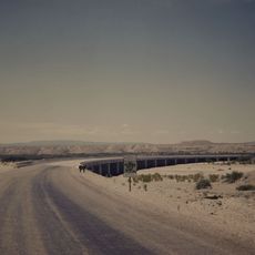
Multi-day river trips require permits and visitors must bring adequate water supplies since drinking water sources are not available along the route. The best time to visit is from late fall through early spring when temperatures remain moderate and more manageable.

The protected area includes three distinct canyons - Boquillas, Mariscal, and Lower Canyon - each with its own rock formations and water conditions. Each canyon offers paddlers different challenges and varying levels of difficulty throughout the journey.

The community of curious travelers

AroundUs brings together thousands of curated places, local tips, and hidden gems, enriched daily by 60,000 contributors worldwide.

Start exploring
Location
Location
Inception
October 2, 1968
Elevation above the sea
466 m
GPS coordinates
29.75756,-102.52897
Latest update
December 11, 2025 11:02
Around this place
Emory Peak
United States of America

Emory Peak

94.3 km
Javelina Formation
United States of America

Javelina Formation

98.6 km
Hot Springs
United States of America

Hot Springs

78.6 km
Marathon Uplift
United States of America

Marathon Uplift

85.1 km
La Linda International Bridge
Mexico

La Linda International Bridge

44.6 km
Mariscal Mine
United States of America

Mariscal Mine

97.5 km
Homer Wilson Ranch
United States of America

Homer Wilson Ranch

101.2 km
Mile Canyon
United States of America

Mile Canyon

94.7 km
Boquillas Canyon
United States of America

Boquillas Canyon

70 km
Persimmon Gap
United States of America

Persimmon Gap

62.9 km
Daniels Farm House
United States of America

Daniels Farm House

76.8 km
Gage Hotel
United States of America

Gage Hotel

85.3 km
Panther Junction Visitor Center
United States of America

Panther Junction Visitor Center

81.2 km
Panther Junction Mission 66 Historic District
United States of America

Panther Junction Mission 66 Historic District

81.2 km
Persimmon Gap Entrance Sign
United States of America

Persimmon Gap Entrance Sign

62.3 km
Chisos Basin Visitor Center
United States of America

Chisos Basin Visitor Center

92.3 km
Dugout Wells
United States of America

Dugout Wells

79.9 km
Princess Theater
United States of America

Princess Theater

44.5 km
Panther Junction Gas Station
United States of America

Panther Junction Gas Station

81.3 km
Rio Grande Village Campground Amphitheater
United States of America

Rio Grande Village Campground Amphitheater

76.5 km
Rio Grande Village Campground
United States of America

Rio Grande Village Campground

76.4 km
Persimmon Gap Entrance Station
United States of America

Persimmon Gap Entrance Station

63.2 km
Boquillas Canyon Overlook
United States of America

Boquillas Canyon Overlook

73.5 km
Langford Hot Springs
United States of America

Langford Hot Springs

78.6 km
Livingston House
United States of America

Livingston House

79.1 km
Hot Springs Store
United States of America

Hot Springs Store

79 km
Tornillo Creek Bridge
United States of America

Tornillo Creek Bridge

78.4 km
Hot Springs Cabins
United States of America

Hot Springs Cabins

78.9 km
Show the full map
« Rio Grande Wild and Scenic River - National Wild and Scenic River in New Mexico and Texas, US » is provided by Around Us (aroundus.com). Images and texts are derived from Wikimedia project under a Creative Commons license. You are allowed to copy, distribute, and modify copies of this page, under the conditions set by the license, as long as this note is clearly visible.

Discover hidden gems everywhere you go!

From secret cafés to breathtaking viewpoints, skip the crowded tourist spots and find places that match your style. Our app makes it easy with voice search, smart filtering, route optimization, and insider tips from travelers worldwide. Download now for the complete mobile experience.

Around Us App Screenshot

A unique approach to discovering new places

Le Figaro

All the places worth exploring

France Info

A tailor-made excursion in just a few clicks

20 Minutes

Around Us
Travel Guide & Maps
Download

Send to your phone

QR Code
1

Open the camera app on your mobile.

2

Point at the QR code with your camera. A notification will appear.

3

Tap the notification to open the link.