Enable Location

We need your location to show you interesting places around you

Discover nearby places

Find interesting locations and hidden gems around you

Precise directions

Get accurate directions and distances to places

Your location is never shared with other users. It's only used when you tap the location button.

Zapata

Log in to your account

Start exploring — it's free

Trusted by 62,494 travelers worldwide

Continue with Google
Continue with Apple
or

We will send you a code to connect

By continuing, you accept our Terms and Conditions and our Privacy Policy

Check your inbox

We've sent a pincode in your inbox. Please enter the code below.

Zapata, County seat in South Texas, United States

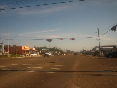
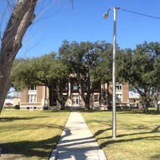
Zapata is the administrative center of Zapata County in South Texas, located where U.S. Highway 83 and State Highway 16 intersect. The town sits at about 120 meters elevation and houses the county government offices that serve the surrounding area.

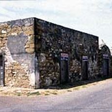
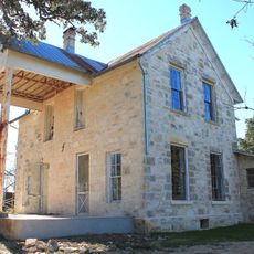
The settlement originated from ranching traditions established in 1750 when José Vázquez Borrego founded Nuestra Señora de los Dolores Hacienda and brought families from Coahuila to the area. Early 1920s oil discoveries transformed the local economy and spurred growth in the region.

The Zapata County Independent School District maintains educational facilities that serve students across multiple campuses, supporting the academic development of local youth.

The town is easily reached via the two highways that connect it, making it a natural transportation hub. Most services and amenities operate during standard business hours, so plan your visit accordingly.

The discovery of oil wells in the early 1920s transformed the region's economy through the efforts of Laredo industrialist Oliver Winfield Killam.

The community of curious travelers

AroundUs brings together thousands of curated places, local tips, and hidden gems, enriched daily by 60,000 contributors worldwide.

Start exploring
Location
Elevation above the sea
120 m
GPS coordinates
26.90610,-99.27000
Latest update
December 7, 2025 10:04
Around this place
Colombia – Solidarity International Bridge
United States of America

Colombia – Solidarity International Bridge

100.1 km
Falcon International Reservoir
Mexico

Falcon International Reservoir

40 km
Uni-Trade Stadium
United States of America

Uni-Trade Stadium

74.5 km
World Trade International Bridge
Mexico

World Trade International Bridge

81.4 km
Gateway to the Americas International Bridge
United States of America

Gateway to the Americas International Bridge

70.1 km
Laredo Energy Arena
United States of America

Laredo Energy Arena

74.8 km
National Butterfly Center
United States of America

National Butterfly Center

121 km
Fort McIntosh
United States of America

Fort McIntosh

71.2 km
Bentsen-Rio Grande Valley State Park
United States of America

Bentsen-Rio Grande Valley State Park

120.3 km
El Sabinal National Park
Mexico

El Sabinal National Park

98 km
Texas Mexican Railway International Bridge
Mexico

Texas Mexican Railway International Bridge

70.3 km
Cathedral of San Agustin
United States of America

Cathedral of San Agustin

70.4 km
Estadio Nuevo Laredo
Mexico

Estadio Nuevo Laredo

71.4 km
Student Activity Complex
United States of America

Student Activity Complex

67.9 km
First Lift Station
United States of America

First Lift Station

121.3 km
Laredo Convent Avenue Port of Entry
United States of America

Laredo Convent Avenue Port of Entry

70.3 km
Roma Historic District
United States of America

Roma Historic District

61 km
Republic of the Rio Grande Museum
United States of America

Republic of the Rio Grande Museum

70.3 km
Falcon Dam Port of Entry
United States of America

Falcon Dam Port of Entry

41.2 km
Laredo United States Post Office, Court House and Custom House
United States of America

Laredo United States Post Office, Court House and Custom House

70.8 km
Webb County Courthouse
United States of America

Webb County Courthouse

70.9 km
Trevino-Uribe Rancho
United States of America

Trevino-Uribe Rancho

23.1 km
Herff-Rozelle Farm
United States of America

Herff-Rozelle Farm

112.4 km
Brooks County Courthouse
United States of America

Brooks County Courthouse

117.2 km
Jet Bowl
United States of America

Jet Bowl

75 km
Plaza Theater
United States of America

Plaza Theater

70.7 km
Regal Laredo Stadium 14
United States of America

Regal Laredo Stadium 14

75.1 km
Garmon Theater
United States of America

Garmon Theater

74 km
Show the full map
« Zapata - County seat in South Texas, United States » is provided by Around Us (aroundus.com). Images and texts are derived from Wikimedia project under a Creative Commons license. You are allowed to copy, distribute, and modify copies of this page, under the conditions set by the license, as long as this note is clearly visible.

Discover hidden gems everywhere you go!

From secret cafés to breathtaking viewpoints, skip the crowded tourist spots and find places that match your style. Our app makes it easy with voice search, smart filtering, route optimization, and insider tips from travelers worldwide. Download now for the complete mobile experience.

Around Us App Screenshot

A unique approach to discovering new places

Le Figaro

All the places worth exploring

France Info

A tailor-made excursion in just a few clicks

20 Minutes

Around Us
Travel Guide & Maps
Download

Send to your phone

QR Code
1

Open the camera app on your mobile.

2

Point at the QR code with your camera. A notification will appear.

3

Tap the notification to open the link.