Enable Location

We need your location to show you interesting places around you

Discover nearby places

Find interesting locations and hidden gems around you

Precise directions

Get accurate directions and distances to places

Your location is never shared with other users. It's only used when you tap the location button.

Dimmit County

Log in to your account

Start exploring — it's free

Trusted by 62,491 travelers worldwide

Continue with Google
Continue with Apple
or

We will send you a code to connect

By continuing, you accept our Terms and Conditions and our Privacy Policy

Check your inbox

We've sent a pincode in your inbox. Please enter the code below.

Dimmit County, Administrative division in southern Texas, United States.

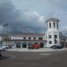
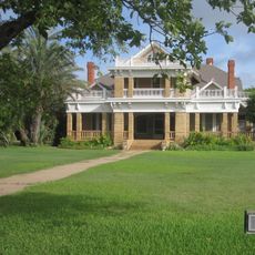
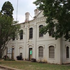
Dimmit County is an administrative division in southern Texas with Carrizo Springs serving as the county seat and government hub. The area encompasses rural and urban sections where county buildings and local facilities provide essential services and meet the needs of residents.

The region was founded in 1858 and formally organized in 1880, taking its name from Philip Dimmitt though an early spelling error altered the final letter. These founding years established the basic framework for what became the county's administrative structure.

Spanish traditions shape daily life here, visible in local celebrations, building styles, and how communities gather together. Walking through towns, you notice these influences in street names, family-run businesses, and neighborhood customs that have endured for generations.

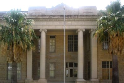
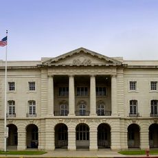
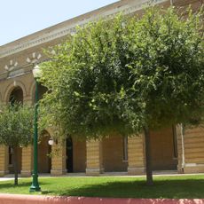
The Dimmit County Annex Building provides centralized access to government services, permits, and community resources in one location. Visitors and residents can handle most administrative matters there efficiently.

Oil discovery in 1943 fundamentally transformed the local economy, shifting the region from purely agricultural to a mixed economy combining farming and petroleum production. This shift shaped the area's development and infrastructure for decades to come.

The community of curious travelers

AroundUs brings together thousands of curated places, local tips, and hidden gems, enriched daily by 60,000 contributors worldwide.

Start exploring
GPS coordinates
28.38219,-99.71782
Latest update
December 7, 2025 19:26
Around this place
Sleeping Spring Draw
United States of America

Sleeping Spring Draw

100.5 km
Uni-Trade Stadium
United States of America

Uni-Trade Stadium

95.7 km
Laredo Energy Arena
United States of America

Laredo Energy Arena

95.3 km
Fort Inge
United States of America

Fort Inge

88.9 km
Fort Duncan
United States of America

Fort Duncan

84.8 km
Fort McIntosh
United States of America

Fort McIntosh

99.5 km
Eagle Pass – Piedras Negras International Bridge
Mexico

Eagle Pass – Piedras Negras International Bridge

85.6 km
John Nance Garner House
United States of America

John Nance Garner House

92.7 km
Cathedral of San Agustin
United States of America

Cathedral of San Agustin

100.1 km
Camino Real International Bridge
United States of America

Camino Real International Bridge

85.1 km
Grand Opera House
United States of America

Grand Opera House

92.4 km
Mexico

Rio San Rodrigo

106.4 km
Martyrs of Christ the King Cathedral, Piedras Negras
Mexico

Martyrs of Christ the King Cathedral, Piedras Negras

89.4 km
Asher and Mary Isabelle Richardson House
United States of America

Asher and Mary Isabelle Richardson House

7.9 km
Laredo United States Post Office, Court House and Custom House
United States of America

Laredo United States Post Office, Court House and Custom House

99.6 km
Webb County Courthouse
United States of America

Webb County Courthouse

99.6 km
Old Frio County Jail
United States of America

Old Frio County Jail

83 km
State Highway 3 Bridge at the Nueces River
United States of America

State Highway 3 Bridge at the Nueces River

93.4 km
Uvalde Downtown Historic District
United States of America

Uvalde Downtown Historic District

92.4 km
La Salle County Courthouse
United States of America

La Salle County Courthouse

47.5 km
Popeye statue in Crystal City
United States of America

Popeye statue in Crystal City

34.9 km
St. Philip's Episcopal Church
United States of America

St. Philip's Episcopal Church

92.8 km
Plaza Theater
United States of America

Plaza Theater

99.8 km
Aztec Theatre
United States of America

Aztec Theatre

84.9 km
Regal Laredo Stadium 14
United States of America

Regal Laredo Stadium 14

95 km
Tivoli Theatre
United States of America

Tivoli Theatre

99.9 km
Oaks Theatre
United States of America

Oaks Theatre

83.1 km
Nicolas Street School
United States of America

Nicolas Street School

91.6 km
Show the full map
« Dimmit County - Administrative division in southern Texas, United States » is provided by Around Us (aroundus.com). Images and texts are derived from Wikimedia project under a Creative Commons license. You are allowed to copy, distribute, and modify copies of this page, under the conditions set by the license, as long as this note is clearly visible.

Discover hidden gems everywhere you go!

From secret cafés to breathtaking viewpoints, skip the crowded tourist spots and find places that match your style. Our app makes it easy with voice search, smart filtering, route optimization, and insider tips from travelers worldwide. Download now for the complete mobile experience.

Around Us App Screenshot

A unique approach to discovering new places

Le Figaro

All the places worth exploring

France Info

A tailor-made excursion in just a few clicks

20 Minutes

Around Us
Travel Guide & Maps
Download

Send to your phone

QR Code
1

Open the camera app on your mobile.

2

Point at the QR code with your camera. A notification will appear.

3

Tap the notification to open the link.