Chest opened
+${chestReward.xp} XP
Explorer
NOUVEAU ×${chestReward.collectible.quantity}
tapez pour fermer
Chest locked

Open chests in the app

Around Us is built for your phone — chests unlock when you walk, explore and capture nearby places.

Enable Location

We need your location to show you interesting places around you

Discover nearby places

Find interesting locations and hidden gems around you

Precise directions

Get accurate directions and distances to places

Your location is never shared with other users. It's only used when you tap the location button.

Log in to your account

Start exploring — it's free

Trusted by 73,005 travelers worldwide

Continue with Google
Continue with Apple
or

We will send you a code to connect

By continuing, you accept our Terms and Conditions and our Privacy Policy

Check your inbox

We've sent a pincode in your inbox. Please enter the code below.

Coahuila y Tejas
Discussion Reviews Photo
49.4k Popularity

Coahuila y Tejas, Former Mexican state in northern Mexico.

Coahuila y Tejas was a former Mexican state created after independence that combined two distinct territories in the north. The combined region included parts of present-day Mexico and what is now southern Texas, administered from multiple centers.

The territory formed as a unified state in 1824 following Mexico's independence from Spain, joining the provinces of Coahuila and Texas administratively. Political tensions between the central government and regional desires for self-rule led to its dissolution in 1835.

The region experienced a demographic transformation as Anglo-American settlers arrived in significant numbers, bringing their customs and practices to the Mexican territory.

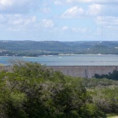
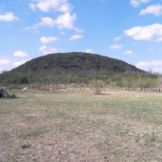
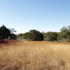
The territory was vast, spanning from the settled regions of Coahuila to the more sparsely populated areas of Texas to the north. Administration required managing two very different zones with distinct settlement patterns and geographic conditions.

The state represented an experiment in early Mexican administration, struggling to balance the developed Coahuila region with the frontier conditions of Texas. The failure to manage these differences contributed to broader political conflicts that reshaped northern Mexico.

The community of curious travelers

AroundUs brings together thousands of curated places, local tips, and hidden gems, enriched daily by 60,000 contributors worldwide.

Start exploring
Location
Location
Inception
May 7, 1824
GPS coordinates
28.83330,-99.50000
Latest update
December 18, 2025 11:41
Around this place
Garner State Park
United States of America

Garner State Park

86.7 km
Medina Lake
United States of America

Medina Lake

95 km
Sleeping Spring Draw
United States of America

Sleeping Spring Draw

75.1 km
Fort Inge
United States of America

Fort Inge

46.4 km
Fort Duncan
United States of America

Fort Duncan

99.2 km
Hill Country State Natural Area
United States of America

Hill Country State Natural Area

93.7 km
Eagle Pass – Piedras Negras International Bridge
United States of America

Eagle Pass – Piedras Negras International Bridge

99.8 km
John Nance Garner House
United States of America

John Nance Garner House

50.9 km
Landmark Inn State Historic Site
United States of America

Landmark Inn State Historic Site

84.1 km
Camino Real International Bridge
United States of America

Camino Real International Bridge

99.8 km
Castroville Historic District
United States of America

Castroville Historic District

83.7 km
Grand Opera House
United States of America

Grand Opera House

50.4 km
Asher and Mary Isabelle Richardson House
United States of America

Asher and Mary Isabelle Richardson House

50.5 km
Atascosa County Courthouse
United States of America

Atascosa County Courthouse

93.5 km
Old Frio County Jail
United States of America

Old Frio County Jail

40.1 km
Frederick and Sallie Lyons House
United States of America

Frederick and Sallie Lyons House

99.8 km
State Highway 3 Bridge at the Nueces River
United States of America

State Highway 3 Bridge at the Nueces River

57 km
Uvalde Downtown Historic District
United States of America

Uvalde Downtown Historic District

50.3 km
La Salle County Courthouse
United States of America

La Salle County Courthouse

51.2 km
Popeye statue in Crystal City
United States of America

Popeye statue in Crystal City

36.4 km
St. Philip's Episcopal Church
United States of America

St. Philip's Episcopal Church

50.8 km
Raye Theater
United States of America

Raye Theater

67.2 km
Aztec Theatre
United States of America

Aztec Theatre

98.8 km
Combination Building
United States of America

Combination Building

86.7 km
Devine Opera House
United States of America

Devine Opera House

67.1 km
Oaks Theatre
United States of America

Oaks Theatre

40 km
D'Hanis Historic District
United States of America

D'Hanis Historic District

60 km
Nicolas Street School
United States of America

Nicolas Street School

50 km
Show the full map
Reviews
Share your experience

No review yet

Discussions
Start a discussion...

No discussion yet

« Coahuila y Tejas - Former Mexican state in northern Mexico » is provided by Around Us (aroundus.com). Images and texts are derived from Wikimedia project under a Creative Commons license. You are allowed to copy, distribute, and modify copies of this page, under the conditions set by the license, as long as this note is clearly visible.

Discover hidden gems everywhere you go!

From secret cafés to breathtaking viewpoints, skip the crowded tourist spots and find places that match your style. Our app makes it easy with voice search, smart filtering, route optimization, and insider tips from travelers worldwide. Download now for the complete mobile experience.

Around Us App Screenshot

A unique approach to discovering new places

Le Figaro

All the places worth exploring

France Info

A tailor-made excursion in just a few clicks

20 Minutes

Around Us
Travel Guide & Maps
Download

Send to your phone

QR Code
1

Open the camera app on your mobile.

2

Point at the QR code with your camera. A notification will appear.

3

Tap the notification to open the link.