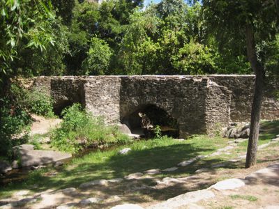
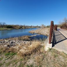
Espada Acequia, Colonial irrigation canal in San Antonio, United States
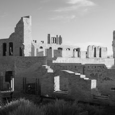
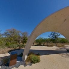
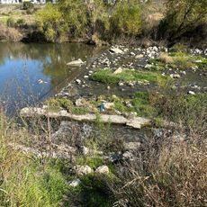
The Espada Acequia is a colonial irrigation channel in San Antonio that extends 1.5 miles from its dam with limestone construction throughout. The engineered aqueduct system carries water over Piedras Creek using original stone channels.
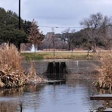
Franciscan friars built this water management system in 1731 to supply the agricultural lands of Mission San Francisco de la Espada. The structure was designed to overcome the region's dry conditions.
The waterway displays Spanish engineering methods that drew from Roman and Moorish irrigation traditions, allowing agriculture to flourish in Texas's dry landscape. This water management system brings together multiple cultural building techniques in one place.
The site is open to the public with pathways allowing close views of the historic stone structures. The cooler months offer the most comfortable conditions for exploring the full length of the waterway.
The structure features a reverse curve arch, an architectural detail that directs water through limestone channels and is rarely seen in Spanish Colonial works. This design demonstrates engineering innovation from the early 1700s.
Location: San Antonio
Location: Bexar County
Location: Texas
Address: Espada Rd., E of U.S. 281S
GPS coordinates: 29.30456,-98.46944
Latest update: December 10, 2025 20:01
Alamodome
12.5 km
San Antonio Missions National Historical Park
6.4 km
Mission San José
6.5 km
Mission San Francisco de la Espada
2.4 km
San Antonio Missions
2.8 km
Hot Wells
6.8 km
Institute of Texan Cultures
12.5 km
Guenther House
12.2 km
Edward Steves Homestead
12.3 km
King William Historic District
12.5 km
Ruby City
12.5 km
BiblioTech
5.6 km
Blue Star
11.9 km
Hangar 9, Brooks Air Force Base
5 km
Anton Wulff House
10.9 km
Ethel Wilson Harris House
6.6 km
Yturri-Edmunds House
10.6 km
Confluence Park
10.2 km
Alamo Methodist Church
12.1 km
Carl Wilhelm August Groos House
12.4 km
Norton-Polk-Mathis House
12.4 km
J.M. and Birdie Nix House
12.3 km
Mission San Jose
6.4 km
The Greenline
4.8 km
Mission Hike and Bike Trails
4.8 km
Bungalow Colony Historic District
12.3 km
The Greenline Park at Brooks
5.4 km
Mission Reach Paddling Trail Access Point
7.3 kmVisited this place? Tap the stars to rate it and share your experience / photos with the community! Try now! You can cancel it anytime.
Discover hidden gems everywhere you go!
From secret cafés to breathtaking viewpoints, skip the crowded tourist spots and find places that match your style. Our app makes it easy with voice search, smart filtering, route optimization, and insider tips from travelers worldwide. Download now for the complete mobile experience.
A unique approach to discovering new places❞
— Le Figaro
All the places worth exploring❞
— France Info
A tailor-made excursion in just a few clicks❞
— 20 Minutes