Hays County

Log in to your account

AroundUs is a community-driven map of interesting places, built by curious explorers like you. It grows with every review, story, and photo you share.
Connect to save your favorite spots, contribute locations, and create personalized routes.
Continue with Google
Continue with Apple
Continue with X
Continue with Facebook
Continue with email
By continuing, you accept our Terms and Conditions and our Privacy Policy
Create an account
Add to collection
Map
Suggest a change
Share

Hays County, Administrative division in Central Texas, US.

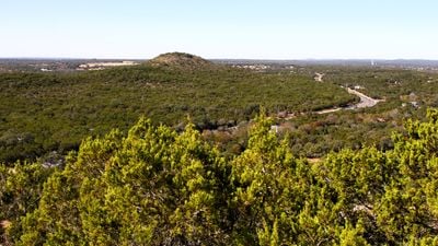
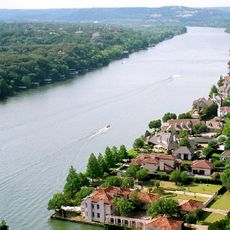
Hays County is an administrative division in Central Texas with San Marcos as its county seat. The territory lies between Austin and San Antonio along Interstate 35 and features river valleys, rolling terrain, and natural springs.

The county was established by the Texas Legislature in 1848 and named after Captain Jack Hays, a Texas Ranger who defended settlers against raids. This naming honors an early protector of Texas's frontier lands.

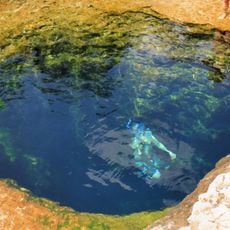
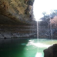
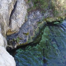
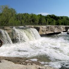
The county maintains multiple parks and natural areas, including Five Mile Dam Park and Jacob's Well Natural Area, which showcase the regional geology and ecosystems.

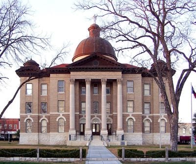
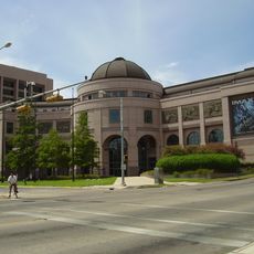
Visitors find San Marcos as the administrative center with public services and local facilities. The region is easily accessible via Interstate 35 and offers entry points to natural areas, parks, and communities throughout the county.

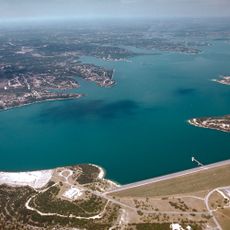
The Edwards Aquifer flows beneath the county and creates natural springs and underground water systems that supply local communities. This underground water source shapes the landscape and is essential to the region's survival.

Location: Texas

Inception: 1848

Capital city: San Marcos

Shares border with: Blanco County, Comal County, Travis County, Caldwell County, Guadalupe County

Website: http://co.hays.tx.us

GPS coordinates: 30.06000,-98.03000

Latest update: December 14, 2025 19:07

Photos
Around this place
Jacob's Well
United States of America

Jacob's Well

9.7 km
Darrell K Royal–Texas Memorial Stadium
United States of America

Darrell K Royal–Texas Memorial Stadium

37.9 km
Texas State Capitol
United States of America

Texas State Capitol

36.7 km
Hamilton Pool Preserve
United States of America

Hamilton Pool Preserve

32.8 km
Lake Austin
United States of America

Lake Austin

35.1 km
Lady Bird Lake
United States of America

Lady Bird Lake

37.1 km
Texas State Cemetery
United States of America

Texas State Cemetery

37.2 km
Mount Bonnell
United States of America

Mount Bonnell

38.1 km
Pennybacker Bridge
United States of America

Pennybacker Bridge

39.3 km
Canyon Lake
United States of America

Canyon Lake

28.4 km
Texas Governor's Mansion
United States of America

Texas Governor's Mansion

36.4 km
Moonlight towers in Austin, Texas
United States of America

Moonlight towers in Austin, Texas

36.2 km
Barton Springs
United States of America

Barton Springs

33.8 km
Lyndon Baines Johnson Library and Museum
United States of America

Lyndon Baines Johnson Library and Museum

38.3 km
Driskill Hotel
United States of America

Driskill Hotel

36.1 km
Main Building
United States of America

Main Building

37.6 km
Armadillo World Headquarters
United States of America

Armadillo World Headquarters

34.8 km
Camp Mabry
United States of America

Camp Mabry

38.7 km
Deep Eddy Pool
United States of America

Deep Eddy Pool

34.5 km
Frost Bank Tower
United States of America

Frost Bank Tower

36 km
McKinney Falls State Park
United States of America

McKinney Falls State Park

32.6 km
The Independent
United States of America

The Independent

35.4 km
Pedernales Falls State Park
United States of America

Pedernales Falls State Park

33.6 km
Ann W. Richards Congress Avenue Bridge
United States of America

Ann W. Richards Congress Avenue Bridge

35.4 km
United States of America

Radha Madhav Dham

12.7 km
El Camino Real de los Tejas National Historic Trail
United States of America

El Camino Real de los Tejas National Historic Trail

39 km
Texas State History Museum
United States of America

Texas State History Museum

37.2 km
West Sixth Street Bridge
United States of America

West Sixth Street Bridge

35.6 km
Show the full map
Reviews

Visited this place? Tap the stars to rate it and share your experience / photos with the community! Try now! You can cancel it anytime.

Administrative divisions
« Hays County - Administrative division in Central Texas, US » is provided by Around Us (aroundus.com). Images and texts are derived from Wikimedia project under a Creative Commons license. You are allowed to copy, distribute, and modify copies of this page, under the conditions set by the license, as long as this note is clearly visible.

Discover hidden gems everywhere you go!

From secret cafés to breathtaking viewpoints, skip the crowded tourist spots and find places that match your style. Our app makes it easy with voice search, smart filtering, route optimization, and insider tips from travelers worldwide. Download now for the complete mobile experience.

Around Us App Screenshot

A unique approach to discovering new places

Le Figaro

All the places worth exploring

France Info

A tailor-made excursion in just a few clicks

20 Minutes