Chest opened
+${chestReward.xp} XP
Explorer
NOUVEAU ×${chestReward.collectible.quantity}
tapez pour fermer

See the monuments around you in AR Open chests in the app

Around Us is built for your phone — point your camera at the streets and discover the monuments and places around you in augmented reality. Around Us is built for your phone — chests unlock when you walk, explore and capture nearby places.

•

Enable Location

We need your location to show you interesting places around you

Discover nearby places

Find interesting locations and hidden gems around you

Precise directions

Get accurate directions and distances to places

Your location is never shared with other users. It's only used when you tap the location button.

Mount Bonnell

Log in to your account

Start exploring — it's free

Trusted by 92,800 travelers worldwide

Continue with Google
Continue with Apple
or

We will send you a code to connect

By continuing, you accept our Terms and Conditions and our Privacy Policy

Check your inbox

We've sent a pincode in your inbox. Please enter the code below.

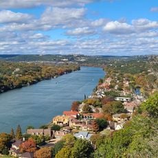
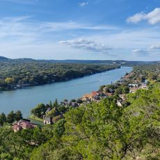
Mount Bonnell, Limestone summit in Austin, Texas.

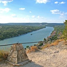
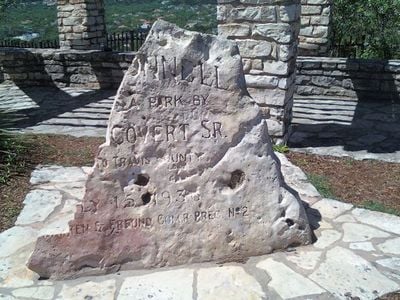
Mount Bonnell is a limestone height above the Colorado River in Austin, rising about 775 feet above sea level. A stone slab at the summit, set in flagstone paving between low stacked-stone walls, is carved with "MT BONNELL", "A PARK BY COVERT SR. TO TRAVIS COUNTY", the date 1938 and the name of the commissioner precinct. From the top, visitors look over Lake Austin and the city.

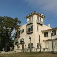
The limestone height was named for George W. Bonnell, who came to Texas in 1836, served as commissioner of Indian affairs under President Sam Houston, and published the Texas Sentinel in Austin in 1840. Albert Sidney Johnston may instead have named it for his friend Joseph Bonnell, a captain in the Texas Army; there is little contemporaneous evidence for either derivation. A historical marker placed in 1969 records the name and the hill's role on the old Indian trail into Austin.

The name Covert Park comes from the Covert family, who donated the land; the stone entrance marker records the transfer to Travis County in 1938. Picnics and outings were already held here in the 1850s and 1860s, and a local legend credits an 1850s excursion to the hill with inspiring the song "Wait for the Wagon and We'll All Take a Ride".

You reach the observation platform by climbing 102 stone steps that are regularly maintained and straightforward to navigate. The best time to visit is early morning or late afternoon when the sun is lower and the light is clearer.

In 1898, Hazel Keyes slid down a cable stretched from the summit of Mount Bonnell to the south bank of what was then Lake McDonald, below. The descent was staged as a public stunt and recorded in the marker text at the site.

The community of curious travelers

AroundUs brings together thousands of curated places, local tips, and hidden gems, enriched daily by 92,800 contributors worldwide.

Start exploring
Location
Address
Mt Bonnell, Austin, TX 78731, USA
GPS coordinates
30.32077,-97.77335
Latest update
October 26, 2026 00:41
Reviews
Share your experience

No review yet

Discussions
Start a discussion...

No discussion yet

« Mount Bonnell - Limestone summit in Austin, Texas » is provided by Around Us (aroundus.com). Images and texts are derived from Wikimedia project under a Creative Commons license. You are allowed to copy, distribute, and modify copies of this page, under the conditions set by the license, as long as this note is clearly visible.

Discover hidden gems everywhere you go!

From secret cafés to breathtaking viewpoints, skip the crowded tourist spots and find places that match your style. Our app makes it easy with voice search, smart filtering, route optimization, and insider tips from travelers worldwide. Download now for the complete mobile experience.

Around Us App Screenshot
❝

A unique approach to discovering new places❞

— Le Figaro

❝

All the places worth exploring❞

— France Info

❝

A tailor-made excursion in just a few clicks❞

— 20 Minutes

Around Us
Travel Guide & Maps
Download

Send to your phone

QR Code
1

Open the camera app on your mobile.

2

Point at the QR code with your camera. A notification will appear.

3

Tap the notification to open the link.