Enable Location

We need your location to show you interesting places around you

Discover nearby places

Find interesting locations and hidden gems around you

Precise directions

Get accurate directions and distances to places

Your location is never shared with other users. It's only used when you tap the location button.

Inks Dam

Log in to your account

Start exploring — it's free

Trusted by 65,492 travelers worldwide

Continue with Google
Continue with Apple
or

We will send you a code to connect

By continuing, you accept our Terms and Conditions and our Privacy Policy

Check your inbox

We've sent a pincode in your inbox. Please enter the code below.

Inks Dam
Discussion Reviews 1 Photos
3.8k Popularity

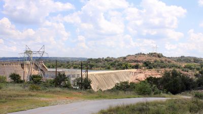
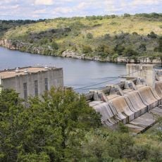
Inks Dam, Gravity dam in Burnet County, United States

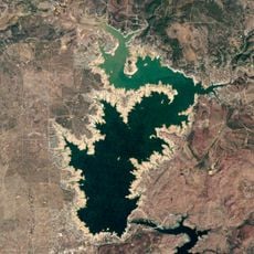
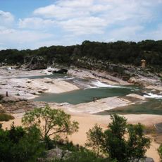
Inks Dam is a concrete gravity dam on the Colorado River in Burnet County, Texas, and forms part of the Texas Highland Lakes chain. The structure holds back the water of Inks Lake and uses on-site turbines to generate electricity for the surrounding region.

Construction took place between 1936 and 1938, and the dam was named after Roy B. Inks, one of the early leaders of the Lower Colorado River Authority. It was one of several dams built in sequence along the Colorado River to bring electricity and reliable water to central Texas.

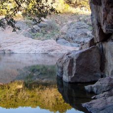
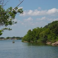
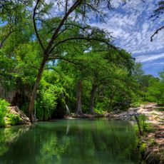
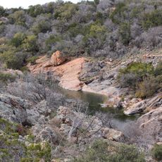
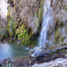
The lake created by the dam is a popular spot for locals who come to swim, fish, and spend time on the water. On weekends, the shoreline fills with families and boaters who treat this stretch of the Colorado River as a natural gathering place.

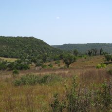
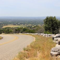
The dam is visible from several public access points around Inks Lake, and walking along the shore gives a clear view of the structure from different angles. The nearby Inks Lake State Park offers trails and water access that make it easy to spend a full day in the area.

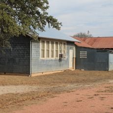
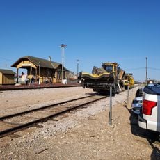
Next to the dam sits a state fish hatchery with dozens of production ponds dedicated to raising species under threat, including some native Texas fish rarely seen in the wild. The facility operates quietly but plays a direct role in restocking rivers and lakes across the region.

The community of curious travelers

AroundUs brings together thousands of curated places, local tips, and hidden gems, enriched daily by 60,000 contributors worldwide.

Start exploring
Location
GPS coordinates
30.73110,-98.38470
Latest update
March 3, 2026 14:03
Around this place
Lake Buchanan
United States of America

Lake Buchanan

4 km
Longhorn Cavern State Park
United States of America

Longhorn Cavern State Park

6.1 km
Balcones Canyonlands National Wildlife Refuge
United States of America

Balcones Canyonlands National Wildlife Refuge

32.6 km
Inks Lake State Park
United States of America

Inks Lake State Park

1.3 km
Inks Lake
United States of America

Inks Lake

12 m
Antlers Hotel
United States of America

Antlers Hotel

9.3 km
Krause Springs
United States of America

Krause Springs

36.1 km
Max Starcke Dam
United States of America

Max Starcke Dam

23 km
Fort Croghan
United States of America

Fort Croghan

14.4 km
Llano County Courthouse and Jail
United States of America

Llano County Courthouse and Jail

28 km
Badu Building
United States of America

Badu Building

28 km
Liberty Hill International Sculpture Park
United States of America

Liberty Hill International Sculpture Park

46.2 km
Roper Hotel
United States of America

Roper Hotel

20.7 km
Burnet County Courthouse
United States of America

Burnet County Courthouse

15.4 km
Austin and Northwestern Railroad Historic District-Fairland to Llano
United States of America

Austin and Northwestern Railroad Historic District-Fairland to Llano

9.3 km
Pecan Creek School
United States of America

Pecan Creek School

43.9 km
Pedernales Falls
United States of America

Pedernales Falls

45.3 km
Longhorn Cavern Administration Building
United States of America

Longhorn Cavern Administration Building

6.1 km
Sulfur Creek Bridge
United States of America

Sulfur Creek Bridge

41 km
Lampasas County Courthouse
United States of America

Lampasas County Courthouse

42.2 km
Bertram Depot
United States of America

Bertram Depot

31.6 km
Devils Waterhole
United States of America

Devils Waterhole

3 km
Park Road 4 Historic District
United States of America

Park Road 4 Historic District

3.4 km
Uptown Marble Theater
United States of America

Uptown Marble Theater

20.5 km
Gorman Falls
United States of America

Gorman Falls

37.6 km
Lampasas Colored School
United States of America

Lampasas Colored School

42.3 km
Acme Dry Goods Building
United States of America

Acme Dry Goods Building

28 km
Briggs State Bank
United States of America

Briggs State Bank

47.3 km
Show the full map
Reviews
Share your experience

No review yet

Discussions
Start a discussion...

No discussion yet

« Inks Dam - Gravity dam in Burnet County, United States » is provided by Around Us (aroundus.com). Images and texts are derived from Wikimedia project under a Creative Commons license. You are allowed to copy, distribute, and modify copies of this page, under the conditions set by the license, as long as this note is clearly visible.

Discover hidden gems everywhere you go!

From secret cafés to breathtaking viewpoints, skip the crowded tourist spots and find places that match your style. Our app makes it easy with voice search, smart filtering, route optimization, and insider tips from travelers worldwide. Download now for the complete mobile experience.

Around Us App Screenshot

A unique approach to discovering new places

Le Figaro

All the places worth exploring

France Info

A tailor-made excursion in just a few clicks

20 Minutes

Around Us
Travel Guide & Maps
Download

Send to your phone

QR Code
1

Open the camera app on your mobile.

2

Point at the QR code with your camera. A notification will appear.

3

Tap the notification to open the link.