Enable Location

We need your location to show you interesting places around you

Discover nearby places

Find interesting locations and hidden gems around you

Precise directions

Get accurate directions and distances to places

Your location is never shared with other users. It's only used when you tap the location button.

Fort Croghan

Log in to your account

Start exploring — it's free

Trusted by 63,440 travelers worldwide

Continue with Google
Continue with Apple
or

We will send you a code to connect

By continuing, you accept our Terms and Conditions and our Privacy Policy

Check your inbox

We've sent a pincode in your inbox. Please enter the code below.

Fort Croghan
Discussion Reviews 1 Photos
3.1k Popularity

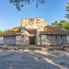
Fort Croghan, Military history museum in Burnet County, United States.

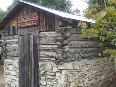
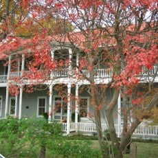
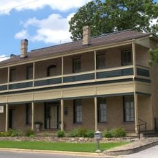
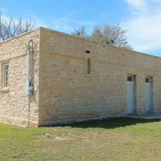
Fort Croghan Museum is a military history site near Burnet displaying multiple restored structures from the frontier period, including a blacksmith shop, schoolhouse, powder storage building, and stagecoach station. The grounds preserve the original layout of this former fort, allowing visitors to understand how each building served its purpose.

The United States established Fort Croghan in 1849 as part of a chain of four forts protecting Texas settlements from threats. The installation closed in 1853 when military protection in this area was no longer required.

The museum displays how life unfolded in this region during the 1800s, with objects and papers showing daily routines of early settlers. Visitors walk through original structures to understand how people worked, lived, and organized their communities during that era.

The museum offers free entry and operates during regular hours throughout the week from its location on Buchanan Drive in Burnet. Since the grounds contain multiple buildings spread across the area, visitors should plan enough time to walk through each structure at a comfortable pace.

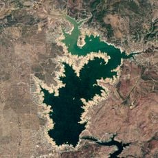
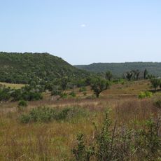
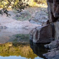
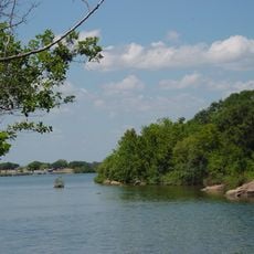
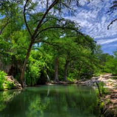
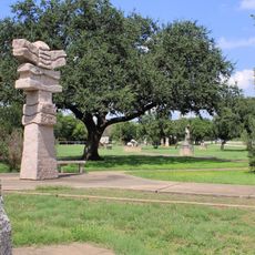
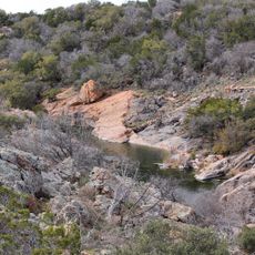
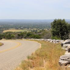
The museum grounds extend across rolling terrain from Hamilton Creek to Post Mountain, showing the fort's actual geographic setting in the landscape. This natural spread helps visitors understand how the original installation was strategically positioned in relation to the surrounding area.

The community of curious travelers

AroundUs brings together thousands of curated places, local tips, and hidden gems, enriched daily by 60,000 contributors worldwide.

Start exploring
Location
GPS coordinates
30.75694,-98.23750
Latest update
December 12, 2025 09:07
Around this place
Lake Buchanan
United States of America

Lake Buchanan

17.3 km
Longhorn Cavern State Park
United States of America

Longhorn Cavern State Park

13.5 km
Balcones Canyonlands National Wildlife Refuge
United States of America

Balcones Canyonlands National Wildlife Refuge

22.1 km
Inks Lake State Park
United States of America

Inks Lake State Park

13.1 km
Inks Lake
United States of America

Inks Lake

14.4 km
Antlers Hotel
United States of America

Antlers Hotel

21.9 km
Krause Springs
United States of America

Krause Springs

32 km
United States of America

Levi Rock Shelter

44.2 km
Inks Dam
United States of America

Inks Dam

14.4 km
Max Starcke Dam
United States of America

Max Starcke Dam

22.4 km
Llano County Courthouse and Jail
United States of America

Llano County Courthouse and Jail

42 km
Badu Building
United States of America

Badu Building

42 km
Liberty Hill International Sculpture Park
United States of America

Liberty Hill International Sculpture Park

33.1 km
Roper Hotel
United States of America

Roper Hotel

21 km
Burnet County Courthouse
United States of America

Burnet County Courthouse

1 km
Austin and Northwestern Railroad Historic District-Fairland to Llano
United States of America

Austin and Northwestern Railroad Historic District-Fairland to Llano

21.9 km
Longhorn Cavern Administration Building
United States of America

Longhorn Cavern Administration Building

13.5 km
Sulfur Creek Bridge
United States of America

Sulfur Creek Bridge

33.6 km
Lampasas County Courthouse
United States of America

Lampasas County Courthouse

34.8 km
Bertram Depot
United States of America

Bertram Depot

17.5 km
Devils Waterhole
United States of America

Devils Waterhole

11.8 km
Park Road 4 Historic District
United States of America

Park Road 4 Historic District

15.1 km
Uptown Marble Theater
United States of America

Uptown Marble Theater

20.9 km
Gorman Falls
United States of America

Gorman Falls

40.9 km
Lampasas Colored School
United States of America

Lampasas Colored School

34.8 km
Acme Dry Goods Building
United States of America

Acme Dry Goods Building

42 km
Briggs State Bank
United States of America

Briggs State Bank

33.3 km
Lake Marble Falls
United States of America

Lake Marble Falls

22.4 km
Show the full map
Reviews
Share your experience

No review yet

Discussions
Start a discussion...

No discussion yet

« Fort Croghan - Military history museum in Burnet County, United States » is provided by Around Us (aroundus.com). Images and texts are derived from Wikimedia project under a Creative Commons license. You are allowed to copy, distribute, and modify copies of this page, under the conditions set by the license, as long as this note is clearly visible.

Discover hidden gems everywhere you go!

From secret cafés to breathtaking viewpoints, skip the crowded tourist spots and find places that match your style. Our app makes it easy with voice search, smart filtering, route optimization, and insider tips from travelers worldwide. Download now for the complete mobile experience.

Around Us App Screenshot

A unique approach to discovering new places

Le Figaro

All the places worth exploring

France Info

A tailor-made excursion in just a few clicks

20 Minutes

Around Us
Travel Guide & Maps
Download

Send to your phone

QR Code
1

Open the camera app on your mobile.

2

Point at the QR code with your camera. A notification will appear.

3

Tap the notification to open the link.