Chest opened
+${chestReward.xp} XP
Explorer
NOUVEAU ×${chestReward.collectible.quantity}
tapez pour fermer
Chest locked

Open chests in the app

Around Us is built for your phone — chests unlock when you walk, explore and capture nearby places.

Enable Location

We need your location to show you interesting places around you

Discover nearby places

Find interesting locations and hidden gems around you

Precise directions

Get accurate directions and distances to places

Your location is never shared with other users. It's only used when you tap the location button.

Sabine River

Log in to your account

Start exploring — it's free

Trusted by 72,887 travelers worldwide

Continue with Google
Continue with Apple
or

We will send you a code to connect

By continuing, you accept our Terms and Conditions and our Privacy Policy

Check your inbox

We've sent a pincode in your inbox. Please enter the code below.

Sabine River
Discussion Reviews 1 Photos
37.5k Popularity

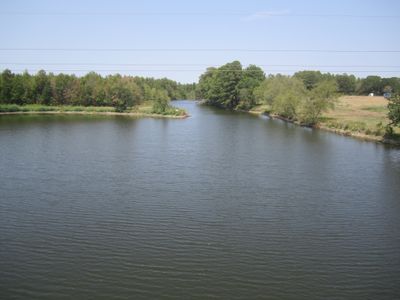
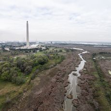
Sabine River, Border river between Texas and Louisiana, United States

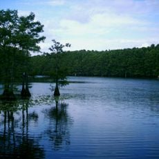
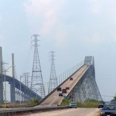
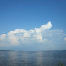
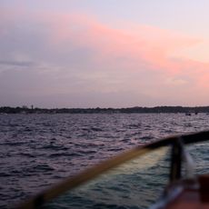
The Sabine River is a waterway that flows roughly 580 miles through northeastern Texas and Louisiana, marking the boundary between the two states before reaching the Gulf of Mexico. Along its course, the river creates reservoirs and lakes that shape the landscape.

Spanish explorers called the river 'Rio de Sabinas' after the cypress trees growing along its banks. Throughout the centuries, it served as a boundary line between different colonial powers and nations, shaping how territory was divided in the region.

The Caddo people made their homes along these banks for thousands of years, relying on the water and land around them. You can see how the river remains central to local communities today, shaping how people live and work in the region.

The river is used for boating, fishing, and water management throughout the region. Water levels and conditions change with the seasons, so visitors should be prepared for varying water quality and accessibility depending on the time of year.

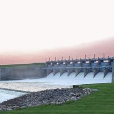
The Toledo Bend Reservoir, created in 1969, is one of the largest man-made lakes in the southern region. This massive dam project transformed the landscape and opened up new opportunities for recreation and fishing along what had once been the natural river channel.

The community of curious travelers

AroundUs brings together thousands of curated places, local tips, and hidden gems, enriched daily by 60,000 contributors worldwide.

Start exploring
Location
Location
GPS coordinates
32.80820,-95.92050
Latest update
December 17, 2025 10:16
Around this place
Show the full map
Reviews
Share your experience

No review yet

Discussions
Start a discussion...

No discussion yet

« Sabine River - Border river between Texas and Louisiana, United States » is provided by Around Us (aroundus.com). Images and texts are derived from Wikimedia project under a Creative Commons license. You are allowed to copy, distribute, and modify copies of this page, under the conditions set by the license, as long as this note is clearly visible.

Discover hidden gems everywhere you go!

From secret cafés to breathtaking viewpoints, skip the crowded tourist spots and find places that match your style. Our app makes it easy with voice search, smart filtering, route optimization, and insider tips from travelers worldwide. Download now for the complete mobile experience.

Around Us App Screenshot

A unique approach to discovering new places

Le Figaro

All the places worth exploring

France Info

A tailor-made excursion in just a few clicks

20 Minutes

Around Us
Travel Guide & Maps
Download

Send to your phone

QR Code
1

Open the camera app on your mobile.

2

Point at the QR code with your camera. A notification will appear.

3

Tap the notification to open the link.