Enable Location

We need your location to show you interesting places around you

Discover nearby places

Find interesting locations and hidden gems around you

Precise directions

Get accurate directions and distances to places

Your location is never shared with other users. It's only used when you tap the location button.

Calcasieu River

Log in to your account

Start exploring — it's free

Trusted by 68,287 travelers worldwide

Continue with Google
Continue with Apple
or

We will send you a code to connect

By continuing, you accept our Terms and Conditions and our Privacy Policy

Check your inbox

We've sent a pincode in your inbox. Please enter the code below.

Calcasieu River
Discussion Reviews 1 Photos
9.9k Popularity

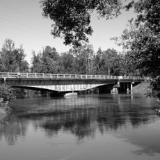
Calcasieu River, River system in southwestern Louisiana, United States.

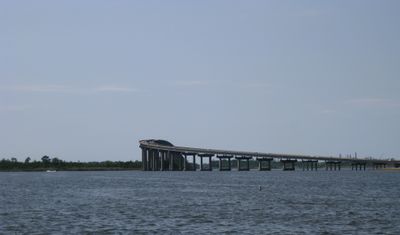
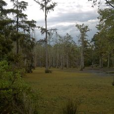
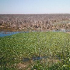
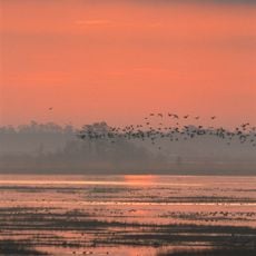
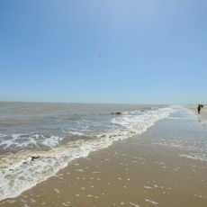
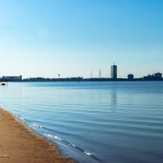
The Calcasieu River is a river in southwestern Louisiana that runs from Vernon Parish down through forests, wetlands, and industrial zones to the Gulf of Mexico. Before reaching the open sea, it widens into Calcasieu Lake, a shallow coastal lake near the city of Lake Charles.

In the early 1800s, the land around the river was part of the Neutral Ground, a strip of territory claimed by both Spain and the United States that neither side officially controlled. That lawless in-between zone attracted outlaws and settlers alike, and shaped the early character of the area.

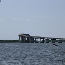
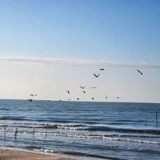
The name Calcasieu comes from an Atakapa word meaning Crying Eagle, a reference to the Native American people who once lived along these banks. Today, fishing is still a daily activity near the lake at the river's mouth, where local boats go out for shrimp and crawfish.

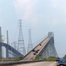
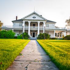
The river is most easily reached from Lake Charles, where there are public boat ramps and waterfront areas open to visitors. Keep in mind that parts of the river handle heavy industrial vessel traffic, so it is worth checking which stretches are open for recreational use before heading out.

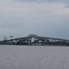
A major chemical spill near the river in the 1990s triggered one of the longest industrial cleanup efforts in Louisiana's history, and the site is still monitored today. This made the river a reference point for environmental law and cleanup standards across the state.

The community of curious travelers

AroundUs brings together thousands of curated places, local tips, and hidden gems, enriched daily by 60,000 contributors worldwide.

Start exploring
Location
Elevation above the sea
1 m
GPS coordinates
30.05528,-93.29722
Latest update
March 3, 2026 10:12
Around this place
Rainbow Bridge
United States of America

Rainbow Bridge

56 km
Calcasieu River Bridge
United States of America

Calcasieu River Bridge

20.8 km
Capital One Tower
United States of America

Capital One Tower

20.9 km
Cowboy Stadium
United States of America

Cowboy Stadium

15.6 km
Sam Houston Jones State Park
United States of America

Sam Houston Jones State Park

27.7 km
Israel LaFleur Bridge
United States of America

Israel LaFleur Bridge

16.4 km
Sabine National Wildlife Refuge
United States of America

Sabine National Wildlife Refuge

28.6 km
W. H. Stark House
United States of America

W. H. Stark House

42.4 km
Cameron Prairie National Wildlife Refuge
United States of America

Cameron Prairie National Wildlife Refuge

24.1 km
Lacassine National Wildlife Refuge
United States of America

Lacassine National Wildlife Refuge

42.9 km
Cathedral of the Immaculate Conception
United States of America

Cathedral of the Immaculate Conception

20.6 km
Charleston Hotel
United States of America

Charleston Hotel

20.8 km
Stark Museum of Art
United States of America

Stark Museum of Art

42.5 km
Gerstner Field
United States of America

Gerstner Field

22 km
Deweyville Swing Bridge
United States of America

Deweyville Swing Bridge

51.1 km
All Saints Episcopal Church
United States of America

All Saints Episcopal Church

45.8 km
Hebert House
United States of America

Hebert House

50.9 km
Muller's Department Store
United States of America

Muller's Department Store

21 km
Orange County Courthouse
United States of America

Orange County Courthouse

42.5 km
Rose Hill
United States of America

Rose Hill

62.4 km
Calkins-Orvis House
United States of America

Calkins-Orvis House

49.8 km
Holly Beach
United States of America

Holly Beach

35.3 km
The Children's Museum of Southwest Louisiana
United States of America

The Children's Museum of Southwest Louisiana

21.2 km
DeQuincy Railroad Museum
United States of America

DeQuincy Railroad Museum

46.1 km
North Beach
United States of America

North Beach

20.9 km
Eddingston Court
United States of America

Eddingston Court

61.9 km
Hackberry Beach
United States of America

Hackberry Beach

42.9 km
Interstate 10 Bridge
United States of America

Interstate 10 Bridge

39.7 km
Show the full map
Reviews
Share your experience

No review yet

Discussions
Start a discussion...

No discussion yet

« Calcasieu River - River system in southwestern Louisiana, United States » is provided by Around Us (aroundus.com). Images and texts are derived from Wikimedia project under a Creative Commons license. You are allowed to copy, distribute, and modify copies of this page, under the conditions set by the license, as long as this note is clearly visible.

Discover hidden gems everywhere you go!

From secret cafés to breathtaking viewpoints, skip the crowded tourist spots and find places that match your style. Our app makes it easy with voice search, smart filtering, route optimization, and insider tips from travelers worldwide. Download now for the complete mobile experience.

Around Us App Screenshot

A unique approach to discovering new places

Le Figaro

All the places worth exploring

France Info

A tailor-made excursion in just a few clicks

20 Minutes

Around Us
Travel Guide & Maps
Download

Send to your phone

QR Code
1

Open the camera app on your mobile.

2

Point at the QR code with your camera. A notification will appear.

3

Tap the notification to open the link.