Chest opened
+${chestReward.xp} XP
Explorer
NOUVEAU ×${chestReward.collectible.quantity}
tapez pour fermer
Chest locked

Open chests in the app

Around Us is built for your phone — chests unlock when you walk, explore and capture nearby places.

Enable Location

We need your location to show you interesting places around you

Discover nearby places

Find interesting locations and hidden gems around you

Precise directions

Get accurate directions and distances to places

Your location is never shared with other users. It's only used when you tap the location button.

Port of South Louisiana

Log in to your account

Start exploring — it's free

Trusted by 73,104 travelers worldwide

Continue with Google
Continue with Apple
or

We will send you a code to connect

By continuing, you accept our Terms and Conditions and our Privacy Policy

Check your inbox

We've sent a pincode in your inbox. Please enter the code below.

Port of South Louisiana
Discussion Reviews 1 Photos
30k Popularity

Port of South Louisiana, Maritime transportation hub on Mississippi River, Louisiana, United States.

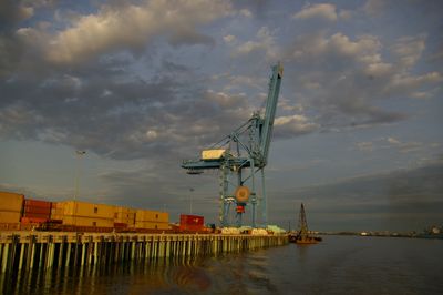
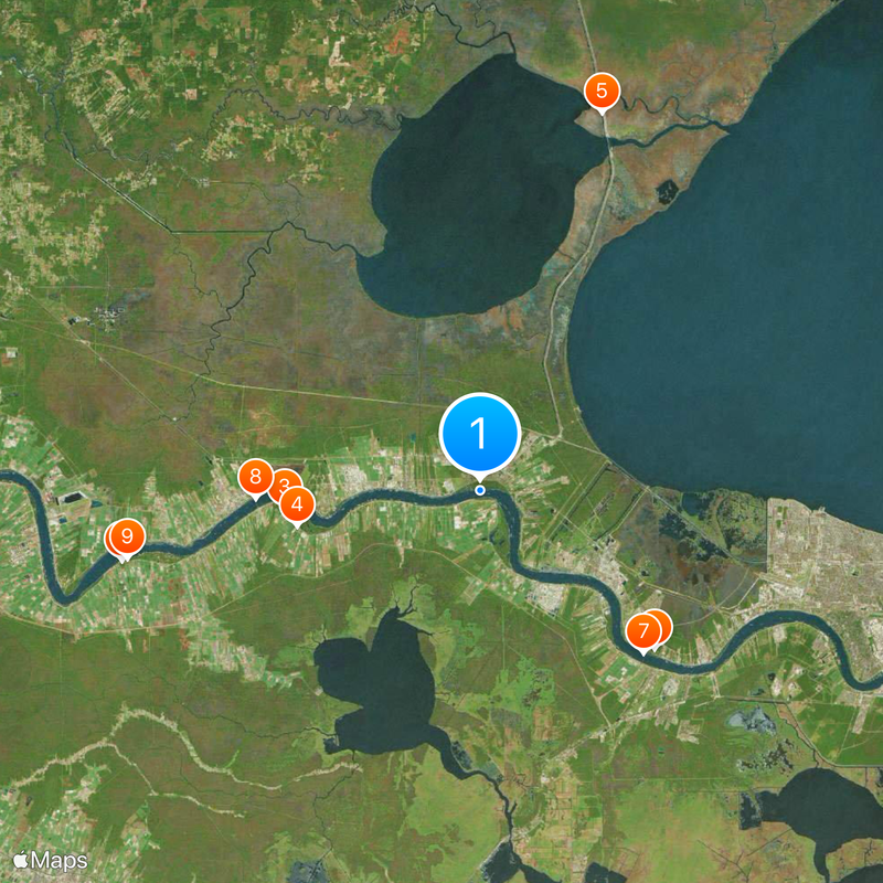
The Port of South Louisiana stretches along the Mississippi River between New Orleans and Baton Rouge with multiple cargo terminals spread across the region. These facilities handle grain shipments, containers, and liquid cargo in separate specialized areas.

The port was created in 1960 to serve regional commerce and grew into a major hub for moving goods between inland farms and ocean routes. This development transformed how the area conducted business with the wider world.

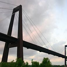
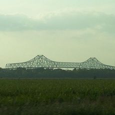
The waterway here shows the connection between agriculture and global trade, with grain barges and cargo ships moving constantly through the region. Local communities have built their lives around the sound and sight of maritime work.

You can watch ship activity from viewing areas along the riverbank or from nearby roads that run parallel to the water. Plan your visit when weather is calm, as strong wind and rain can limit visibility of the operations.

The facility moves American grain from inland farms to ocean-going ships, serving as a crucial link in getting crops to international buyers. Without this transfer point, much of the harvest from the farming heartland would have no easy path to overseas markets.

The community of curious travelers

AroundUs brings together thousands of curated places, local tips, and hidden gems, enriched daily by 60,000 contributors worldwide.

Start exploring
Location
GPS coordinates
30.05100,-90.50000
Latest update
December 20, 2025 02:49
Around this place
Oak Alley Plantation
United States of America

Oak Alley Plantation

27.1 km
Whitney Plantation Historic District
United States of America

Whitney Plantation Historic District

14.6 km
Evergreen Plantation
United States of America

Evergreen Plantation

13.8 km
Manchac Swamp Bridge
United States of America

Manchac Swamp Bridge

29.5 km
Destrehan Plantation
United States of America

Destrehan Plantation

17.5 km
Hale Boggs Memorial Bridge
United States of America

Hale Boggs Memorial Bridge

17.2 km
Gramercy Bridge
United States of America

Gramercy Bridge

16.6 km
St. Joseph Plantation
United States of America

St. Joseph Plantation

26.7 km
San Francisco Plantation House
United States of America

San Francisco Plantation House

10.2 km
Ormond Plantation House
United States of America

Ormond Plantation House

15.3 km
Cajun Pride Swamp Tours
United States of America

Cajun Pride Swamp Tours

7.9 km
Homeplace Plantation House
United States of America

Homeplace Plantation House

12.6 km
LaBranche Plantation Dependency
United States of America

LaBranche Plantation Dependency

21 km
Laura Plantation
United States of America

Laura Plantation

22.2 km
Godchaux–Reserve Plantation
United States of America

Godchaux–Reserve Plantation

6.2 km
Desire Plantation House
United States of America

Desire Plantation House

22 km
Maurepas Swamp Wildlife Management Area
United States of America

Maurepas Swamp Wildlife Management Area

10.7 km
Wildcat Stadium
United States of America

Wildcat Stadium

14.8 km
Olive Jeanette
United States of America

Olive Jeanette

19 km
Bayou Boeuf Elementary School
United States of America

Bayou Boeuf Elementary School

22.1 km
Emilie Plantation
United States of America

Emilie Plantation

10.6 km
Mather House
United States of America

Mather House

30.8 km
Raziano House
United States of America

Raziano House

25.7 km
Our Lady of Grace Church
United States of America

Our Lady of Grace Church

6 km
Kenner Town Hall
United States of America

Kenner Town Hall

25.7 km
Dorvin House
United States of America

Dorvin House

10.3 km
San Francisco Plantation
United States of America

San Francisco Plantation

9.9 km
Hope Plantation (Louisiana)
United States of America

Hope Plantation (Louisiana)

11.6 km
Show the full map
Reviews
Share your experience

No review yet

Discussions
Start a discussion...

No discussion yet

« Port of South Louisiana - Maritime transportation hub on Mississippi River, Louisiana, United States » is provided by Around Us (aroundus.com). Images and texts are derived from Wikimedia project under a Creative Commons license. You are allowed to copy, distribute, and modify copies of this page, under the conditions set by the license, as long as this note is clearly visible.

Discover hidden gems everywhere you go!

From secret cafés to breathtaking viewpoints, skip the crowded tourist spots and find places that match your style. Our app makes it easy with voice search, smart filtering, route optimization, and insider tips from travelers worldwide. Download now for the complete mobile experience.

Around Us App Screenshot

A unique approach to discovering new places

Le Figaro

All the places worth exploring

France Info

A tailor-made excursion in just a few clicks

20 Minutes

Around Us
Travel Guide & Maps
Download

Send to your phone

QR Code
1

Open the camera app on your mobile.

2

Point at the QR code with your camera. A notification will appear.

3

Tap the notification to open the link.