Chest opened
+${chestReward.xp} XP
Explorer
NOUVEAU ×${chestReward.collectible.quantity}
tapez pour fermer
Chest locked

Open chests in the app

Around Us is built for your phone — chests unlock when you walk, explore and capture nearby places.

Enable Location

We need your location to show you interesting places around you

Discover nearby places

Find interesting locations and hidden gems around you

Precise directions

Get accurate directions and distances to places

Your location is never shared with other users. It's only used when you tap the location button.

Log in to your account

Start exploring — it's free

Trusted by 73,029 travelers worldwide

Continue with Google
Continue with Apple
or

We will send you a code to connect

By continuing, you accept our Terms and Conditions and our Privacy Policy

Check your inbox

We've sent a pincode in your inbox. Please enter the code below.

Clark Creek Natural Area
Discussion Reviews Photo
8.1k Popularity

Clark Creek Natural Area, Protected natural area near Woodville, Mississippi, United States.

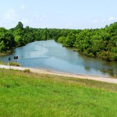
Clark Creek Natural Area is a protected forest reserve in Mississippi covering roughly 700 acres with numerous waterfalls throughout the landscape. The terrain features diverse woodland sections connected by hiking trails that wind past cascades and natural pools.

This protected area was established in 1978 through collaboration between conservation organizations and a major paper company. The founding effort arose from a desire to preserve the natural forest landscape and its water systems.

The place draws its name from the creek that runs through it and shapes how people explore the landscape. Local visitors come here specifically for the waterfalls and forest walks that define the experience.

This location sits 13 miles west of Woodville and can be reached via Mississippi Highway 24. Multiple trails of varying difficulty allow visitors to choose routes suited to their hiking experience.

The area harbors uncommon fish species and unusual tree varieties that are rarely found elsewhere. Among its trees are specimens that rank among the largest of their kinds in the region.

The community of curious travelers

AroundUs brings together thousands of curated places, local tips, and hidden gems, enriched daily by 60,000 contributors worldwide.

Start exploring
Location
GPS coordinates
31.06910,-91.51640
Latest update
December 8, 2025 19:59
Around this place
Louisiana State Penitentiary
United States of America

Louisiana State Penitentiary

14.6 km
Old River Control Structure
United States of America

Old River Control Structure

16.6 km
Rosedown Plantation
United States of America

Rosedown Plantation

33.4 km
John James Audubon Bridge
United States of America

John James Audubon Bridge

41 km
Red Hat Cell Block
United States of America

Red Hat Cell Block

14.8 km
Butler Greenwood Plantation
United States of America

Butler Greenwood Plantation

30.2 km
Cat Island National Wildlife Refuge
United States of America

Cat Island National Wildlife Refuge

31 km
Locust Grove State Historic Site
United States of America

Locust Grove State Historic Site

30.7 km
White Hall Plantation House
United States of America

White Hall Plantation House

26.8 km
Afton Villa Gardens
United States of America

Afton Villa Gardens

27.1 km
Live Oak
United States of America

Live Oak

16.2 km
Mazique Archeological Site
United States of America

Mazique Archeological Site

40.3 km
LSU Gymnastics Training Facility
United States of America

LSU Gymnastics Training Facility

45.6 km
Mamie S. Barrett
United States of America

Mamie S. Barrett

38.8 km
Rosemont
United States of America

Rosemont

23.3 km
Avoyelles High School
United States of America

Avoyelles High School

43.7 km
Poydras High School
United States of America

Poydras High School

42.5 km
St. Francis Chapel
United States of America

St. Francis Chapel

37.9 km
Jackson Historic District
United States of America

Jackson Historic District

38.3 km
St. Stephen's Episcopal Church
United States of America

St. Stephen's Episcopal Church

24 km
First National Bank
United States of America

First National Bank

42.7 km
Kingston Methodist Church
United States of America

Kingston Methodist Church

42.2 km
Samson House
United States of America

Samson House

42.3 km
Thomas A. Lemoine House
United States of America

Thomas A. Lemoine House

44.2 km
Sarto Bridge
United States of America

Sarto Bridge

26.3 km
Pointe Coupee Parish Courthouse
United States of America

Pointe Coupee Parish Courthouse

42.5 km
Satterfield Motor Company Building
United States of America

Satterfield Motor Company Building

42.6 km
Bordelonville Floodgate
United States of America

Bordelonville Floodgate

33.3 km
Show the full map
Reviews
Share your experience

No review yet

Discussions
Start a discussion...

No discussion yet

« Clark Creek Natural Area - Protected natural area near Woodville, Mississippi, United States » is provided by Around Us (aroundus.com). Images and texts are derived from Wikimedia project under a Creative Commons license. You are allowed to copy, distribute, and modify copies of this page, under the conditions set by the license, as long as this note is clearly visible.

Discover hidden gems everywhere you go!

From secret cafés to breathtaking viewpoints, skip the crowded tourist spots and find places that match your style. Our app makes it easy with voice search, smart filtering, route optimization, and insider tips from travelers worldwide. Download now for the complete mobile experience.

Around Us App Screenshot

A unique approach to discovering new places

Le Figaro

All the places worth exploring

France Info

A tailor-made excursion in just a few clicks

20 Minutes

Around Us
Travel Guide & Maps
Download

Send to your phone

QR Code
1

Open the camera app on your mobile.

2

Point at the QR code with your camera. A notification will appear.

3

Tap the notification to open the link.