Chest opened
+${chestReward.xp} XP
Explorer
NOUVEAU ×${chestReward.collectible.quantity}
tapez pour fermer
Chest locked

Open chests in the app

Around Us is built for your phone — chests unlock when you walk, explore and capture nearby places.

Enable Location

We need your location to show you interesting places around you

Discover nearby places

Find interesting locations and hidden gems around you

Precise directions

Get accurate directions and distances to places

Your location is never shared with other users. It's only used when you tap the location button.

Log in to your account

Start exploring — it's free

Trusted by 72,891 travelers worldwide

Continue with Google
Continue with Apple
or

We will send you a code to connect

By continuing, you accept our Terms and Conditions and our Privacy Policy

Check your inbox

We've sent a pincode in your inbox. Please enter the code below.

Discussion Reviews Photo
15.8k Popularity

Pine Belt, Geographic region in southeastern Mississippi, United States.

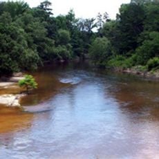
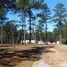
The Pine Belt is a geographic region spanning nine counties across southeastern Mississippi. Extensive forests of longleaf pine trees dominate the landscape throughout this area.

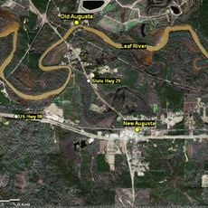
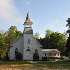
The region experienced significant growth during the late 1800s when railroad construction enabled timber transport and the founding of new communities. This development transformed the area from wilderness into settled territory.

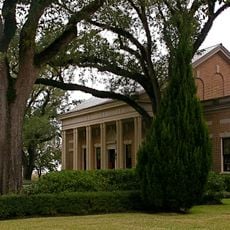
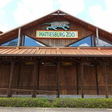
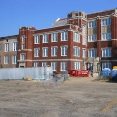
Hattiesburg, Laurel und Petal sind die Zentren dieser Region, wo Menschen in Fabriken, Schulen und Geschäften arbeiten. Heute prägen diese Städte das wirtschaftliche Gesicht des Gebiets durch ihre lokalen Industrien und Gemeinschaften.

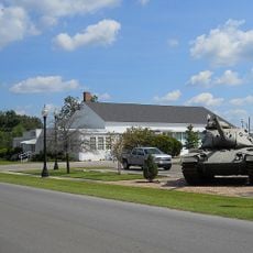
Temperatures remain moderate throughout the year, making the region comfortable for visiting. The Camp Shelby military facility near Hattiesburg is a significant landmark that shapes the landscape in this area.

The longleaf pines in this area grow to exceptional heights and trunk diameters. These trees reach such impressive sizes because of the specific soil and climate conditions found here.

The community of curious travelers

AroundUs brings together thousands of curated places, local tips, and hidden gems, enriched daily by 60,000 contributors worldwide.

Start exploring
Location
GPS coordinates
31.12280,-88.93675
Latest update
December 7, 2025 19:29
Around this place
M. M. Roberts Stadium
United States of America

M. M. Roberts Stadium

44 km
Lauren Rogers Museum of Art
United States of America

Lauren Rogers Museum of Art

66.5 km
Hattiesburg Zoo
United States of America

Hattiesburg Zoo

42.4 km
Amos Deason Home
United States of America

Amos Deason Home

59.7 km
Mahned Bridge
United States of America

Mahned Bridge

18.1 km
African American Military History Museum
United States of America

African American Military History Museum

41.2 km
Mississippi Armed Forces Museum
United States of America

Mississippi Armed Forces Museum

28.6 km
Black Creek Wilderness
United States of America

Black Creek Wilderness

18.2 km
Longleaf Trace
United States of America

Longleaf Trace

48.7 km
Old Hattiesburg High School
United States of America

Old Hattiesburg High School

41.2 km
Old Augusta Historic Site
United States of America

Old Augusta Historic Site

15.6 km
Eaton Elementary School
United States of America

Eaton Elementary School

39.7 km
All-American Rose Garden
United States of America

All-American Rose Garden

44.3 km
Sweetbay Bogs Preserve
United States of America

Sweetbay Bogs Preserve

47 km
Red Creek Wildlife Management Area (Mississippi)
United States of America

Red Creek Wildlife Management Area (Mississippi)

43.7 km
Vernal Presbyterian Church
United States of America

Vernal Presbyterian Church

32.5 km
Amos Deason House
United States of America

Amos Deason House

59.5 km
Leaf River Bridge
United States of America

Leaf River Bridge

11.4 km
Tanner Farmhouse
United States of America

Tanner Farmhouse

63.4 km
George Austin McHenry House
United States of America

George Austin McHenry House

50 km
Walthall School
United States of America

Walthall School

39.9 km
Trinity Episcopal Church
United States of America

Trinity Episcopal Church

40.8 km
Building 6981, Camp Shelby
United States of America

Building 6981, Camp Shelby

28.7 km
Barr's Subdivision Historic District
United States of America

Barr's Subdivision Historic District

66.6 km
Newell Rogers House
United States of America

Newell Rogers House

66.6 km
Saenger Theatre
United States of America

Saenger Theatre

40.6 km
Hub City Historic District
United States of America

Hub City Historic District

40.7 km
Hattiesburg Historic Neighborhood District
United States of America

Hattiesburg Historic Neighborhood District

39.9 km
Show the full map
Reviews
Share your experience

No review yet

Discussions
Start a discussion...

No discussion yet

« Pine Belt - Geographic region in southeastern Mississippi, United States » is provided by Around Us (aroundus.com). Images and texts are derived from Wikimedia project under a Creative Commons license. You are allowed to copy, distribute, and modify copies of this page, under the conditions set by the license, as long as this note is clearly visible.

Discover hidden gems everywhere you go!

From secret cafés to breathtaking viewpoints, skip the crowded tourist spots and find places that match your style. Our app makes it easy with voice search, smart filtering, route optimization, and insider tips from travelers worldwide. Download now for the complete mobile experience.

Around Us App Screenshot

A unique approach to discovering new places

Le Figaro

All the places worth exploring

France Info

A tailor-made excursion in just a few clicks

20 Minutes

Around Us
Travel Guide & Maps
Download

Send to your phone

QR Code
1

Open the camera app on your mobile.

2

Point at the QR code with your camera. A notification will appear.

3

Tap the notification to open the link.