Monroe County

Log in to your account

AroundUs is a community-driven map of interesting places, built by curious explorers like you. It grows with every review, story, and photo you share.
Connect to save your favorite spots, contribute locations, and create personalized routes.
Continue with Google
Continue with Apple
Continue with X
Continue with Facebook
Continue with email
By continuing, you accept our Terms and Conditions and our Privacy Policy
Create an account
Add to collection
Map
Suggest a change
Share

Monroe County, Administrative division in northeastern Mississippi, United States

Monroe County is an administrative division in northeastern Mississippi that spans across 772 square miles and includes small towns and rural communities. The area stretches between the Tombigbee River and the Tennessee border, displaying the typical landscape of the rural South.

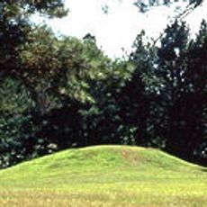
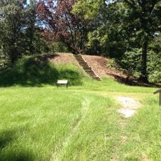
The county was established in 1821 on former Native American territories and became a center for cotton production during the 1800s. This development shaped the region's economy and settlement patterns for generations.

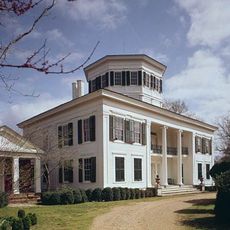
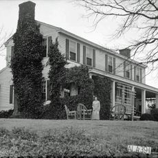
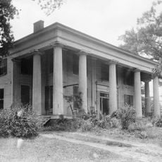
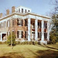
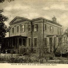
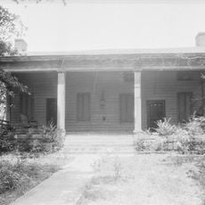
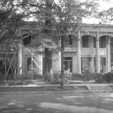
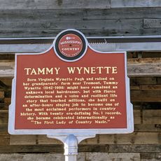
The county maintains several historic buildings and hosts regular farmers markets where residents gather to share local goods and customs. These gatherings reflect the rural traditions and deep connections people have with the land.

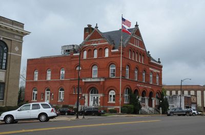
The Monroe County Courthouse in Aberdeen provides essential government services including property tax collection, marriage licenses, and vehicle registration. Visitors can find central points for administrative matters throughout the county.

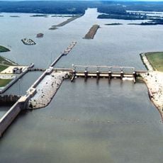
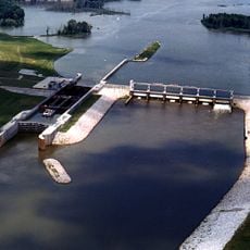
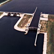
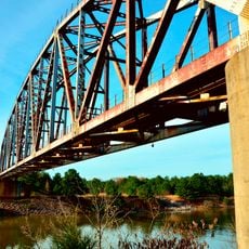
The Tennessee-Tombigbee Waterway passes through Monroe County and links the Tennessee River to the Gulf of Mexico via a series of locks. This engineered waterway represents a major modern construction project connecting inland water routes to coastal shipping.

GPS coordinates: 33.88849,-88.47470

Latest update: December 7, 2025 19:28

Photos
Around this place
Waverley
United States of America

Waverley

35.6 km
Bynum Mound and Village Site
United States of America

Bynum Mound and Village Site

43.6 km
James Greer Bankhead House
United States of America

James Greer Bankhead House

32.7 km
Tombigbee State Park
United States of America

Tombigbee State Park

41 km
John C. Stennis Lock and Dam
United States of America

John C. Stennis Lock and Dam

41.3 km
Aberdeen Lock and Dam
United States of America

Aberdeen Lock and Dam

7.7 km
Payne Field
United States of America

Payne Field

28.8 km
Reuben Davis House
United States of America

Reuben Davis House

10.3 km
Owl Creek Mounds
United States of America

Owl Creek Mounds

45.5 km
Old Fort House
United States of America

Old Fort House

43.5 km
Charles McLaran House
United States of America

Charles McLaran House

44.5 km
Fulton Lock
United States of America

Fulton Lock

41.4 km
Stephen D. Lee House
United States of America

Stephen D. Lee House

43.7 km
South Columbus Historic District
United States of America

South Columbus Historic District

46.4 km
Brownrigg-Harris-Kennebrew House
United States of America

Brownrigg-Harris-Kennebrew House

43.3 km
The Cedars
United States of America

The Cedars

42.4 km
West Commerce Street Historic District
United States of America

West Commerce Street Historic District

10.3 km
Aberdeen City Hall
United States of America

Aberdeen City Hall

9.6 km
Cox-Uithoven House
United States of America

Cox-Uithoven House

32 km
John Holliday House
United States of America

John Holliday House

10.1 km
Waverly Bridge
United States of America

Waverly Bridge

36.1 km
Amory's Tribute to the Heroes of 1861–1865
United States of America

Amory's Tribute to the Heroes of 1861–1865

10.8 km
Weaver Place
United States of America

Weaver Place

44.3 km
Old Homestead
United States of America

Old Homestead

9.9 km
Harris-Banks House
United States of America

Harris-Banks House

44.8 km
Tammy Wynette Legacy Center
United States of America

Tammy Wynette Legacy Center

43.3 km
Aberdeen Downtown Historic District
United States of America

Aberdeen Downtown Historic District

9.6 km
Amory Railway Bridge
United States of America

Amory Railway Bridge

12.5 km
Show the full map
Reviews

Visited this place? Tap the stars to rate it and share your experience / photos with the community! Try now! You can cancel it anytime.

« Monroe County - Administrative division in northeastern Mississippi, United States » is provided by Around Us (aroundus.com). Images and texts are derived from Wikimedia project under a Creative Commons license. You are allowed to copy, distribute, and modify copies of this page, under the conditions set by the license, as long as this note is clearly visible.

Discover hidden gems everywhere you go!

From secret cafés to breathtaking viewpoints, skip the crowded tourist spots and find places that match your style. Our app makes it easy with voice search, smart filtering, route optimization, and insider tips from travelers worldwide. Download now for the complete mobile experience.

Around Us App Screenshot

A unique approach to discovering new places

Le Figaro

All the places worth exploring

France Info

A tailor-made excursion in just a few clicks

20 Minutes