Moundville Archaeological Site

Log in to your account

14M+
places
190+
countries
Save your favorite places
Create custom travel routes
Rate and review places
Access the full interactive map
Continue with Google
Continue with Apple
Continue with email
By continuing, you accept our Terms and Conditions and our Privacy Policy
Create an account
Add to collection
Map
Suggest a change
Share

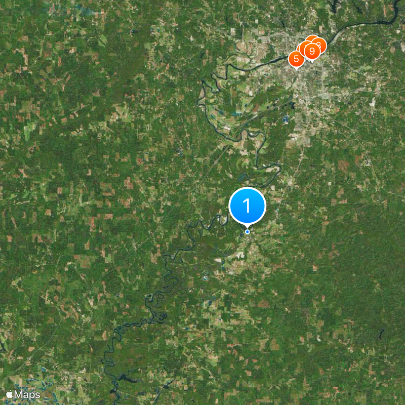
Moundville Archaeological Site, Native American archaeological park in Moundville, Alabama, United States

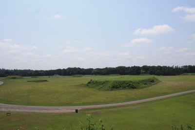
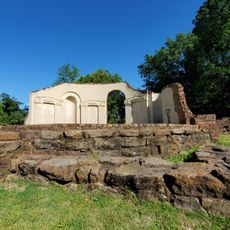
Moundville Archaeological Site is an archaeological site in Moundville, Alabama, covering roughly 185 acres with twenty-nine earthen platforms arranged around a rectangular central plaza near the Black Warrior River. The largest mounds rise up to 56 feet (17 meters) above the surrounding terrain and were once connected by ramps and staircases.

The site emerged around 1000 and grew into one of the most important political and ceremonial centers of Mississippian culture before being largely abandoned around 1450. The inhabitants likely left the area due to resource depletion and social changes affecting the entire Mississippian system.

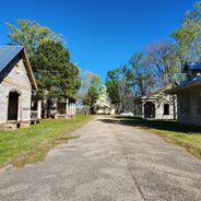
The name Moundville refers directly to the earthen mounds that still shape the landscape, once serving as foundations for temples and elite residences. Visitors often see reconstructions of traditional building methods during tours and can attend demonstrations of ancient craft techniques.

The grounds are accessible via several paved paths suitable for a walk of roughly ninety minutes that wind between the individual mounds. Visitors should wear comfortable shoes as some sections cross open grassland and can become slippery after rain.

Archaeologists found unusually large copper plates and finely worked shell ornaments in some graves, indicating long-distance trade connections reaching the Great Lakes and the Gulf Coast. These objects show that Moundville elites had access to materials sourced hundreds of miles away.

Location: Moundville

Email: moundville@bama.ua.edu

Website: http://moundville.ua.edu

GPS coordinates: 33.00467,-87.63107

Latest update: December 20, 2025 02:33

Photos
Hidden gems in Alabama

Alabama holds many out-of-the-way places that tell the story of the state's history and natural world. Visitors can explore underground caves like Dismals Canyon, where light filters through narrow openings, or wander through museums such as the Berman Museum of World History and the Holmes Medical...

Around this place
Bryant–Denny Stadium
United States of America

Bryant–Denny Stadium

23.8 km
Stand in the Schoolhouse Door
United States of America

Stand in the Schoolhouse Door

24.1 km
Bryce Hospital
United States of America

Bryce Hospital

25.1 km
Dr. John R. Drish House
United States of America

Dr. John R. Drish House

22.4 km
Foster Auditorium
United States of America

Foster Auditorium

24 km
Denny Chimes
United States of America

Denny Chimes

24.1 km
Rhoads Stadium
United States of America

Rhoads Stadium

25.1 km
Paul W. Bryant Museum
United States of America

Paul W. Bryant Museum

24 km
Alabama Museum of Natural History
United States of America

Alabama Museum of Natural History

24.5 km
President's Mansion
United States of America

President's Mansion

24.1 km
Tuscaloosa Amphitheater
United States of America

Tuscaloosa Amphitheater

23.7 km
Gorgas–Manly Historic District
United States of America

Gorgas–Manly Historic District

24.4 km
Bama Theatre
United States of America

Bama Theatre

23.4 km
Old University of Alabama Observatory
United States of America

Old University of Alabama Observatory

24.2 km
Jemison-Van de Graaff Mansion
United States of America

Jemison-Van de Graaff Mansion

22.9 km
Paul Bryant Bridge
United States of America

Paul Bryant Bridge

28.9 km
Hugh R. Thomas Bridge
United States of America

Hugh R. Thomas Bridge

24 km
Queen City Pool and Pool House
United States of America

Queen City Pool and Pool House

24.2 km
Battle-Friedman House
United States of America

Battle-Friedman House

23 km
Asa White House
United States of America

Asa White House

29.8 km
City National Bank
United States of America

City National Bank

23.6 km
Carson Place
United States of America

Carson Place

22.8 km
Guild-Verner House
United States of America

Guild-Verner House

23.9 km
Collier-Overby House
United States of America

Collier-Overby House

23.4 km
Northport Historic District
United States of America

Northport Historic District

24.3 km
Fitch House
United States of America

Fitch House

22.9 km
Capitol Park
United States of America

Capitol Park

23.2 km
Black Warrior River Trestle
United States of America

Black Warrior River Trestle

23.8 km
Show the full map
Reviews

Visited this place? Tap the stars to rate it and share your experience / photos with the community! Try now! You can cancel it anytime.

« Moundville Archaeological Site - Native American archaeological park in Moundville, Alabama, United States » is provided by Around Us (aroundus.com). Images and texts are derived from Wikimedia project under a Creative Commons license. You are allowed to copy, distribute, and modify copies of this page, under the conditions set by the license, as long as this note is clearly visible.

Discover hidden gems everywhere you go!

From secret cafés to breathtaking viewpoints, skip the crowded tourist spots and find places that match your style. Our app makes it easy with voice search, smart filtering, route optimization, and insider tips from travelers worldwide. Download now for the complete mobile experience.

Around Us App Screenshot

A unique approach to discovering new places

Le Figaro

All the places worth exploring

France Info

A tailor-made excursion in just a few clicks

20 Minutes