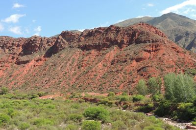
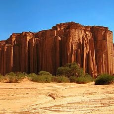
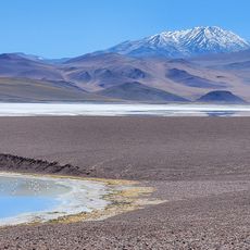
Cuesta de Miranda, Mountain pass in La Rioja Province, Argentina.
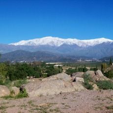
Cuesta de Miranda is a mountain pass in the Famatina range where a narrow road winds through red rock walls. The route climbs to an elevation of 2,040 meters (6,700 feet) at Bordo Atravesado Pass, featuring numerous curves that follow the contours of the terrain.
The pass received its name from Captain Juan de Miranda, who controlled the region during the Calchaquí wars around 1667. The route traces ancient pathways that were used for centuries by different groups for trade and transport.
The passage serves as a vital connection between two towns and is used by travelers crossing between valleys. Locals view this route as a lifeline for their region, enabling commerce and exchange between communities.
The pass is a demanding drive with numerous curves that requires full driver attention and careful navigation. Visitors should plan to travel early in the day to drive in daylight and experience the changing views along the route.
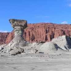
The red coloring of the rock walls comes from high concentrations of iron oxide, shaped by geological processes over 500 million years. This mineral composition makes the landscape a visible window into the deep geological history of the region.
Location: La Rioja Province
GPS coordinates: -29.34450,-67.76630
Latest update: December 6, 2025 19:06
Talampaya National Park
50.4 km
Ischigualasto Provincial Park
87.1 km
Reserva provincial Laguna Brava
165.9 km
San Guillermo National Park
141.9 km
Termas de Fiambalá
179.6 km
Cerro General M. Belgrano
37.3 km
Samay Huasi
33.7 km
Quebrada de los Cóndores
188.4 km
Monumento a Francisco Narciso Laprida
137.5 km
Capilla de Achango
173.7 km
Iglesia de San José de Jáchal
137.6 km
Chirau Mita Botanical Garden
34 km
La Rioja cathedral
88.6 km
Ischigualasto / Talampaya Natural Parks
63.8 km
Excursión a Laguna Brava
75.6 km
Iglesia de Nuestra Señora de la Merced
39.1 kmSalina del Alto del Mogna
177.1 km
Chilecito-La Mejicana ropeway station no. 9 "La Mejicana"
37 km
Tapiales de Las Padercitas
82 km
Viejo Molino de Huaco o de los Dojorti
132.5 km
Colegio Nacional Joaquín V. González
88.4 km
Templo y Convento de Santo Domingo
88.8 km
Chilecito-La Mejicana ropeway station no. 8 "Los Bayos"
36.6 km
Casa que habito Joaquín V. González
88.1 km
Chilecito-La Mejicana ropeway station no. 2 "El Durazno"
30.6 km
Templo de San José de Jachal
137.6 km
Molino de Sardiña
132.5 km
Iglesia de Achango y su entorno, compuesto por el caserío, los corrales y el cementerio
173.7 kmVisited this place? Tap the stars to rate it and share your experience / photos with the community! Try now! You can cancel it anytime.
Discover hidden gems everywhere you go!
From secret cafés to breathtaking viewpoints, skip the crowded tourist spots and find places that match your style. Our app makes it easy with voice search, smart filtering, route optimization, and insider tips from travelers worldwide. Download now for the complete mobile experience.
A unique approach to discovering new places❞
— Le Figaro
All the places worth exploring❞
— France Info
A tailor-made excursion in just a few clicks❞
— 20 Minutes