Chest opened
+${chestReward.xp} XP
Explorer
NOUVEAU ×${chestReward.collectible.quantity}
tapez pour fermer
Chest locked

Open chests in the app

Around Us is built for your phone — chests unlock when you walk, explore and capture nearby places.

Enable Location

We need your location to show you interesting places around you

Discover nearby places

Find interesting locations and hidden gems around you

Precise directions

Get accurate directions and distances to places

Your location is never shared with other users. It's only used when you tap the location button.

Cape Sable

Log in to your account

Start exploring — it's free

Trusted by 72,878 travelers worldwide

Continue with Google
Continue with Apple
or

We will send you a code to connect

By continuing, you accept our Terms and Conditions and our Privacy Policy

Check your inbox

We've sent a pincode in your inbox. Please enter the code below.

Cape Sable
Discussion Reviews 1 Photos
13.6k Popularity

Cape Sable, Coastal cape in Monroe County, Florida

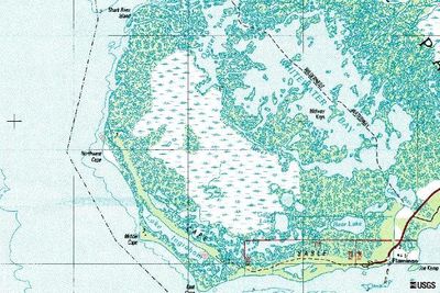
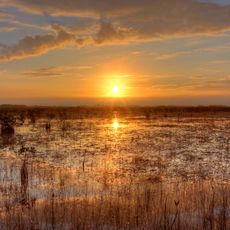
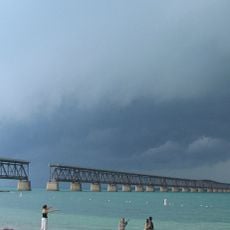
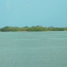
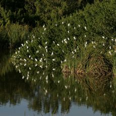
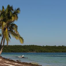
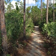
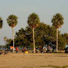
Cape Sable is a coastal point at the southeastern tip of Florida, divided into three sections called East Cape, Middle Cape, and Northwest Cape. The land transitions into extensive mangrove marshes and sandy shores that slope gradually into the surrounding waters.

The Tequesta people originally lived in this area, relying on fishing and hunting from the coastal waters. During the Second Seminole War, the United States built Fort Poinsett here in 1838 to prevent Spanish forces from aiding the Seminoles.

The Tequesta people maintained a settlement at Cape Sable, utilizing the coastal resources for fishing and hunting activities before European contact.

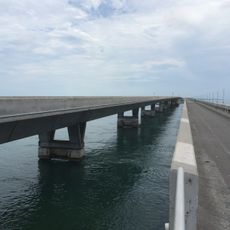
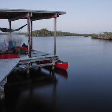
Reaching this location requires traveling by boat through the waterways of Everglades National Park, as there are no roads to access it. Backcountry campsites are scattered along the route for those planning multi-day visits.

This location marks the southernmost point of the continental United States mainland, with Lake Ingraham nearby serving as the nation's southernmost lake. This distinction gives it special appeal for visitors interested in reaching the geographic extremes of the country.

The community of curious travelers

AroundUs brings together thousands of curated places, local tips, and hidden gems, enriched daily by 60,000 contributors worldwide.

Start exploring
Location
GPS coordinates
25.11722,-81.08806
Latest update
December 7, 2025 20:25
Around this place
Seven Mile Bridge
United States of America

Seven Mile Bridge

50.4 km
Everglades National Park
United States of America

Everglades National Park

45.8 km
Overseas Railroad
United States of America

Overseas Railroad

45.3 km
Bahia Honda Rail Bridge
United States of America

Bahia Honda Rail Bridge

55.4 km
Pigeon Key
United States of America

Pigeon Key

46.5 km
Florida Keys National Marine Sanctuary
United States of America

Florida Keys National Marine Sanctuary

51 km
Alligator Reef Light
United States of America

Alligator Reef Light

55.9 km
Sombrero Key Light
United States of America

Sombrero Key Light

54.5 km
Dolphin Research Center
United States of America

Dolphin Research Center

41.6 km
National Key Deer Refuge
United States of America

National Key Deer Refuge

53.1 km
Theater of the Sea
United States of America

Theater of the Sea

52.5 km
Indian Key State Historic Site
United States of America

Indian Key State Historic Site

47.2 km
Long Key Bridge
United States of America

Long Key Bridge

42 km
Everglades & Dry Tortugas
United States of America

Everglades & Dry Tortugas

35.4 km
Pigeon Key Historic District
United States of America

Pigeon Key Historic District

46.5 km
Pigeon Key
United States of America

Pigeon Key

46.5 km
George Adderley House
United States of America

George Adderley House

44.3 km
Bahia Honda State Park
United States of America

Bahia Honda State Park

53.6 km
Snake Creek Bridge
United States of America

Snake Creek Bridge

53.7 km
Mud Lake Canal
United States of America

Mud Lake Canal

16.4 km
Pa-hay-okee Trail
United States of America

Pa-hay-okee Trail

47.3 km
Pinelands Trail
United States of America

Pinelands Trail

53.5 km
Hell's Bay Canoe Trail
United States of America

Hell's Bay Canoe Trail

29.6 km
Florida Keys Memorial
United States of America

Florida Keys Memorial

50.8 km
Flamingo Visitor Center
United States of America

Flamingo Visitor Center

16.8 km
Flamingo Campground
United States of America

Flamingo Campground

14.9 km
Flamingo Campground Amphitheater
United States of America

Flamingo Campground Amphitheater

15.8 km
Long Pine Key Campground
United States of America

Long Pine Key Campground

53.8 km
Show the full map
Reviews
Share your experience

No review yet

Discussions
Start a discussion...

No discussion yet

« Cape Sable - Coastal cape in Monroe County, Florida » is provided by Around Us (aroundus.com). Images and texts are derived from Wikimedia project under a Creative Commons license. You are allowed to copy, distribute, and modify copies of this page, under the conditions set by the license, as long as this note is clearly visible.

Discover hidden gems everywhere you go!

From secret cafés to breathtaking viewpoints, skip the crowded tourist spots and find places that match your style. Our app makes it easy with voice search, smart filtering, route optimization, and insider tips from travelers worldwide. Download now for the complete mobile experience.

Around Us App Screenshot

A unique approach to discovering new places

Le Figaro

All the places worth exploring

France Info

A tailor-made excursion in just a few clicks

20 Minutes

Around Us
Travel Guide & Maps
Download

Send to your phone

QR Code
1

Open the camera app on your mobile.

2

Point at the QR code with your camera. A notification will appear.

3

Tap the notification to open the link.